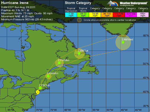
 THUNDER BAY – It is now Tropical Storm Irene. After hitting New York City as a Category One Hurricane, Irene has downgraded to a Tropical Storm. That does not mean the danger is over. Reports from an Air Force hurricane hunter aircraft and National Weather Service Doppler radar indicate that the center of Irene moved over New York City around 900 am EDT (1300 UTC).
Irene has weakened to a tropical storm and the estimated intensity at landfall was 65 mph (100 km/h).
The storm currently has maximum sustained winds are near 75 mph (120 km/h) with higher gusts. Irene is a category one hurricane on the Saffir-Simpson hurricane wind scale. Irene is forecast to weaken and become a Post-tropical cyclone by tonight or early Monday.
Flooding in New York City and the region remain a concern. In New York, the Holland Tunnel is currently closed due to flooding. Battery Park in New York City has recently reported a total water level near 8.6 feet. There are reports coming in that there is flooding in the Battery Park area of lower Manhattan.
In Newark, New Jersey, Mayor Cory Booker is reporting that a number of people are having to be rescued from their vehicles due to flooding.
As the storm passes, there are millions of people without power. FEMA is asking that people remain indoors, not get out to sight-see, as there are downed powerlines, and other hazards that first-responders are dealing with.
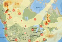
An indication of the spread of the power outages can be seen from the visitor maps to NNL. Over the course of the weekend, thousands of readers from the eastern seaboard have been on the site. As you can see, however from the visitor maps, this morning there are no visitors from the areas impacted by the storm.
Map of Visitors Sunday Morning:

Map of Visitors Saturday Night:

Of interest, the server hosting NetNewsledger.com is in Virginia. This week, between the earthquake and then Hurricane Irene, our hosting company has maintained coverage. The Commonwealth of Virginia has experienced power outages as a result of Irene.
As Tropical Storm Irene continues to head toward Canada, it is being forecast to have winds in the 100 – 120 Km/h range, and impact the regions with rainfall.
Cornwall Ontario is under a heavy rainfall warning. Environment Canada states, “Heavy rainfall beginning later this morning. Rainfall beginning later this morning originating from hurricane Irene will continue through the afternoon and early evening across the regions. 40 to 60 millimetres of rain are expected before midnight. There is the possibility of locally higher amounts, possibly up to 80 millimetres, due to the tropical origin of the moisture associated with this large scale storm”.
There are wind and heavy rainfall warnings issued for New Brunswick, Nova Scotia, Newfoundland, and Prince Edward Island.


