Far North Ontario weather for September 2-4, 2026: Fog and showers affect Neskantaga, Marten Falls/Ogoki, KI/Big Trout Lake, Summer Beaver, Fort Severn and Peawanuck Wednesday before improving weather Thursday and mild, cloudy conditions Friday
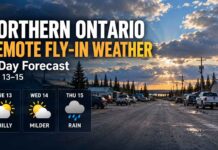
FAR NORTH ONTARIO – WEATHER – Wednesday, September 2, 2026 – September’s first week continues with damp and locally foggy conditions across several remote fly-in communities in Northern Ontario.
Neskantaga, Marten Falls/Ogoki Post, KI/Big Trout Lake and Summer Beaver all carry shower chances today. Fog is an important early-morning aviation concern around Ogoki, where visibility had fallen to only 400 metres, while mist at Big Trout Lake was reducing visibility to about 5 kilometres.
Near Hudson Bay, Wasaho Cree Nation/Fort Severn and Peawanuck remain cooler, with Peawanuck reaching only 15°C today under northeast winds.
Conditions generally improve Thursday, especially at KI and Fort Severn, while Friday turns cloudier but mild across most communities.
Today’s Weather Overview
Neskantaga First Nation
Environment Canada’s Fort Hope–Lansdowne House–Ogoki regional forecast is being used for Neskantaga.
Wednesday brings a mix of sun and cloud with a 30 percent chance of showers. Morning fog patches will dissipate, while northwest winds strengthen to 30 km/h.
The high reaches 20°C.
Tonight stays mainly cloudy with a 30 percent chance of showers or drizzle and a low of 13°C.
Thursday, September 3
Thursday offers a mix of sun and cloud with a 40 percent chance of showers.
The high reaches 21°C, with a humidex of 25.
Thursday night becomes cloudy with a low near 11°C.
Friday, September 4
Friday remains cloudy, with a high near 22°C.
Friday night stays cloudy and falls to approximately 12°C.
Marten Falls / Ogoki Post
Ogoki Post had one of the most significant early-morning aviation weather concerns.
At 6:00 AM EDT, Ogoki Post Airport was reporting fog and 12.1°C. Humidity was 100 percent, pressure was 100.8 kPa, west winds were 9 km/h, and visibility had fallen to just 0.4 kilometres.
Wednesday brings a mix of sun and cloud with a 30 percent chance of showers. Northwest winds increase to 30 km/h, with a high of 20°C.
Tonight remains mainly cloudy with a 30 percent chance of showers or drizzle and a low of 13°C.
Thursday
Expect a mix of sun and cloud with a 40 percent chance of showers and a high of 21°C.
Thursday night becomes cloudy with a low of 11°C.
Friday
Friday remains cloudy with a high of 22°C.
Friday night stays cloudy at 12°C.
KI / Big Trout Lake — Kitchenuhmaykoosib Inninuwug
At 5:47 AM CDT, Big Trout Lake Airport was reporting mist and 14.7°C.
Humidity was 99 percent, barometric pressure was 101.2 kPa, north winds were light at 5 km/h and visibility was reduced to 5 kilometres.
Wednesday stays mainly cloudy with a 40 percent chance of showers and a high of 20°C.
Tonight remains mainly cloudy with a 30 percent chance of showers during the evening and after midnight. The low falls to 9°C.
Thursday
Thursday improves considerably.
A mix of sun and cloud gives way to clearing near noon, with a high of 21°C.
Cloud returns Thursday night with a low of 13°C.
Friday
Friday turns cloudy with a high of 21°C.
Friday night remains cloudy and milder, with a low of 15°C.
Summer Beaver
At 6:48 AM EDT, the nearby Lansdowne House observing station was reporting cloudy skies and 13.2°C.
Humidity was 100 percent, pressure was 101.0 kPa, northwest winds were light at 5 km/h and visibility was 16 kilometres.
Wednesday stays cloudy with a 40 percent chance of showers and a high of 19°C.
Tonight remains cloudy with another 40 percent shower chance and a low of 12°C.
Thursday
Thursday improves to a mix of sun and cloud, with a high of 22°C.
Thursday night becomes cloudy with a low of 13°C.
Friday
Friday stays cloudy and mild, with a high of 22°C.
Friday night remains cloudy with a low of 14°C.
Wasaho Cree Nation / Fort Severn
At 6:00 AM EDT, Fort Severn Airport was reporting mostly cloudy skies and 11.8°C.
Humidity was 98 percent, pressure was 101.3 kPa, and east-northeast winds were blowing at 11 km/h. Visibility was a good 16 kilometres.
Wednesday brings a 30 percent chance of showers, with a high of 17°C.
Tonight becomes mostly clear with only a few clouds and a low of 8°C.
Thursday
Thursday will be sunny, with another high of 17°C.
Clouds return Thursday night with a low of 10°C.
Friday
Friday becomes cloudy but warmer, reaching 20°C.
Friday night remains cloudy with a low of 12°C.
Peawanuck
At 5:00 AM CDT, Peawanuck Airport was reporting clear skies and 11.2°C.
Humidity was 94 percent, pressure was 101.1 kPa, north-northeast winds were light at 5 km/h and visibility was 16 kilometres.
Cloud increases Wednesday, bringing a 40 percent chance of showers.
Northeast winds strengthen to 30 km/h, holding the afternoon high to only 15°C.
Tonight stays mainly cloudy with a 40 percent chance of showers. Winds ease this evening and the low reaches 11°C.
Thursday
Thursday improves to a mix of sun and cloud with a high of 19°C.
Thursday night turns cloudy with a low of 9°C.
Friday
Friday remains cloudy but mild, reaching 21°C.
Friday night stays cloudy with a low of 11°C.
Aviation and Fly-In Travel Outlook
Wednesday morning presents the greatest aviation concerns of this three-day period.
Ogoki Post is the standout problem area, with early-morning fog reducing visibility to only 400 metres. Big Trout Lake was also reporting mist and visibility of five kilometres.
Fog patches are expected to dissipate this morning, but scattered showers and low cloud could continue to produce localized reductions in ceilings and visibility.
Northwest winds around 30 km/h at Neskantaga and Ogoki may also result in somewhat bumpier approaches and departures.
Thursday should provide a better overall flying window, particularly around KI/Big Trout Lake and Fort Severn, where clearing or sunshine is expected.
Friday is generally mild but cloudier, meaning flight crews and passengers should continue checking ceiling, visibility and runway conditions before departure.
Regional Three-Day Trend
Wednesday is the least settled day, with shower chances ranging from 30 to 40 percent across most communities and early fog affecting some inland airports.
Thursday brings broader improvement. KI clears by midday, Fort Severn turns sunny, and Summer Beaver reaches 22°Cunder a mix of sun and cloud.
Friday turns cloudier again, but temperatures remain mild. Highs range from around 20°C at Fort Severn to 22°C around Neskantaga, Ogoki and Summer Beaver.
Wardrobe Recommendations
A water-resistant jacket and layered clothing will be useful Wednesday. Temperatures are mild, but showers, fog and northwest winds will make exposed locations feel cooler.
For Fort Severn and Peawanuck, a light fleece or wind-resistant jacket will remain comfortable through much of the day.
Thursday becomes better suited to lighter clothing inland, although overnight temperatures still drop into the 8°C to 13°C range.
For anyone travelling by air, keep a warmer layer in carry-on luggage. Delays or diversions in remote communities can mean spending longer periods outside near airstrips where conditions are cooler and windier than sheltered areas.
Weather Trivia
Early September temperatures are running considerably above normal in parts of the Far North.
At Big Trout Lake, Environment Canada lists a normal high of approximately 15°C, compared with forecast highs of 20°C Wednesday and 21°C Thursday and Friday. Ogoki’s normal maximum is about 16°C, while highs near 20°C to 22°C are expected through Friday.
The combination of warmer-than-normal air and longer autumn nights can also favour morning fog. When temperatures cool toward the dew point overnight, moisture condenses into low cloud or fog—an especially important consideration around remote northern airstrips.
Source: Environment and Climate Change Canada observations and Far Northern Ontario forecasts issued early Wednesday, September 2, 2026, including an updated regional forecast issued at 6:50 a.m. EDT.