Northwestern Ontario weather for July 20, 2026, including Dryden, Kenora, Red Lake and Fort Frances forecasts, strong winds
DRYDEN, KENORA, RED LAKE and FORT FRANCES — Northwestern Ontario is heading into a windy and unsettled Monday as a low-pressure system pulls cooler air across the region.
Showers and thunderstorms remain possible today, while strengthening west and northwest winds could produce gusts of 60 to 70 km/h. Haze and local wildfire smoke may also reduce visibility.
Tuesday will be considerably cooler, with cloudy skies and strong northerly winds. Temperatures rebound Wednesday, when most communities will see sunshine or a mix of sun and cloud.
Weather Advisories
Environment Canada reported no formal weather alerts in effect for Dryden, Kenora, Red Lake or Fort Frances at 6:00 a.m. CDT Monday. Residents should still treat the forecast seriously because thunderstorms and strong wind gusts are expected across the region.
The primary weather concerns are:
- Thunderstorms capable of producing sudden heavy rain and lightning
- Northwest wind gusts reaching 60 to 70 km/h
- Haze or local wildfire smoke
- Rapidly changing conditions on area highways and lakes
Loose outdoor objects should be secured. Boaters and backcountry travellers should monitor conditions closely because winds may strengthen quickly.
Today’s Weather Overview
Dryden
At 6:00 a.m., Dryden Airport was mainly sunny and 22°C. Humidity was 87 per cent, the pressure was 99.9 kPa, and southwest winds were blowing at 17 km/h. The humidex was already 29.
Monday will be mainly cloudy with a 60 per cent chance of showers. There is a risk of a thunderstorm late this morning and during the afternoon. Morning haze is expected.
West winds will increase to 30 km/h, gusting to 50. The temperature will reach 22°C before falling to 19°C during the afternoon.
Tonight will remain cloudy with a 60 per cent chance of showers and an evening thunderstorm risk. Northwest winds will increase to 40 km/h, gusting to 60. The low will be 11°C.
Kenora
Kenora Airport reported mainly sunny skies and a temperature of 20.7°C at 6:00 a.m. Humidity was 78 per cent, pressure was falling at 100.0 kPa, and winds were west-southwest at 12 km/h.
Monday will become mainly cloudy with a 60 per cent chance of showers and a risk of thunderstorms. Haze is expected during the morning.
Northwest winds will increase to 30 km/h, gusting to 60. The high will reach 24°C, with a humidex of 29.
Tonight will be cloudy with a 60 per cent chance of showers and an evening thunderstorm risk. Northwest winds of 40 km/h could gust to 70. The overnight low will be 12°C.
Red Lake
Red Lake Airport was mainly sunny and 17.8°C at 6:00 a.m. Humidity was 99 per cent, pressure was falling at 99.7 kPa, and southwest winds were blowing at 14 km/h.
Monday will be mainly cloudy with a 60 per cent chance of showers and a risk of thunderstorms. Haze is expected this morning.
Northwest winds will increase from 20 km/h, gusting to 50, to 40 km/h, gusting to 60, late in the afternoon. The high will be 24°C, with a humidex of 30.
Tonight will be cloudy with a 60 per cent chance of showers and an evening thunderstorm risk. Northwest winds could gust to 70 km/h. The low will fall to 11°C.
Fort Frances
At 6:00 a.m., Fort Frances reported a temperature of 21.6°C. Humidity was 87 per cent, pressure was falling at 100.1 kPa, and northwest winds were blowing at 11 km/h. The humidex was 29.
Monday will bring a mix of sun and cloud with a 60 per cent chance of showers. A thunderstorm could develop late in the afternoon, and haze is expected during the morning.
West winds will increase to 40 km/h, gusting to 60. The high will be 25°C, with a humidex of 30.
Tonight will be cloudy with a 60 per cent chance of showers and an evening thunderstorm risk. Northwest winds will blow at 40 km/h, gusting to 70. The low will be 15°C.
Three-Day Forecast
Tuesday, July 21
Dryden: Cloudy with a 40 per cent chance of early-morning showers. North winds will blow at 30 km/h, gusting to 60. High 19°C. Clear Tuesday night with a low of 12°C.
Kenora: Overcast and windy. North winds will reach 30 km/h, gusting to 60. High 20°C. Clear overnight with a low of 13°C.
Red Lake: Overcast with north winds of 40 km/h, gusting to 60, easing during the afternoon. High 20°C. Clear Tuesday night with a low of 12°C.
Fort Frances: Cloudy with a 30 per cent chance of morning showers. Northwest winds could gust to 70 km/h. High 20°C. Clear overnight with a low of 10°C.
Wednesday, July 22
Dryden: A mix of sun and cloud with a 30 per cent chance of showers. High 26°C. Cloudy periods Wednesday night with a 30 per cent chance of showers and a low of 17°C.
Kenora: A mix of sun and cloud with a 30 per cent chance of showers. High 26°C. Clear overnight with a low of 17°C.
Red Lake: A mix of sun and cloud with a 30 per cent chance of showers. High 26°C. Clear Wednesday night with a low of 16°C.
Fort Frances: Sunny with a high of 26°C. Cloudy periods and a 30 per cent chance of showers Wednesday night, with a low of 15°C.
Latest Northwestern Ontario Wildfire Update
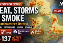
The latest available Northwest Fire Region report, issued Saturday evening, listed 137 active wildland fires. Of those fires, 67 were not under control, seven were being held, four were under control and 59 were being observed. Eight new fires were confirmed July 18.
Dryden 38, a 0.1-hectare fire near Patricia Lake, was declared out. However, active fires across the wider region may continue to produce local smoke or haze around Dryden, Kenora and Red Lake as winds shift.
Fort Frances-Area Fires
Fort Frances 14 remained not under control at approximately 51,806 hectares. Its northern perimeter was about five kilometres southwest of the Trans-Canada Highway. An evacuation order and expanded evacuation alert remained associated with rural and remote areas around the fire. These orders do not apply to the Town of Fort Frances.
Fort Frances 15 was estimated at 48,261 hectares and remained not under control. Its northern edge was approximately 1.5 kilometres south of Highway 11.
Fort Frances 38, north of Crystal Lake, was being held at 44.2 hectares. Travellers should check current road conditions before entering affected areas and must obey emergency barricades or access restrictions.
Restricted Fire Zone
A Restricted Fire Zone remains in effect across the Northwest Region. Open-air burning, including campfires, is prohibited, and all burning permits are suspended.
Portable gas or propane stoves may be used for cooking or warmth, but they must be handled with extreme caution. The restrictions remain in effect until further notice.
Anyone who sees a wildland fire north of the French and Mattawa rivers should call 310-FIRE — 310-3473.
Smoke and Air-Quality Precautions
Smoke levels can change quickly as strong winds move plumes across the region.
People who experience coughing, throat irritation, headaches or breathing difficulties should reduce outdoor exertion. Children, older adults, pregnant people and those with heart or lung conditions may be more strongly affected.
Keep windows closed when smoke is heavy and use an appropriate air filter or portable air cleaner where available. A properly fitted N95 or equivalent respirator can reduce exposure to fine smoke particles when outdoor activity cannot be avoided.
Wardrobe Recommendations
A waterproof, wind-resistant jacket will be the most useful item Monday because showers, thunderstorms and strong gusts are possible.
Wear light layers during the morning, but keep a sweater or warmer jacket available for Monday evening and Tuesday. Overnight temperatures will fall as low as 10°C or 11°C in parts of the region.
Secure hats and avoid relying on umbrellas once wind gusts increase. Sturdy footwear is recommended for wet surfaces and debris from small branches.
Weather Trivia
A rapid wind shift from southwest to northwest often marks the passage of a cold front. In this forecast, that change will help push Monday’s warm and humid air out of Northwestern Ontario, bringing noticeably cooler temperatures Tuesday before warmer weather returns Wednesday.
Weather Overview: Northwestern Ontario weather for July 20, 2026, including Dryden, Kenora, Red Lake and Fort Frances forecasts, strong winds, thunderstorms, wildfire haze, fire restrictions and the latest Northwest Fire Region update.