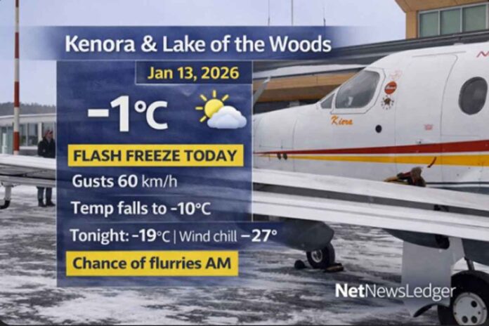
Thunder Bay – Weather Desk – Kenora and the Lake of the Woods region is starting Tuesday near -1°C, but don’t let that fool you—this is a classic “warm early, cold fast” setup. Strong northwest winds are kicking in this morning, and temperatures are expected to drop sharply through the day, setting up a flash-freeze risk on any wet or slushy surfaces.
Skies will clear late tonight, and that will allow the cold to punch in hard.
Today’s Weather Overview
Current Conditions (5:00 AM CST — Kenora Airport)
-
Temperature: -0.9°C (Weather Focus: -1°C)
-
Condition: Partly Cloudy
-
Wind: W 14 km/h
-
Wind Chill: -5
-
Humidity: 96%
-
Pressure: 99.5 kPa and falling
-
Visibility: 24 km
What to expect today (Tuesday)
-
Cloudy, with a 40% chance of flurries this morning
-
Wind ramps up quickly: NW 20 km/h gusting 40, increasing to 40 km/h gusting 60 early today
-
Temperature falling to -10°C this afternoon
-
Wind chill near -17 this afternoon
Travel note: When temps drop this fast, puddles and slush can turn into black ice—especially on bridges, hills, untreated sidewalks, and parking lots.
Extended Forecast
Expected Conditions (Next Three Days)
Tonight (Tue, Jan 13)
-
Mainly cloudy, then clearing late this evening
-
Wind north 30 km/h gusting 50, becoming light before morning
-
Low: -19°C
-
Wind chill: -17 this evening, dropping to around -27 overnight
Wednesday (Jan 14)
-
Mix of sun and cloud
-
Wind up to 15 km/h
-
High: -12°C
-
Wind chill: -28 in the morning, -15 in the afternoon
-
Risk of frostbite (especially with exposed skin)
Thursday (Jan 15)
-
Periods of snow
-
High: -5°C
-
Thursday night: periods of snow, low -13°C
Wardrobe Recommendations
-
Today: Dress for the wind, not the early temperature. A windproof outer layer, warm gloves, and a hat make a big difference when gusts reach 60 km/h.
-
This afternoon into tonight: Switch to full winter gear—insulated coat, scarf/neck warmer, mitts, and lined boots. Wind chills diving toward -27 can become dangerous fast.
-
Wednesday morning: Limit exposed skin. If you’re outside for more than a few minutes, cover up completely (face/neck protection helps a lot).
Weather Trivia
Clear skies at night often mean temperatures can fall faster. With fewer clouds to trap heat, the ground loses warmth more quickly—so “clearing late this evening” is one reason the overnight low plunges toward -19°C.


