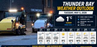
Today’s Setup – Gusts, Clouds, and a Chill in the Air
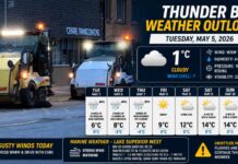
THUNDER BAY – A crisp start sets the tone. At 7:00 AM EST, Thunder Bay Airport reported mainly clear skies and 0.7°C (call it 1°C). The pressure is 101.3 kPa and rising, humidity a damp 96%, with a light westerly wind at 13 km/h and excellent visibility of 32 km.
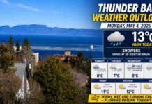
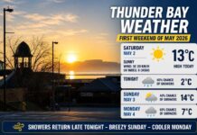
Skies turn cloudy this morning as winds shift northwest 30 km/h, gusting to 60 by late morning. The temperature holds steady near +3°C despite the sunshine breaks, and with that northwest push it’ll feel snappier than the number suggests. UV index 1 (low).
Tonight – Clearing Out, Turning Sharply Colder
Clouds clear this evening while the NW 30 gusting 60 breeze eases to light early tonight. Air pours in from the north, dropping to –6°C with a wind chill near –10 overnight. Expect frost and a few icy patches by dawn, especially on bridges and shaded sidewalks.
Thursday – Quiet Start, Then Building Clouds
Thursday begins bright-ish with increasing cloudiness in the morning and light winds (up to 15 km/h). The high reaches +3°C, but early risers face a wind chill near –10—bundle accordingly. UV index 1 (low).
Thursday night: A system noses in with periods of snow or rain, low near 0°C. Roads trend wet in town at first, with slush possible late as temps flirt with freezing.
Friday – A Wintry Tease
Friday looks cloudy with a 70% chance of snow and a high near –1°C—our first solid taste of November’s mood. Friday night turns clear, down to –5°C, setting up a crisp weekend start.
What to Wear (Wardrobe Coach)
-
This morning: thermal layer, wind-resistant shell, toque and gloves—those NW gusts bite.
-
Tonight & Friday: swap to warmer jacket, insulated footwear with good grip.
-
Thursday night: toss a waterproof layer in the bag for the rain/snow mix.
Barometer, Wind & Feel
Rising pressure now hints at short-lived stability, but the northwest surge flips the feel from cool to cold by evening. With high humidity near freezing, any breeze cuts quickly—hence the big wind-chill swing to –10 tonight and Thursday morning.
Lake Superior Trivia
Superior’s cold surface this time of year helps build low cloud on a northwest flow—why we can ping-pong between bright breaks and stubborn grey while the temperature barely budges.

