Northwestern Ontario Weather: Warm Thanksgiving Sunday Gives Way to Rain, Wind and Early Snow Risk
Sunday, October 11 to Tuesday, October 13, 2026 — Northwestern Ontario will see a sharp change during the Thanksgiving weekend. Thunder Bay, Atikokan and Fort Frances start Sunday warm, while Kenora, Dryden, Sioux Lookout, Red Lake and Pickle Lake face increasing rain. Cooler air arrives Monday, with light snow possible in the far north.
Sunday, October 11: A major west-to-east weather split
Thunder Bay: Mainly sunny, becoming partly cloudy in the afternoon. The high is expected to reach 23 C, with southwest winds near 20 km/h. Showers are possible Sunday evening, followed by periods of rain near midnight. The overnight low is 8 C.
Atikokan and Quetico: A warm day with sun and cloud and a high near 23 C. Winds will shift from southwest to north near 20 km/h during the afternoon. There is a 30 per cent chance of showers in the evening, with periods of rain developing near midnight. The low will be about 5 C.
Fort Frances, Emo and Rainy River: Increasing cloudiness and periods of rain beginning in the morning. The high is expected to be 18 C. Northeast winds may reach 20 km/h, gusting to 40 km/h, especially in the afternoon. The overnight low will be 7 C.
Kenora and Lake of the Woods: Periods of rain are expected, with a high near 13 C. Northeast winds will be around 20 km/h, gusting to 40 km/h. Rain will continue Sunday night, with a low near 5 C.
Dryden and Vermilion Bay: Cloudy with a 60 per cent chance of rain late in the morning and through the afternoon. The high will be about 16 C. North winds will reach 20 km/h, gusting to 40 km/h. Periods of rain will continue overnight, with a low near 3 C.
Sioux Lookout and Savant Lake: Cloudy with a 30 per cent chance of showers and a high near 13 C. The chance of rain rises Sunday night, when the low will be about 3 C.
Red Lake and Ear Falls: Cloudy, with a 40 per cent chance of morning showers and periods of rain beginning near noon. The temperature will remain near 9 C. Northeast winds will reach 20 km/h, gusting to 40 km/h. Rain continues overnight, with a low near 3 C.
Pickle Lake and nearby remote communities: Rain or drizzle is expected, with a high near 8 C. Northeast winds will gust to 40 km/h. Rain or drizzle may change to light snow overnight, with a low near 1 C. Poplar Hill is also expected to see rain or drizzle changing to light snow overnight.
Monday, October 12: Cooler with showers and northern snow
Thanksgiving Monday will be much cooler across the region.
- Thunder Bay: Cloudy with a 40 per cent chance of showers; high 8 C.
- Kenora: Cloudy with a 40 per cent chance of showers; high 7 C.
- Dryden and Vermilion Bay: Cloudy with a 40 per cent chance of showers; high 7 C.
- Sioux Lookout and Savant Lake: Cloudy with a 30 per cent chance of showers; high 5 C.
- Red Lake and Ear Falls: Cloudy with a 40 per cent chance of showers; high near 4 C.
- Fort Frances, Emo and Rainy River: Cloudy with a 40 per cent chance of showers; high 8 C.
- Atikokan and Quetico: Periods of rain; high 9 C.
- Pickle Lake: Periods of light snow ending in the morning, then cloudy; high 3 C, with a low near -1 C.
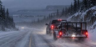
The strongest risk of snow is expected in the Pickle Lake and far-northern corridor. Any accumulation should be limited, but untreated roads, airstrips and ramps may become slippery.
Tuesday, October 13: Mainly cloudy and cool
Tuesday will remain mainly cloudy across Northwestern Ontario. Forecast highs range from about 7 C in Red Lake and Pickle Lake to 10 C in Thunder Bay and Fort Frances. Most areas should be dry, although cloud cover will remain extensive.
Travel and outdoor safety
Sunday’s rain, gusty winds and falling temperatures will create changing driving conditions. Roads may become wet and spray may reduce visibility, particularly along Highways 11, 17 and 527 and on secondary roads around the lakes.
- Check Ontario 511 for current closures, collisions, construction and road conditions before leaving.
- Allow extra following distance on wet roads.
- Be prepared for strong crosswinds, especially on exposed sections of Highway 17 and near Lake of the Woods.
- In the far north, carry winter clothing and emergency supplies because rain may change to snow overnight.
- Remote-air travel may be affected by rain, low cloud or gusty winds. Confirm schedules directly with the airline or charter operator.
- Boaters should be cautious on larger lakes as northeast winds gust toward 40 km/h. Conditions on sheltered shorelines may be calmer than on open water.
Weather alerts and air quality
The Environment and Climate Change Canada forecast pages reviewed did not display an active weather warning in the forecast text for the listed communities at the time of this check. Conditions and alerts can change quickly, so the official alert map should be refreshed before publication and travel.
Thunder Bay’s latest AQHI reading was 2, classified as low risk. The forecast maximum was 3, also low risk, for Sunday and Sunday night. School-bus update