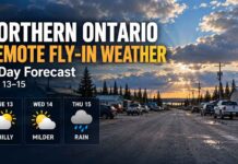
August 30, 2026: Far North Ontario Three-Day Forecast — Warm Inland Sunday, Rain Arrives Monday, Hudson Bay Warms Sharply
Thunder Bay – WEATHER – Sunday, August 30, 2026 – A strong temperature divide remains in place across Ontario’s Far North this morning. Neskantaga, Marten Falls/Ogoki Post, KI/Big Trout Lake and Summer Beaver are headed for a warm Sunday with highs from 23°C to 25°C, while Wasaho Cree Nation/Fort Severn and Peawanuck stay considerably cooler near Hudson Bay at 17°C.
The pattern changes Monday. Inland communities warm again before rain and possible thunderstorms arrive from the west and south. At the same time, Fort Severn and Peawanuck surge into the low 20s under mainly sunny skies, but southeast winds could gust to 50 km/h. Tuesday brings more widespread showers across the region.
Today’s Weather Overview
Neskantaga First Nation
Environment Canada’s Lansdowne House forecast and observations are being used for Neskantaga.
At 7:00 AM EDT, Lansdowne House Airport was sunny and 8.6°C. Humidity was 90 percent, pressure was 101.7 kPa, and east-southeast winds were blowing at 11 km/h.
Sunday will clear early and warm to 23°C, with a high UV index of 6. Tonight will be clear and cool with a low of 10°C.
Marten Falls / Ogoki Post
At 7:06 AM EDT, Ogoki Post Airport was reporting mist and 6.1°C. Humidity was 99 percent, winds were east-northeast at 11 km/h, and visibility was reduced to 5 kilometres.
The mist will give way to clearing early this morning. The high reaches 23°C, with a high UV index of 6. Tonight will be clear with a low of 10°C.
KI / Big Trout Lake
Environment Canada’s latest forecast calls for a mix of sun and cloud today. East winds increase to 20 km/h late this afternoon, with a high of 23°C and a moderate UV index of 5.
Tonight will start clear before clouds increase near midnight. Southeast winds around 20 km/h continue, with a low of 13°C.
Summer Beaver
Summer Beaver was sunny at 8.6°C at 7:00 AM EDT, using observations from Lansdowne House Airport. Humidity was 90 percent with east-southeast winds at 11 km/h.
Clouds clear this morning, leaving a warm Sunday with a high of 25°C. The UV index reaches 5, or moderate. Tonight stays clear and much milder than recent nights, with a low of 16°C.
Wasaho Cree Nation / Fort Severn
At 7:00 AM EDT, Fort Severn Airport was cloudy and 9.2°C, with 96 percent humidity, calm winds and pressure of 101.8 kPa.
Mainly cloudy skies will clear around noon as fog patches dissipate. The high reaches 17°C, with a moderate UV index of 4.
Tonight will have just a few clouds and a low of 8°C.
Peawanuck
Peawanuck remains on the cool side Sunday. Environment Canada is forecasting mainly cloudy skies with a 30 percent chance of drizzle early this morning, with fog patches dissipating through the morning.
The high reaches 17°C, with a moderate UV index of 4. Tonight clears later in the evening, with a low of 8°C.
Monday, August 31
Monday becomes the most active weather day inland.
Neskantaga: Sunny early, then increasing cloud followed by periods of rain in the afternoon. A thunderstorm is possible late in the day. Southeast winds increase to 20 km/h gusting to 40, with a high of 24°C. Monday night carries a 70 percent chance of rain and a low of 12°C.
Marten Falls/Ogoki Post: Nearly identical conditions, with sunshine giving way to increasing cloud and rain. A late-afternoon thunderstorm is possible. Southeast winds reach 20 km/h gusting to 40, and the high climbs to 24°C. Monday night has a 70 percent rain chance and a low of 12°C.
KI/Big Trout Lake: Cloudy with a high of 22°C. Showers move in Monday night, with a low of 12°C.
Summer Beaver: Sunshine early gives way to cloud and periods of rain beginning during the afternoon, with a late-day thunderstorm risk. Southeast winds increase to 20 km/h gusting to 40. The high is 20°C. Monday night remains unsettled with a 60 percent shower chance and low of 12°C.
Fort Severn: Monday brings a major warm-up. Expect mainly sunny skies and a high of 23°C, about nine degrees above the community’s late-August normal. Southeast winds become 30 km/h gusting to 50 during the morning. Clouds increase Monday night, with a low of 9°C.
Peawanuck: Mainly sunny and much warmer at 22°C. Southeast winds also strengthen to 30 km/h gusting to 50. Monday night brings cloudy periods and a low of 9°C.
Tuesday, September 1
Tuesday carries the most widespread shower chances of the three-day period.
Neskantaga: Cloudy with a 60 percent chance of rain, high 22°C, with a 40 percent shower chance Tuesday night and a low of 12°C.
Marten Falls/Ogoki Post: Cloudy with a 60 percent chance of rain and a high of 22°C. Tuesday night carries a 40 percent shower chance with a low of 12°C.
KI/Big Trout Lake: Cloudy with a 60 percent chance of showers, high 20°C, followed by a cloudy night at 12°C.
Summer Beaver: Cloudy with a 60 percent chance of showers and a high of 21°C. Tuesday night keeps a 30 percent shower chance and a low of 12°C.
Fort Severn: Cloudy with a 40 percent chance of showers and a cooler high of 18°C. Tuesday night brings cloudy periods and a low of 10°C.
Peawanuck: Cloudy with a 60 percent chance of showers, high 20°C, followed by a 30 percent chance of showers Tuesday night and a low of 9°C.
Regional Three-Day Weather Trend
The big story is the changing air mass. Sunday is warm and bright inland while Hudson Bay keeps Fort Severn and Peawanuck cool. Monday reverses part of that pattern: the coast warms sharply into the low 20s, while a rain-producing system begins moving through Neskantaga, Ogoki and Summer Beaver.
Tuesday then spreads cloud and showers across nearly every community in this forecast.
Fort Severn’s Monday high of 23°C is especially noteworthy compared with its normal late-August maximum of about 14°C. Peawanuck’s Monday high of 22°C is similarly well above its normal of about 14°C.
Wardrobe Recommendations
Sunday supports lighter clothing during the afternoon in Neskantaga, Ogoki, KI and Summer Beaver, although cool early-morning temperatures still make a hoodie or light jacket useful before temperatures climb.
Fort Severn and Peawanuck will feel cooler through Sunday, so a light jacket or fleece remains a good choice.
Monday’s rain and thunderstorm risk inland means a waterproof shell and sturdy footwear will be useful. Fort Severn and Peawanuck residents will want a wind-resistant layer because southeast gusts may reach 50 km/h.
By Tuesday, rain protection becomes worthwhile across virtually the entire region.
Weather Trivia
Hudson Bay can hold communities near its shoreline several degrees cooler than locations only a few hundred kilometres inland because the huge body of water warms slowly during summer.
That influence is visible Sunday, when Summer Beaver is forecast to reach 25°C while Fort Severn and Peawanuck reach only 17°C. By Monday, a change in wind direction allows much warmer air to push toward the coast, sending Fort Severn to 23°C and Peawanuck to 22°C.
Source: Environment and Climate Change Canada observations and public forecasts issued at 5:30 AM EDT Sunday, August 30, 2026. Forecast details can change as Monday’s rain and thunderstorm system develops.
Summary
Far North Ontario weather for August 30 to September 1, 2026: Warm and sunny conditions in Neskantaga, Ogoki, KI and Summer Beaver give way to rain and thunderstorms Monday, while Fort Severn and Peawanuck warm sharply before showers return Tuesday.