NORTHWESTERN ONTARIO – WEATHER – Saturday, August 29, 2026 – A warm late-August weekend is underway across Northwestern Ontario, with afternoon temperatures climbing well above seasonal normals from Kenora and Fort Frances through Dryden, Red Lake, Sioux Lookout and Pickle Lake.
The trade-off for the warmth is increasing instability. Environment Canada is forecasting a 30 percent chance of showers and a risk of thunderstorms later Saturday across much of the region. Sunday remains warm, but clouds, scattered showers and another thunderstorm risk continue in many western communities. By Monday, precipitation chances increase substantially, with a 60 percent chance of showers across much of the district.
Today’s Weather Overview
Northwestern Ontario began Saturday on the cool and humid side before temperatures started their rapid climb. At Sioux Lookout Airport at 6:00 a.m. CDT, it was partly cloudy and 9.6°C, with humidity at 100 percent, pressure at 101.6 kPa and falling, and light south-southeast winds at 5 km/h.
At Dryden Airport, the nearby observation at 6:00 a.m. showed clear skies and 12.2°C, humidity of 89 percent and pressure of 101.5 kPa.
The regional pattern becomes considerably warmer this afternoon, with highs generally between 24°C and 26°C.
Saturday, August 29
Kenora
Kenora will see a mix of sun and cloud, with a 30 percent chance of showers late this afternoon and a risk of a thunderstorm.
The high reaches 26°C, with a humidex of 31. The UV index is 6, or high.
Tonight stays mainly cloudy with a 30 percent chance of showers and a thunderstorm risk through the evening and after midnight. Fog patches may develop overnight, with a low of 15°C.
Fort Frances
Fort Frances will be mainly cloudy with a 30 percent chance of showers and a risk of a thunderstorm late this afternoon.
The temperature reaches 26°C, with a humidex of 31 and a high UV index of 6.
Tonight remains mainly cloudy with a 30 percent shower chance and a continuing thunderstorm risk. Fog may develop overnight as temperatures fall to 14°C.
Red Lake
Red Lake will see a mix of sun and cloud with a 30 percent chance of afternoon showers. A thunderstorm is possible.
The high reaches 25°C, feeling closer to 28 with the humidex.
Tonight will be partly cloudy with a 30 percent chance of showers and a thunderstorm risk before fog patches develop. The low is 13°C.
Vermilion Bay and Dryden
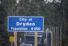
Dryden and Vermilion Bay share a similar forecast today: a mix of sun and cloud with a 30 percent chance of showers late this afternoon and a risk of a thunderstorm.
Both communities reach 25°C, with a humidex of 28 and a high UV index of 6.
Tonight will be partly cloudy with a 30 percent chance of showers and thunderstorms. Fog patches may develop overnight as temperatures fall to 14°C.
Sioux Lookout
Sioux Lookout will have a mix of sun and cloud, with a 30 percent chance of showers developing late this afternoon and a risk of a thunderstorm.
The high reaches 25°C, with a humidex of 28 and a high UV index of 6.
Tonight stays partly cloudy with a 30 percent chance of showers and a thunderstorm risk. Fog patches may develop, with a low of 13°C.
Pickle Lake
Pickle Lake will see a mix of sun and cloud with a 40 percent chance of showers late this afternoon and a risk of a thunderstorm.
The high reaches 24°C, with a humidex of 26 and a moderate UV index of 5.
Tonight remains mainly cloudy with a 40 percent chance of showers and an evening thunderstorm risk. The overnight low is 11°C.
Sunday, August 30
Sunday remains warm, but conditions vary considerably across the district.
Kenora stays mainly cloudy with a 30 percent chance of showers and a risk of an afternoon thunderstorm. Southeast winds increase to 20 km/h, with a high of 26°C and humidex of 31.
Fort Frances will be cloudy with a 30 percent chance of showers and an afternoon thunderstorm risk. Easterly winds near 20 km/h ease toward noon. The high reaches 25°C, feeling closer to 30.
Red Lake reaches 26°C under a mix of sun and cloud, with a 30 percent chance of showers and an afternoon thunderstorm risk. Southeast winds develop late in the day.
Dryden and Vermilion Bay will be mainly cloudy with a 30 percent chance of showers and a thunderstorm risk. Southeast winds reach 20 km/h around noon, with highs near 25°C and humidex values around 30.
Sioux Lookout reaches 25°C with a mix of sun and cloud, a 30 percent chance of showers and an afternoon thunderstorm risk. Southeast winds develop near noon.
Pickle Lake gets the best Sunday weather in this roundup. Environment Canada’s latest available forecast calls for sunshine and a high of 24°C, followed by a clear night and low of 13°C.
Monday, August 31
Monday brings the most widespread rain chances of the three-day period.
Kenora will be cloudy with a 60 percent chance of showers and a high of 25°C, followed by a cloudy night near 15°C.
Fort Frances remains warm at 25°C, with Environment Canada’s extended forecast carrying a 40 percent chance of showers.
Red Lake reaches around 24°C with a 60 percent chance of showers.
Dryden and Vermilion Bay are forecast to reach 25°C under cloudy skies with a 60 percent chance of showers.
Sioux Lookout reaches 24°C, also with a 60 percent chance of showers. Monday night keeps a 30 percent chance of precipitation with a low of 13°C.
Pickle Lake turns distinctly cooler and wetter. Expect cloudy skies, a 60 percent chance of showers and a high of only 21°C, followed by another 60 percent shower chance Monday night and a low of 12°C.
Regional Weather Trend
Saturday and Sunday will feel much warmer than typical late-August conditions. Kenora’s normal August 29 high is about 20°C, yet today’s forecast calls for 26°C. Red Lake’s normal high is about 19°C compared with today’s 25°C, while Pickle Lake’s normal is near 18°C compared with a forecast high of 24°C.
The main concern through the weekend is not prolonged rain but scattered convection. That means some communities may see little or no precipitation while nearby areas receive a thunderstorm.
People boating, fishing, camping or travelling between communities should therefore pay attention to changing skies during the late afternoon and evening.
Wardrobe Recommendations
Light summer clothing will be comfortable Saturday and Sunday afternoons as temperatures rise into the mid-20s. With humidex values approaching 30 or 31 around Kenora and Fort Frances, breathable clothing will be especially useful.
Keep a light waterproof jacket nearby and have a plan to get indoors if thunderstorms develop. Rain gear does not provide protection from lightning.
Sunscreen, sunglasses and a hat are worthwhile with UV levels reaching the high category in much of the region.
Evenings remain cooler, particularly around Pickle Lake, where Saturday night falls to 11°C. A hoodie or light jacket remains useful for camping, late-evening events and early morning travel.
Weather Trivia
A forecast showing a 30 percent chance of precipitation does not mean it will rain for 30 percent of the day. It represents the probability of measurable precipitation occurring at a particular location during the forecast period.
That distinction is especially important on a day like Saturday, when scattered showers and thunderstorms may be highly localized. One lake or community can remain dry while another nearby receives a heavy downpour.
Source: Environment and Climate Change Canada forecasts issued early Saturday, August 29, 2026, including the Northern Ontario public forecast issued at 5:30 a.m. EDT.
Summary
Northwestern Ontario weather for August 29-31, 2026: Warm highs of 24°C to 26°C bring afternoon thunderstorm risks Saturday and Sunday in Kenora, Fort Frances, Red Lake, Dryden, Sioux Lookout and Pickle Lake before more widespread showers Monday.