Northern Ontario weather forecast for August 13-16, 2026, covering Fort Severn/Wasaho Cree Nation, KI/Big Trout Lake, Neskantaga, Marten Falls/Ogoki Post, Sandy Lake and Attawapiskat
NORTHERN ONTARIO – WEATHER – Communities across Ontario’s Far North are waking up to a cool, damp and generally cloudy Thursday morning. The August 13 forecast includes scattered showers and an afternoon thunderstorm risk for several inland communities, while Fort Severn and Attawapiskat will remain cooler under the influence of the far northern weather pattern.
Conditions improve considerably Friday, August 14, with temperatures climbing into the low 20s across most communities. Saturday remains relatively mild, while increasing cloud and renewed chances of showers become the main weather story by Sunday, August 16. Environment Canada issued the forecasts early Thursday morning.
Today’s Weather Overview – Thursday, August 13
Current Conditions
Early Thursday morning, humidity is very high across much of the region, with cloudy skies dominating. Environment Canada was not reporting a current observation for Fort Severn at forecast time, but observations were available from the other communities or their local airports.
| Community | Temperature | Conditions | Wind | Pressure | Humidity |
|---|---|---|---|---|---|
| Fort Severn / Wasaho Cree Nation | — | Current observation unavailable | — | — | — |
| KI / Big Trout Lake | 11.5°C | Cloudy | NNE 4 km/h | 101.6 kPa | 98% |
| Neskantaga / Lansdowne House area | 14.2°C | Cloudy | E 11 km/h | 101.4 kPa | 98% |
| Marten Falls / Ogoki Post | 12.8°C | Cloudy | NE 13 km/h | 101.3 kPa | 91% |
| Sandy Lake | 11.0°C | Mostly cloudy | N 5 km/h | 101.7 kPa | 100% |
| Attawapiskat | 11.4°C | Cloudy | NNW 4 km/h | 101.3 kPa | 98% |
Big Trout Lake Airport reported its observation at 6:00 AM CDT, Sandy Lake at 6:00 AM CDT, Lansdowne House at 7:14 AM EDT, Ogoki Post at 7:00 AM EDT and Attawapiskat at 7:06 AM EDT.
Fort Severn / Wasaho Cree Nation
Thursday will be the coolest day of the forecast period in Fort Severn. Mainly cloudy skies come with a 30 per cent chance of drizzle this morning, while morning fog patches will dissipate. Northwest winds increase to 20 km/h with gusts to 40 km/h late this morning. The high will reach only 15°C, with a moderate UV index of 5. Tonight clears with a low of 8°C.
Friday, August 14 brings a mix of sun and cloud and a much warmer high of 20°C. Northwest winds again increase to 20 km/h, gusting to 40 near noon. Friday night will be clear with a low of 12°C.
Saturday, August 15 will feature a mix of sun and cloud with a high of 21°C, followed by cloudy periods and a low of 10°C overnight. Sunday, August 16 remains partly sunny but cooler at 18°C. Cloudy periods Sunday night bring a 30 per cent chance of showers and a low of 10°C.
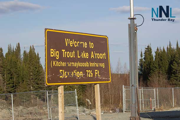
KI / Big Trout Lake
Kitchenuhmaykoosib and the Big Trout Lake area will see mainly cloudy skies Thursday, with a 30 per cent chance of showers or drizzle this morning. Fog patches will dissipate through the morning. The high will be 19°C, with a moderate UV index of 5. Clouds clear before Friday morning as temperatures fall to 11°C overnight.
Friday looks like the best weather day, with mainly sunny skies and a high of 22°C. Clouds increase Friday night with a low of 13°C.
Saturday will be cloudy with a high of 21°C. A 30 per cent chance of showers develops Saturday night as the temperature falls to 13°C. Sunday remains cloudy with a 30 per cent chance of showers, a high of 20°C, and another 30 per cent shower chance Sunday night with a low of 14°C.
Neskantaga
For Neskantaga, using Environment Canada’s Lansdowne House forecast area, Thursday will be mainly cloudy with a 40 per cent chance of showers and a risk of an afternoon thunderstorm. Morning fog patches will dissipate, and the high will reach 20°C. The UV index is 5, or moderate.
Thursday evening retains a 40 per cent chance of showers and a thunderstorm risk before fog patches develop overnight. The low will be 11°C.
Friday begins with a mix of sun and cloud before becoming cloudy during the morning. Fog patches will dissipate, and the temperature climbs to 23°C, with a humidex of 26. Friday night falls to 12°C.
Saturday stays cloudy but mild at 23°C, with an overnight low of 12°C. Sunday turns somewhat cooler, with cloudy skies, a 30 per cent chance of showers and a high of 20°C. The shower chance continues Sunday night with a low of 12°C.
Marten Falls / Ogoki Post
Marten Falls and Ogoki Post start Thursday under a damp and unsettled pattern. At Ogoki Post Airport shortly after 7:00 AM, the temperature was 12.8°C, with 91 per cent humidity and northeast winds at 13 km/h.
Thursday will be mainly cloudy with a 40 per cent chance of showers and a risk of an afternoon thunderstorm. Morning fog patches will dissipate, with a high of 20°C. Tonight remains mainly cloudy, with a 40 per cent chance of early-evening showers and a thunderstorm risk. Fog can redevelop overnight as the temperature falls to 11°C.
Friday reaches 23°C. A mix of sun and cloud will give way to cloudy skies during the morning. The humidex may reach 26. Friday night falls to 12°C.
Saturday remains cloudy with a high of 23°C and a low of 12°C. Sunday turns cooler at 20°C, with cloudy skies and a 30 per cent chance of showers. Sunday night carries another 30 per cent chance of showers with a low of 12°C.
Sandy Lake
Sandy Lake has one of the more unsettled forecasts for Thursday. Mainly cloudy skies bring a 40 per cent chance of showers and a risk of an afternoon thunderstorm, with a high of 19°C. The UV index will be 4, or moderate.
Thursday night becomes partly cloudy, with fog patches developing and a low of 11°C.
Conditions improve Friday, beginning mainly sunny before clouds increase late in the morning. The high reaches 22°C, followed by a cloudy night and a low of 14°C.
Saturday stays cloudy with a high of 20°C. There is a 30 per cent chance of showers Saturday night with a low of 13°C. Sunday remains cloudy with a 40 per cent chance of showers and a high of 21°C. Sunday night carries a 30 per cent chance of showers and a low of 14°C.
Attawapiskat
Attawapiskat starts Thursday cool and damp. At 7:06 AM EDT, Attawapiskat Airport was reporting 11.4°C, cloudy skies, 98 per cent humidity, and a light north-northwest wind at 4 km/h.
Today remains mainly cloudy, with morning fog patches dissipating. Northwest winds increase to 20 km/h, gusting to 40 km/h near noon. The high will be 17°C, with a moderate UV index of 5. Tonight stays overcast, with northwest winds gusting to 40 before becoming light. The low will be 10°C.
There is a significant warm-up Friday, when mainly cloudy skies clear during the early afternoon. Northwest winds again reach 20 km/h with gusts to 40 around noon. The temperature climbs to 23°C, with a humidex of 25. Friday night will be clear with a low of 10°C.
Saturday should be the warmest day of this forecast period in Attawapiskat, with a mix of sun and cloud and a high of 24°C. Saturday night brings cloudy periods and a low of 11°C.
Sunday turns cooler and more unsettled, with cloudy skies, a 30 per cent chance of showers and a high of 19°C. The 30 per cent shower chance continues Sunday night with a low of 11°C.
Far North Weather Trend
The main concern Thursday is the combination of showers, fog and isolated thunderstorm potential, especially from Sandy Lake eastward through the Neskantaga and Ogoki areas. KI and Big Trout Lake have a smaller morning shower or drizzle risk, while Attawapiskat and Fort Severn remain comparatively cool.
Friday brings the broadest improvement. Most communities rise into the 20°C to 23°C range, with Attawapiskat and the Neskantaga/Ogoki region reaching about 23°C. Saturday remains mild, with Attawapiskat reaching 24°C, while cloud cover becomes more widespread inland. By Sunday, shower chances return to KI, Neskantaga, Ogoki, Sandy Lake and Attawapiskat. Fort Severn remains dry through the daytime Sunday under a mix of sun and cloud.
Wardrobe Recommendations
Thursday calls for layers. A sweater or fleece under a light waterproof jacket will work well, particularly in Fort Severn and Attawapiskat where temperatures remain in the mid-to-upper teens. A rain shell is especially useful in Sandy Lake, Neskantaga and the Ogoki area because of the shower and thunderstorm risk.
Friday and Saturday will be warmer, so lighter daytime clothing will be comfortable, but keep a sweater or jacket nearby for evenings. Overnight lows range from about 8°C to 14°C during the forecast period, making warm layers important for anyone camping, travelling on the land, or spending extended periods outdoors.
Fog is also part of Thursday’s forecast in several communities. Anyone travelling by air or heading out on the land should check the latest local conditions before departure.
Weather Trivia
Fort Severn, also known as Wasaho Cree Nation, is Ontario’s northernmost community. Its far northern location near Hudson Bay places it in a distinctly different climate from communities farther south, something clearly visible in Thursday’s forecast: Fort Severn reaches only 15°C while some inland communities climb to around 20°C.
Forecast information is based on Environment and Climate Change Canada forecasts and observations available on the morning of Thursday, August 13, 2026. Forecasts, thunderstorm risks and local aviation conditions can change quickly in the Far North, so residents and travellers should monitor the latest Environment Canada updates.