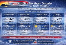
Thunder Bay – Weather – Just after a day where Thunder Bay started as Ontario’s hot spot and finished in Ontario’s deep freeze, here we are with a Saturday where putting mittens on the kittens is a real need.
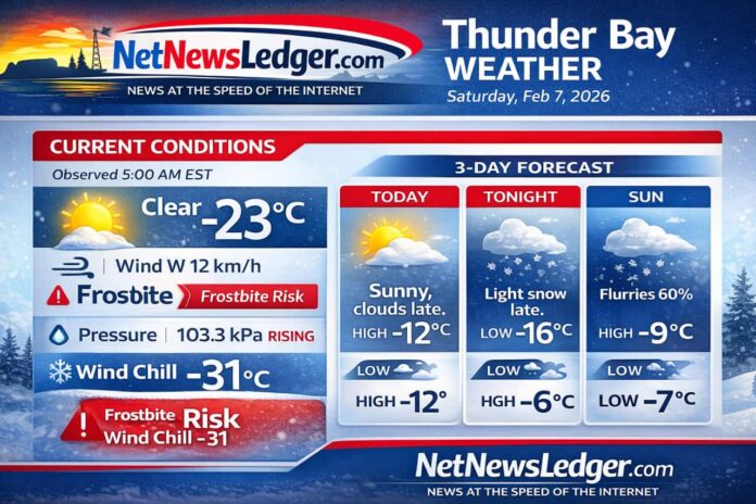
A cold, quiet start across Thunder Bay under clear skies and high pressure. The air is dry and sharp, and the wind is enough to push wind chills into the “risk of frostbite” range.
Clouds will increase later today, as light snow moves in late this evening into the overnight hours.
Today’s Weather Overview
Current Conditions (Observed 5:00 AM EST)
At daybreak, Thunder Bay is sitting near -23°C (-9°F) with a west wind around 12 km/h, producing a wind chill near -31°C (-24°F). Humidity is 73%, with a dew point of -26°C, and visibility is excellent around 23 km. Barometric pressure is 103.3 kPa and rising, a classic sign of stable winter weather—sunny now, before the next system thickens cloud cover later today.
What to expect today (Saturday)
Sunny this morning, with increasing cloudiness this afternoon. Winds stay up to 15 km/h. The temperature climbs to a high near -12°C (10°F), but it will still feel biting early: wind chill near -32 this morning improving to about -15 by afternoon—still cold enough to warrant caution for exposed skin. UV index remains 1 (low).
Expected Conditions: Next 3 Days
Tonight (Sat night):
Clouding over, with periods of light snow beginning late this evening. Wind up to 15 km/h. Low near -16°C (3°F)with wind chill around -22 this evening.
Sunday, Feb 8:
Cloudy with a 40% chance of flurries, wind up to 15 km/h. High near -6°C (21°F). Wind chills hover near -19 in the morning and -10 in the afternoon. Sunday night stays cloudy with a 60% chance of flurries, low near -9°C (16°F).
Monday, Feb 9:
Cloudy with a 60% chance of flurries, high near -2°C (28°F). Monday night turns a bit less active: 30% chance of flurries, low near -7°C (19°F).
Trend note: Temperatures moderate noticeably from today’s deep cold toward “near-freezing-by-day” territory by early week, but the cloud-and-flurry pattern sticks around.
Wardrobe Recommendations
-
This morning (wind chill near -31 to -32): insulated parka, thermal base layer + mid-layer fleece, lined snow pants if you’re outside for more than a quick errand.
-
Protect skin: mitts (warmer than gloves), toque, neck gaiter/scarf, and consider a face covering if you’re waiting for transit or walking the dog. (Frostbite risk rises fast with exposed skin.)
-
Footwear: insulated boots + wool socks; add traction cleats if sidewalks glaze up after tonight’s snow.
-
Tonight into Sunday: keep a brush/scraper handy and wear something windproof—light snow and flurries can still sting with a breeze.
Weather Trivia
On February 7 in the Thunder Bay climate record (Thunder Bay CS, 2004–2025), the warmest Feb 7 reached +2.5°C (2024), while the coldest dropped to -30.5°C (2018)—a reminder of how wide the winter swings can be in Northwestern Ontario.


