DULUTH – WEATHER – The NOAA out of Duluth report that a prolonged period of snow, rain and wintry mix will be moving into the region on Tuesday, and will have lasting impacts through Thursday.
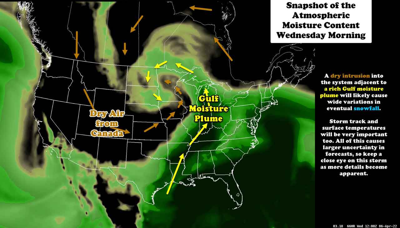
The National Weather Service says snow accumulations are still remaining uncertain at this time due to surface temperatures and other key factors.
Any snow that is produced however, NOAA says will be WET and HEAVY in nature and could lead to snow loading on branches and power lines. With gusty southeast winds expected to accompany this system there may be some power outages.
Winter Storm Watch in Effect
...WINTER STORM WATCH IN EFFECT FROM TUESDAY EVENING THROUGH
WEDNESDAY EVENING...

* WHAT...Heavy wet snow possible. Total snow accumulations of 4
  to 8 inches possible. Winds could gust as high as 40 mph.

* WHERE...Northern Cook and Lake, Southern Lake and Southern
  Cook Counties. This includes the Tribal Lands of the Grand
  Portage Reservation.

* WHEN...From Tuesday evening through Wednesday evening.

* IMPACTS...Travel could be very difficult. The hazardous
  conditions could impact the morning or evening commute.