THUNDER BAY – WEATHER – Yes, that white stuff on the ground in Thunder Bay is snow.
There are no weather alerts or warnings in effect in either Western or Northern Ontario this morning.
We are following what the Duluth NOAA – The National Weather Service in the United States is calling a severe spring storm south of the border.
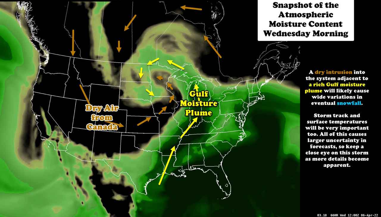
This weather system could impact parts of the region later this week.
Thunder Bay
Cloudy skies and light snow in Thunder Bay this morning. The forecast is for a 60 per cent chance of flurries changing to a 30 per cent chance of rain showers or flurries near noon.
There is a risk of freezing drizzle early this morning. Fog patches will be dissipating this morning. Winds will be light at up to 15 km/h. High of +3 for Monday. Wind chill -6 this morning.
UV index 3 or moderate.
Tonight the outlook is for cloudy skies with a continued 30 per cent chance of flurries. Additionally there is a risk of freezing drizzle late this evening and overnight. Fog patches will developing near midnight. Winds will remain light at up to 15 km/h. Low of -2 overnight with the wind chill at -4.
Fort Frances
It is -4 to start your week in Fort Frances. Skies are a mix of sun and cloud. There is a 30 per cent chance of flurries early this morning. Fog patches will be dissipating this morning. Winds will be light at up to 15 km/h. High of +7 for the day. Wind chill is at -10 this morning.
UV index 4 or moderate.
Tonight we are calling for a few clouds. Winds will remain light at up to 15 km/h. Low overnight of -3. Wind chill -7 overnight.
Dryden and Vermilion Bay
It is -1 headed to a high for Monday of +6 in Dryden and Vermilion Bay. Mainly cloudy skies with a 30 per cent chance of flurries this morning then a 30 per cent chance of rain showers this afternoon. Fog patches will be dissipating this morning. Winds will be light blowing at up to 15 km/h. Wind chill is at -6 this morning.
UV index 3 or moderate.
Tonight will see partly cloudy skies with a 30 per cent chance of showers early this evening. Winds will be light at up to 15 km/h. Low -5 with the wind chill at -11 overnight.
Sachigo Lake
Good Morning Sachigo Lake. It is -10 this morning. The forecast is for increasing cloudiness with a 40 per cent chance of rain showers or flurries this afternoon.
Winds will be light at up to 15 km/h. High of +3 with the wind chill at -8 this morning.
UV index 2 or low.
Tonight will see cloudy skies with a 30 per cent chance of rain showers or flurries changing to a 30 per cent chance of flurries this evening.
There will be a risk of freezing drizzle late this evening and overnight. Winds will remain light at up to 15 km/h. Low -3. Wind chill -7 overnight.


