Thunder Bay – Wildfire Update – There are 24 active fires in the region. Three new fires were discovered by this afternoon. Four of the wildfires are not under control. Ten fires are being observed and ten are under control. Two fires were put out today.
- Three new fires were discovered in the northwest region by the late afternoon of June 25.
- Sioux Lookout 19 is located near Kezik Lake, approximately 10 kilometres north of Slate Falls First Nation. The fire is under control at 0.1 hectares.
- Fort Frances 49 is located near Lower Manitou Lake, approximately 60 kilometres north of Fort Frances. The 0.1 hectare fire is not under control.
- Sioux Lookout 20 is located approximately 23 kilometres west of Cat Lake First Nation. The 1.5 hectare fire is not under control.
- At the time of this update there are 24 active fires in the region. Four fires are not under control, 10 fires are under control and 10 fires are being observed. Two fires were called out today.
- The wildland fire hazard is high to extreme in the Kenora and Red Lake sectors. Moderate to high hazard conditions exist in the Fort Frances, Dryden, Sioux Lookout, Thunder Bay and Nipigon sectors.
- To see the fire hazard near you, consult the interactive fire map at Ontario.ca/forestfire
Fires of Note
Fort Frances 49
- Fire remains not under control at 437 hectares.
- Fire responded well to near continuous air attack over the fire in recent days and minimal growth has been observed.
- Northwest winds have brought smoke into the community. Some residents have voluntarily evacuated due to air quality issues.
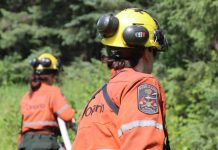
- Twelve crews are currently working the fire in various roles with more crew resources to be placed on the fire as they become available.
- Waterbombers worked the fire again today as crews continue to establish hoselines.
- Warm temperatures, minimal precipitation and a chance of thunderstorms is expected in the area in coming days.
- An Implementation Order is now in effect for the fire area (see below).
Sioux Lookout 17
- Fire has now been remapped to 1,000 hectares and remains not under control.
- Recent precipitation in the area has reduced fire behaviour significantly.
Heavy equipment is working to establish fire line in strategic areas and crews are establishing hoselines. - More resources are expected to enter the area in the coming days.
Restrictions due to forest fire activity in the Fort Frances District
The Ministry of Natural Resources and Forestry, Fort Frances District, is advising the public that due to extreme forest fire activity from the Fort Frances 47 fire, an Implementation Order is now in effect until further notice that restricts access and use of certain roads and Crown lands.
All travel, use and access to the following areas are prohibited unless authorized by a travel permit issued by the Fort Frances District Ministry of Natural Resources and Forestry.
This includes all travel on Northwest Bay Road outside of Naicatchewenin First Nation, including West Spencer Road, Woody Road, Alex Road, and Kaiarskon South Road. Also including Charles Road south of the kilometre marker 24 and all branch roads associated with the previously identified road networks.
All use or occupation of Crown lands, on or within 500 metres of the identified roads, is prohibited.
For information on how to obtain a travel permit please call 807-271-0216.


