
Lake Ontario Water Levels Very High
THUNDER BAY – Heavy rainfalls in Southern Ontario have raised the possibility that the Great Lakes St. Lawrence could be shutdown to allow officials to open dams and release the large amounts of water releasing the pressure.
If outflows are increased further, unsafe currents would halt shipping, causing a break in a long time scheduled chain of multi-goods transiting between overseas and the Great Lakes and impacting all those industries and jobs that rely on Seaway shipping.
The International Lake Ontario-St. Lawrence River Board, which controls the Seaway have opened the taps at the Moses-Saunders power dam at Cornwall to record levels. The outflow volume at Cornwall is 10,200 cubic metres per second, equalling the highest outflow since recording began there 117 years ago.
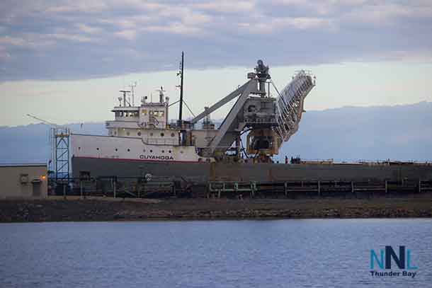
A shutdown to the seaway could impact the Port of Thunder Bay. However there is not official word on how long such a shutdown would be should it happen.
The International Lake Ontario – St. Lawrence River Board assessed current and expected conditions to determine the best outflow release strategy to address high water level and associated impacts throughout the system. Months of high precipitation produced the highest recorded waters level on Lake Ontario since reliable records began in 1918. The level was stable for several days as a result of drier weather and increased outflows, and barring significant additional rainfall, the Lake Ontario level may have halted its rapid rise. The Board has been maximizing the outflows from Lake Ontario, and has been balancing water levels upstream and downstream to minimize flood and erosion impacts to the extent possible.
The Ottawa River flow has continued to decline since reaching its record-breaking peak on 8 May 2017. As a result, less water is entering the St. Lawrence River at Lake St. Louis (near Montreal), and more outflow from Lake Ontario has been able to be released into the St. Lawrence River, while still keeping levels downstream from exceeding the flood levels experienced since the beginning of May.
Lake Ontario outflows have now reached 10,200 m3/s (360,200 cfs). These extremely high outflows are now impacting navigation conditions in the St. Lawrence Seaway between the Thousand Islands and Massena, NY /Cornwall, ON. With these higher flows, the Board also had to consider not only maximizing relief on riparians upstream and downstream but to also consider the impacts on the commercial shipping industry. To assist the Board, the Seaway agencies have adopted mitigation measures to ensure the safety of ships transiting this section of the St. Lawrence River.
The Board continues to provide maximum relief to shoreline communities while also attempting to a lesser extent to maintain the Seaways safe operations. If weather conditions remain as expected, the Board will continue to release an outflow of 10,200 m3/s (360,200 cfs); a flow equivalent to the record maximum weekly flows passed in 1993 and 1998, for several weeks in an effort to reduce the high level of Lake Ontario as quickly and safely as possible.
If the drier conditions of the past weeks continue across the Lake Ontario – St. Lawrence River basin, Lake Ontario outflows are expected to soon surpass inflows, at which time Lake Ontario’s water level will begin to decline. However, owing to the huge surface area and large volume of water on Lake Ontario, it will take several weeks to significantly reduce levels, and longer to return to more average water level conditions. The Board therefore advises continued caution and preparedness for sustained high water levels in the weeks to come.
On 25 May 2017, Lake Ontario was 75.88 m (248.95 ft), 84 cm (33.1 inches) above its long-term average level for this time of year. The level at Lake St. Lawrence was 6 cm (0.x inches) below average, while the level at Lake St. Louis is about 22.52 m (73.88 ft), 106 cm (41.7 inches) above average. At Montreal Harbour, the level is 140 cm (55.1 inches) above average. Downstream, the flooding which has caused evacuations around Lake St. Peter is prolonged.


")


