
THUNDER BAY – WEATHER – UPDATED – ENDED — All alerts and warning for the region have ended .
Environment Canada is reporting that conditions are favourable for the development of dangerous thunderstorms that may be capable of producing damaging wind gusts, large hail and heavy rain.
Updated at 17:52PM EDT……. SEVERE Thunderstorm Warning and Watches…
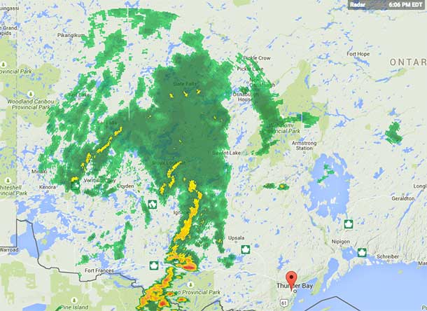
Severe thunderstorm watch in effect for:
- Thunder Bay – Thunderstorm Watch
- Atikokan – Shebandowan – Quetico Park
- Upsala – Raith
- Gull Bay – Black Sturgeon
- Dryden – Ignace Severe Thunderstorm Warning
- Vermillion Bay – Kenora
- Fort Frances – Atikokan
- Red Lake
- Sioux Lookout – Severe Thunderstorm Warning
The weather service states that “Thunderstorms are expected to develop this afternoon and continue into the early evening hours. A few of these thunderstorms will have the potential to produce severe weather”.
Fast moving water across a road can sweep a vehicle away. Large hail can damage property and cause injury. Very strong wind gusts can damage buildings, down trees and blow large vehicles off the road. Remember, severe thunderstorms can produce tornadoes. Be prepared for severe weather. Take cover immediately, if threatening weather approaches.
The Office of the Fire Marshal and Emergency Management recommends that you take cover immediately, if threatening weather approaches.


