
WINTER STORM WARNINGS IN EFFECT
THUNDER BAY – Northern Ontario has a number of Winter Storm Warnings and Weather Alerts in effect. Mother Nature is taking a step back in several parts of the region and winter is back.
Winter storm warning in effect for:
- Fort Hope – Lansdowne House – Ogoki
- Webequie
- Pickle Lake – Cat Lake
- Summer Beaver – Wunnummin Lake – Kingfisher Lake
- Attawapiskat
- Sandy Lake – Weagamow Lake – Deer Lake
Hazardous winter conditions are expected.
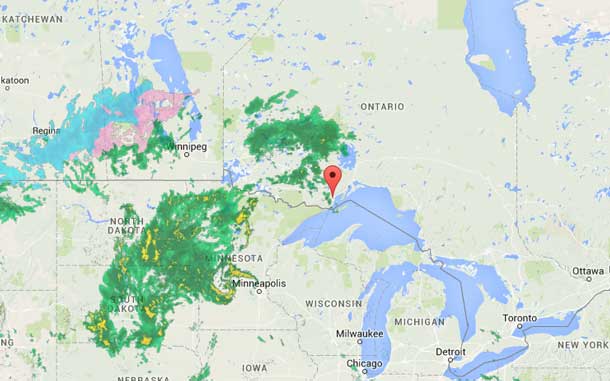
Much colder arctic air is invading the region from the north in the wake of a sharp cold front that is moving through this morning. As the front settles just to the south of the region later today, precipitation from a strong Colorado low will move in, starting out initially as rain, then changing over to freezing rain and ice pellets later today and this evening then into snow, heavy at times tonight as the cold air continues to flood in. Many areas may receive a few millimetres of freezing rain over a several hour period before the changeover to snow. Latest indications suggest 15 to 20 cm of snow will fall from this storm, with locally higher amounts of 20 to 30 cm quite possible by the time this winter storm ends Monday night.
In addition strong and gusty northerly winds will whip up the freshly fallen snow overnight and Monday, resulting in reduced visibility in blowing snow in exposed areas.
Hazardous winter travelling conditions are expected from this nasty winter storm, and travel is not recommended.
Weather Alerts in Northwestern Ontario
Special weather statement in effect for:
- Atikokan – Shebandowan – Quetico Park
- Upsala – Raith
- Dryden – Vermilion Bay
- Ignace – English River
- Nipigon
- Fort Frances – Emo – Rainy River
- Seine River Village – Mine Centre
- Kenora – Grassy Narrows – Whitedog
- Sioux Narrows – Nestor Falls – Morson
- Ear Falls – Perrault Falls – Western Lac Seul
- Red Lake – Woodland Caribou Park
Significant rainfall today followed by a brief return to winter like conditions tonight and Monday.
A strong low pressure area that formed over Colorado will track into Northern Minnesota today then follow a path east across Lake Superior into Northeastern Ontario Monday. This moisture laden low pressure area will bring a significant rainfall to Northwestern Ontario today, with total rainfall amounts of 20 to 40 mm quite likely by tonight. A few locally higher rainfall amounts of 40 to 60 mm are possible especially in areas that receive an embedded thunderstorm or two. Lesser total rainfall amounts are expected over regions extending from Lake Nipigon to the Quebec border.
However another significant weather situation that is expected to affect all regions tonight into Monday will be the rain changing over to freezing rain as stiff northeasterly winds push in ever colder air from the Arctic, forcing the temperature down to near or slightly below zero.
The freezing precipitation is expected to switch through ice pellets to snow over areas from Nakina to Geraldton and west by Monday, giving quite the taste of winter for the Victoria day holiday. Travelling conditions will likely deteriorate in areas that receive freezing rain, ice pellets and snow.


