#Santabomb Morphs to #Christmess Storm

434
Eastern Canada is under weather warnings.

Winter Storm Watch

THUNDER BAY – WEATHER – The #santabomb has shifted to a #Christmess. Rather than the originally forecast snowfall of up to 45cm, the weather system has shifted to more of a combination of rain, freezing rain, and a little bit of snow.

The real issue for most in Thunder Bay will be for those travelling east. Freezing rain warnings are in effect for much of Southern Ontario.

For Northwestern Ontario, as of 08:00AM on December 23rd, there are no weather alerts or warnings in effect.

Eastern Canada is under weather warnings.

For the latest road conditions visit Winter Driving Conditions.

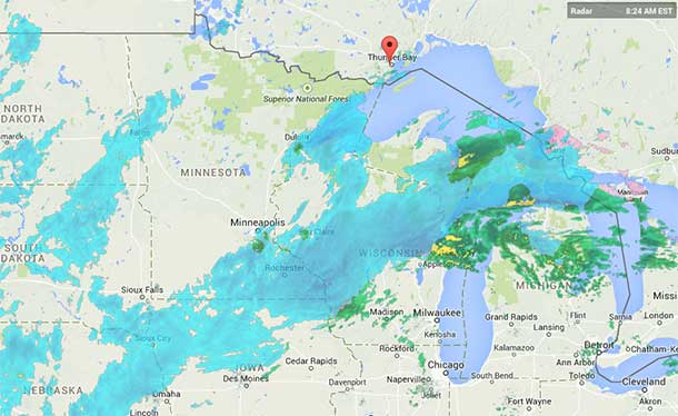
The latest Weather Radar is showing quite the change from last weekend when the Christmas #santabomb was first reported.

It is looking now like most of the storm will slide east of Thunder Bay.

Weather Radar showing most of the storm appears to be headed east of Thunder Bay
Previous articleFood Banks – Growth in Need Continues
Next articleKeurig Recall for MINI Plus Brewer
NetNewsledger.com or NNL offers news, information, opinions and positive ideas for Thunder Bay, Ontario, Northwestern Ontario and the world. NNL covers a large region of Ontario, but are also widely read around the country and the world. To reach us by email: newsroom@netnewsledger.com Reach the Newsroom: (807) 355-1862