
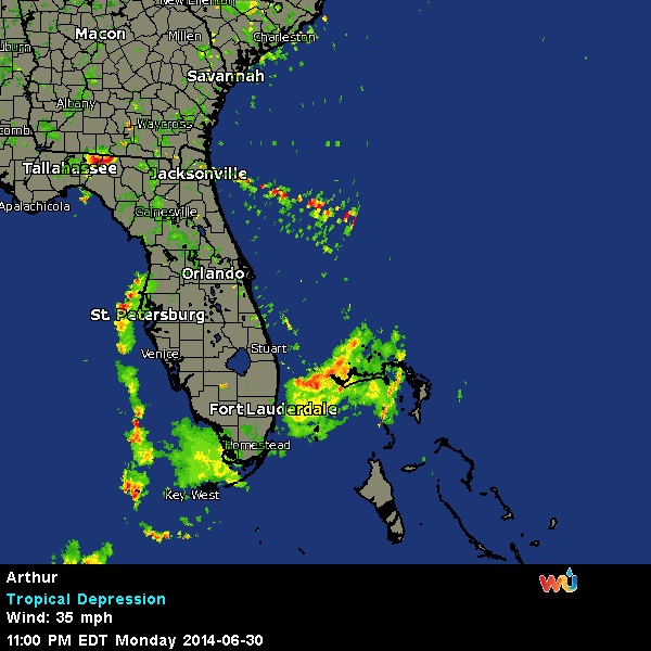
Hurricane Arthur Update
THUNDER BAY – WEATHER – Hurricane Arthur is tracking its way along the eastern seaboard of the United States. Watches are in effect in Canada for the Maritime provinces. The storm which grew to Category One Hurricane status overnight, is now reaching across a wide track as it threatens the coastline.
Arthur as Seen from International Space Station
For Canadians, the saving grace for the weekend is likely to be that the waters in the Atlantic Ocean are colder along the coastline than they are off the more southern geographic area.
…Arthur now a hurricane…
…Expected to move near the North Carolina Outer Banks tonight…
Summary of 500 am EDT…0900 UTC…information
———————————————-
location…31.3n 79.1w
about 340 mi…545 km SW of Cape Hatteras North Carolina
about 190 mi…305 km SSW of Cape Fear North Carolina
maximum sustained winds…75 mph…120 km/h
present movement…N or 10 degrees at 9 mph…15 km/h
minimum central pressure…985 mb…29.09 inches
Watches and warnings
——————–
changes with this advisory…
The Hurricane Warning has been extended northward from Duck North Carolina to the North Carolina/Virginia border.
Summary of watches and warnings in effect…
A Hurricane Warning is in effect for…
* Surf City North Carolina to the North Carolina/Virginia border
* Pamlico Sound
* eastern Albemarle Sound
A Hurricane Watch is in effect for…
* Little River Inlet to south of Surf City
A Tropical Storm Warning is in effect for…
* South Santee River South Carolina to south of Surf City
* the North Carolina/Virginia border to Cape Charles Light
Virginia…including the mouth of the Chesapeake Bay
* western Albemarle Sound
A Hurricane Warning means that hurricane conditions are expected somewhere within the warning area. Preparations to protect life and property should be rushed to completion.
A Hurricane Watch means that hurricane conditions are possible within the watch area. Any deviation of the forecast track to the left…or an increase in the forecast size of Arthur would likely require the issuance of hurricane warnings for all or part of the Hurricane Watch area.
A Tropical Storm Warning means that tropical storm conditions are expected somewhere within the warning area.
Interests along the United States East Coast north of the warning area…primarily in southeastern New England…should monitor the
progress of Arthur.
For storm information specific to your area…including possible inland watches and warnings…please monitor products issued by your local National Weather Service forecast office.
Discussion and 48-hour outlook
——————————
at 500 am EDT…0900 UTC…the center of Hurricane Arthur was located by hurricane hunter aircraft and NOAA Doppler radars near latitude 31.3 north…longitude 79.1 west. Arthur is moving toward the north near 9 mph…15 km/h. A turn toward the northeast with an increase in forward speed are expected today…followed by a further increase in forward speed tonight and Friday. On the forecast track…the core of Arthur is expected to approach the coast in the Hurricane Warning area tonight.
Data from NOAA and Air Force Reserve hurricane hunter aircraft indicate that maximum sustained winds have increased to near 75 mph…120 km/h…with higher gusts. Some additional strengthening is forecast in the next 24 hours.
Hurricane-force winds extend outward up to 25 miles…35 km…from the center…and tropical-storm-force winds extend outward up to 90
miles…150 km.
The latest minimum central pressure reported by the NOAA hurricane hunter aircraft is 985 mb…29.09 inches.
Hazards affecting land
———————-
wind…tropical storm conditions are expected to spread northward in the tropical storm and Hurricane Warning areas later today and tonight.
Hurricane conditions are expected within portions of the Hurricane Warning area by tonight.
Storm surge…the combination of a dangerous storm surge and the tide will cause normally dry areas near the coast to be flooded by rising waters.
The water could reach the following heights above ground if the peak surge occurs at the time of high tide…
North Carolina Outer Banks…2 to 4 ft
Pamlico and Albemarle sounds…2 to 4 ft
southern North Carolina and northeastern South Carolina…1 to 3 ft
extreme southeastern Virginia…1 to 2 ft
The highest water will occur along the immediate coast in areas of onshore flow. The surge will be accompanied by large and damaging waves. Surge-related flooding depends on the relative timing of the surge and the tidal cycle…and can vary greatly over short distances. For information specific to your area…please see products issued by your local National Weather Service office and the new experimental potential storm surge flooding map for more details.
Rainfall…rainfall accumulations of 2 to 4 inches…with isolated maximum amounts of 6 inches…are expected over coastal areas of North Carolina through Friday. Rainfall accumulations of 1 to 2 inches are possible along the upper coast of South Carolina.
Tornadoes…isolated tornadoes are possible over portions of coastal North Carolina today.
Surf…swells generated by Arthur are affecting areas from the east-central coast of Florida northward to South Carolina. These swells are expected to cause life-threatening surf and rip currents. For more information…please monitor products issued by your local National Weather Service forecast office.
Next advisory
————-
next intermediate advisory…800 am EDT.
Next complete advisory…1100 am EDT.
$$
Forecaster Brennan

Canadian Hurricane Centre
Tropical cyclone information statement for:
NEW BRUNSWICK
NEWFOUNDLAND
NOVA SCOTIA
PRINCE EDWARD ISLAND
For tropical storm Arthur.
The next statement will be issued by 9:00 AM ADT.
Tropical storm Arthur to merge with a cold front late this week while moving toward Atlantic Canada. Arthur will likely affect the weather to parts of Atlantic Canada on Saturday.
1. Summary of basic information at 3.00 AM ADT.
Location: 30.9 north 79.1 west.
About 250 kilometres east of Jacksonville.
Maximum sustained winds: 110 km/hour.
Present movement: north near 13 km/h.
Minimum central pressure: 988 MB.
2. Public weather impacts and warnings summary.
The tropical storm is expected to intensify to hurricane strength later this morning as it moves slowly northeastward not far off the U.S. East Coast. A trough of low pressure will be moving eastward from the Great Lakes, guiding Arthur toward Atlantic Canada. The nature of the trough approaching from the Great Lakes will make all the difference in Arthur’s intensity, track and structure as it moves toward our region.
As usual, the track map forecast implies detailed location and storm intensity however there is still considerable uncertainty. The forecast track has been adjusted slightly to the west since the track model guidance this morning indicates a track slightly farther west.
A. Wind.
Significant wind is possible for portions of Atlantic Canada this weekend especially for regions to the south and east of the storm track. However, due to uncertainty in the storm track, it is too early to confidently say where in Atlantic Canada the strongest winds will be.
B. Rainfall.
Significant rainfall amounts are likely for parts of Atlantic Canada on the weekend. Details in the nature of the interaction of the cold front with Arthur as well as the exact track of Arthur will determine where the highest rainfall amounts will occur.
C. Surge/waves.
Significant storm surge and waves is possible with Arthur especially for regions south and east of the storm track. Details as to the exact location of where the biggest impact from surge and waves will occur will become clearer in the next two days.
3. Marine weather impacts and warnings summary.
Mariners should remain on alert and stay tuned for forecast updates.
Visit weather.gc.ca/hurricane (all in lower case) for the latest:
– forecast position, central pressure table.
– strength and predicted wind radii table.
– hurricane track information map.
– technical discussion.
Please also refer to the public and marine forecasts and warnings issued by Environment Canada for your area.
Forecaster(s): hatt


