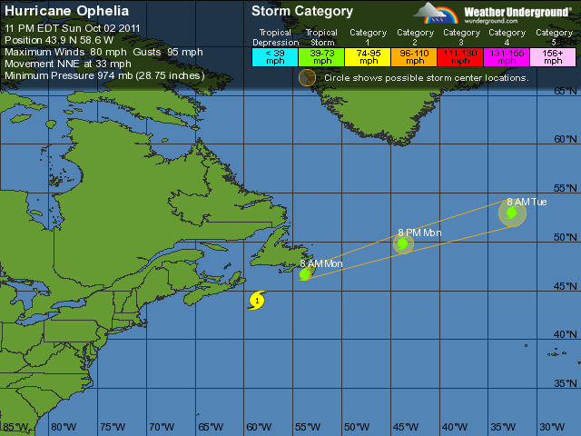
 THUNDER BAY – The latest on Ophelia as of 12AM EDT has the storm passing east of Sable and turning towards southern Newfoundland. Expected to track near the Avalon Peninsula Monday morning as a strong post-tropical storm.
Hurricane Ophelia is currently near 43.9 north and 58.6 west with a maximum wind speed of 70 knots or 130 km/h. The system is moving northeast at about 29 knots or 54 km/h. The central pressure is estimated to be 975 MB.
The system is still giving storm to hurricane force winds, but the system continues to be tight with the storm and hurricane force winds not extending very far. Currently it is over cool 15 degree water, which will continue to weaken the system as it moves northeast.
Strong southwesterly shear is starting to displace the cloud and precipitation to the north of the surface circulation which should help diminish the storm intensity further.
Near 10 PM ADT it passed halfway between Sable Island and buoy 44141, giving us a relatively good fix on the position. Buoy 44141 had winds gusting to 67 knots while Sable gusted to 45 knots. The buoy also reported a significant wave height of 13.8 metres with a peak wave height of 21.8 metres.
