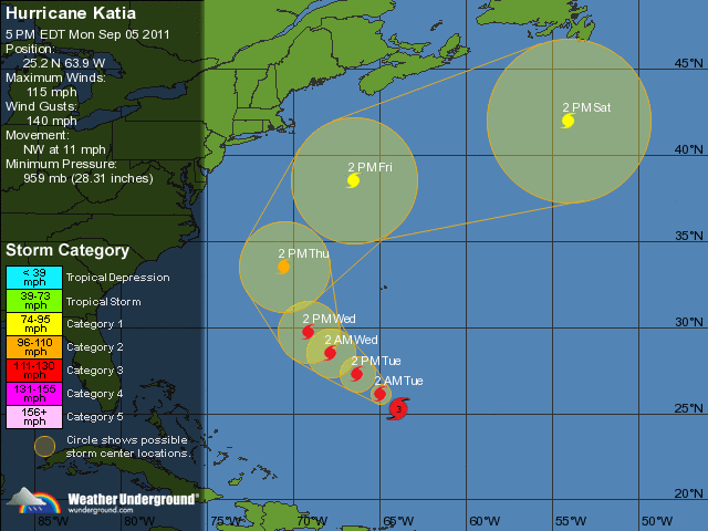
 THUNDER BAY – Hurricane Katia is now a category three hurricane on the Saffir-Simpson hurricane wind scale. It is expected there will be some additional strengthening through Tuesday, followed by little change in strength over Wednesday.
The Five Day Tracking is predicting that Katia will not make landfall in either the United States or Canada. However winds and surf are a likely problem.
At 500 PM AST (2100 UTC) the center of Hurricane Katia was located near latitude 25.2 north / longitude 63.9 west. Katia is moving toward the northwest near 12 mph…19 km/h…and this general motion with a slight decrease in forward speed is expected through Wednesday.
Maximum sustained winds have increased to near 115 mph (185 km/h) with higher gusts.
Hurricane force winds extend outward up to 60 miles (95 km) from the center. Tropical storm force winds extend outward up to 205 miles (335 km). Estimated minimum central pressure is 959 mb…28.32 inches.
The problems coming from this major storm include large swells generated by Katia which are expected to affect most of the East Coast of the United States, Bermuda, and the Greater Antilles. These swells are likely to cause life-threatening surf and rip current conditions. Swells affecting the northern Leeward Islands should continue to subside today.


