NetNewsLedger Weather Desk – Winnipeg Cold Alert in Effect!
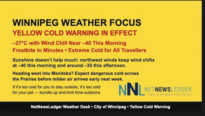
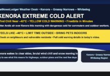
THUNDER BAY – WEATHER DESK – Winnipeg is locked in a dangerous deep freeze this morning, as brutally cold Arctic air holds much of the Prairies in its grip. Environment Canada has a Yellow Warning – Cold in effect for the City of Winnipeg, with wind chills at or below –40 and frostbite possible in just minutes on exposed skin. Anyone travelling west from Northwestern Ontario toward Winnipeg today is heading straight into the heart of this cold air mass.
At 6:00 AM CST, Winnipeg Richardson International Airport was reporting clear skies and a temperature of –27.4°C. With a west-northwest wind at 21 km/h, the wind chill is near –40, cold enough to make time outside extremely limited without proper gear. Humidity is at 73 percent, with a dew point of –30.8°C, and visibility is a crisp 24 kilometres under the clear, bitter sky. The barometric pressure is 102.8 kPa and rising, showing that high pressure and very stable — and very cold — air is in place.
Long-term climate normals for mid-December in Winnipeg usually feature daytime highs in the minus teens and overnight lows in the minus twenties. This current cold snap sits on the harsh side of what southern Manitoba can see in early winter, especially with the wind chill reaching the –40 threshold.
Today: Sunshine, But Wind Chill Near –41
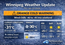
Today will be sunny, which sounds pleasant until you step outside. Winds will be from the northwest at 20 km/h, gusting to 40 km/h, and the high will only reach about –20°C. The wind chill will sit near –41 this morning, improving only to about –30 this afternoon. Environment Canada notes that “frostbite in minutes” is a real risk at these values.
Even though the sun will be shining, the air will remain sharply cold all day long. This isn’t the kind of day to get lulled into light clothing by blue sky — this is full-on Prairie deep freeze, the kind that makes your breath feel like it’s freezing as soon as you step outside.
Tonight: Clear and Even Colder
Tonight will stay clear, with winds easing somewhat to up to 15 km/h. The temperature will fall to around –28°C, but the wind chill will remain around –30°C this evening and drop again to near –41 overnight. That means another night where frostbite can develop in minutes if skin is left exposed.
With clear skies and light winds, radiational cooling will let the temperature tumble quickly after sunset. It’s a classic Winnipeg winter night: beautiful to look at from inside, rough to stand around in for long.
Sunday: Still Dangerous Cold, Then Gradual Improvement
On Sunday, the pattern begins to shift — slowly. Skies will become cloudy in the morning, with a 30 percent chance of light snow in the morning and afternoon and some blowing snow in outlying areas as winds ramp up.
Winds will turn south 20 km/h, increasing to 40 km/h gusting to 60 km/h in the morning. The high will be near –15°C, but the wind chill will again be near –41 in the morning, only improving to around –24 in the afternoon. That means yet another morning where frostbite is a concern and any outdoor time needs serious preparation.
Sunday night brings cloudy periods with a low near –14°C, signalling the beginning of a slow warm-up that will become more noticeable early next week.
Early Next Week: “Warmer,” But Still Winter
On Monday, Winnipeg will see a mix of sun and cloud with a high near –9°C and cloudy periods Monday night with a low around –9°C. After the –40 wind chills of this weekend, that will almost feel comfortable by comparison, even though it’s still solidly winter.
Tuesday brings a mix of sun and cloud, windy conditions and a relatively mild high near –1°C, followed by cloudy periods Tuesday night and a low near –13°C.
By Wednesday, the pattern turns more unsettled, with periods of snow and a high near –7°C, then more periods of snow Wednesday night and a low plunging back toward –27°C. Thursday is expected to be sunny with a high near –27°C, and a clear, very cold night near –30°C, followed by a chance of flurries and a high near –14°C on Friday.
So while there will be some milder days early next week, the Prairies will remain in an overall cold pattern, with brief warm-ups quickly followed by fresh reinforcing shots of Arctic air.
Health and Safety: Extreme Cold Puts Everyone at Risk
Environment Canada and Manitoba Health emphasize that extreme cold puts everyone at risk, not just those who work outdoors. They advise watching for cold-related symptoms, including:
-
Shortness of breath
-
Chest pain
-
Muscle pain and weakness
-
Numbness and colour changes in fingers and toes
If any of those develop, it’s important to get warm and seek medical advice. Manitoba Health provides more information at gov.mb.ca/health/publichealth/environmentalhealth/cold.html, and residents can call Health Links – Info Santé at 204-788-8200 or toll-free at 1-888-315-9257 for guidance.
The message is simple and clear:
If it’s too cold for you to stay outside, it’s too cold for your pet to stay outside.
Cold warnings are issued when very cold temperatures or wind chills create an elevated risk of frostbite and hypothermia. With wind chills near –40, this is exactly that kind of situation.
What to Wear in Winnipeg Today
This is full Arctic-layering weather, not “just a quick run into the store” weather. To handle these conditions safely:
-
Start with a thermal or moisture-wicking base layer (top and bottom).
-
Add a warm mid-layer, like a hoodie or fleece.
-
Top it with a heavy insulated winter parka that blocks the wind.
-
Wear insulated winter pants or snow pants; denim or thin pants alone are not enough at –40 wind chill.
-
On your feet, choose insulated winter boots with warm, thick socks.
-
A toque that fully covers your ears is essential, along with a neck warmer or scarf you can pull over your nose and mouth.
-
Thick mitts are better than thin gloves — mitts keep fingers together and warmer for longer.
If you’re travelling, especially outside the city, stock your vehicle with a winter emergency kit: blanket, extra mitts and hats, booster cables, a flashlight, phone charger, and some water and snacks. In this kind of cold, even a minor breakdown can get dangerous quickly.
Winnipeg Cold Trivia – Classic Prairie Tough
Winnipeg’s reputation as one of Canada’s coldest large cities is well-earned. Situated far from the moderating influence of oceans or big lakes, the city is fully exposed to Arctic air masses that slide south across the Prairies. That’s why Winnipeg can see stretches like this where temperatures and wind chills drop into the –30s and –40s, even as the sun shines brightly.
It’s the kind of cold that tightens the snow under your boots, makes car seats feel like ice blocks, and instantly fogs glasses when you walk indoors. But it’s also the kind of cold that Winnipeggers are famous for enduring — and even joking about — as long as they’ve got a good parka, a warm toque, and maybe a hot coffee in hand.
Last Focus on Saturday’s Weather:
Winnipeg sits near –27°C this morning with wind chill near –40 and a Yellow Cold Warning in effect, with frostbite in minutes and dangerous cold through Sunday.

