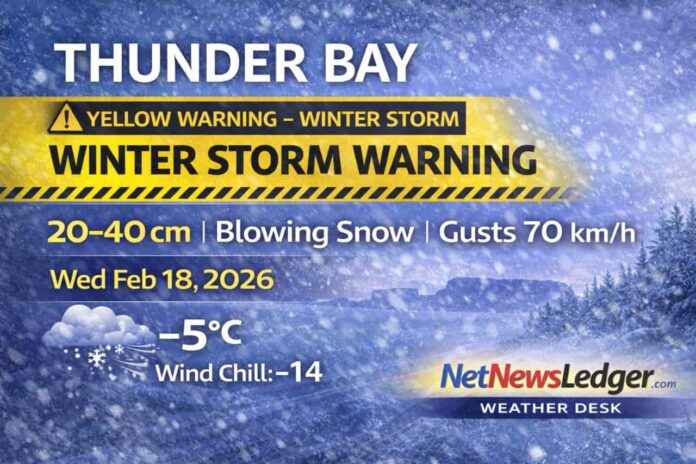
Thunder Bay – WEATHER – Thunder Bay is in the thick of a significant winter storm setup today. Environment Canada’s Yellow Winter Storm Warning remains in effect for the City of Thunder Bay, with heavy snow and blowing snow expected through Wednesday night. With strong easterly winds already gusting over 50 km/h early this morning—and forecast gusts pushing 60 to 70 km/h—visibility can drop quickly, especially in open areas. If you can avoid travel, today is a good day to do it.
Current Conditions
As of 4:00 AM EST (Thunder Bay area), it’s cloudy and -4.9°C. Winds are already strong from the ENE at 38 km/h, gusting to 53 km/h, producing a wind chill near -14. Visibility is 24 km right now, but that can change fast once snowfall intensifies. Barometric pressure is 101.2 kPa and falling, supporting the incoming storm pattern.
Today
Snow becomes the main story—snow at times heavy with blowing snow.
-
Expected snowfall (daytime): 10 to 15 cm
-
Wind: east 40 km/h gusting to 60 (locally higher gusts possible)
-
High: -4°C
-
Wind chill: near -15
-
Impact: drifting, reduced visibility, difficult roads and walkways
Winter Storm Warning
Environment Canada’s warning highlights:
-
Storm total snowfall: 20 to 40 cm
-
Blowing snow: significantly reduced visibility at times, potentially near zero
-
Strong winds: gusts up to 70 km/h
-
Timing: tonight into Wednesday night (with conditions ongoing today)
Expected Conditions (Next 3 Days)
Thursday, February 19
The storm doesn’t end cleanly—periods of snow continue.
-
High: -2°C
-
Night: periods of snow, low -4°C
Friday, February 20
Still unsettled with more snow chances.
-
Day: periods of snow, high -2°C
-
Night: cloudy with a 40% chance of flurries, low -6°C
Saturday, February 21
A bit less active, but flakes remain possible.
-
Day: 40% chance of flurries, high -4°C
-
Night: 30% chance of flurries, turning colder, low -15°C
Looking ahead: Sunday night is currently projected to plunge toward -26°C with clearing—classic “storm exits, colder air rushes in” pattern.
Wardrobe Recommendations
This is full winter-storm gear:
-
Outdoors today: insulated coat, snow pants if you’re outside for long, warm boots, and mittens (not gloves).
-
Wind protection: a scarf/neck gaiter or balaclava helps a lot in blowing snow.
-
Eyes: glasses or goggles can make a big difference when snow is blowing sideways.
-
If driving: pack a brush/scraper, warm blanket, and charger—and make sure the tank is topped up.
Weather Trivia
Blowing snow is often the real hazard in storms like this. You can have “only” moderate snowfall rates, but when winds gust 60–70 km/h, snow gets lifted off the ground and thrown back into the air—creating sudden whiteouts that can be more dangerous than the snowfall total itself.
Weather Summary
Thunder Bay weather for Wednesday, February 18, 2026: Winter Storm Warning in effect with snow at times heavy and blowing snow. Storm totals of 20–40 cm possible and wind gusts up to 70 km/h, with near-zero visibility at times. Periods of snow continue Thursday and Friday.

