Kenora – Grassy Narrows – Whitedog Locked in Deep Freeze
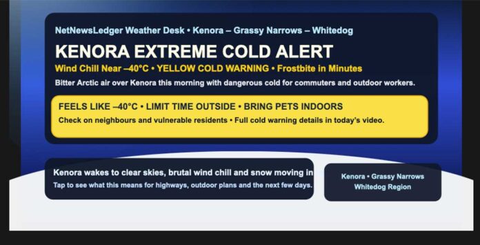
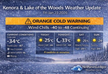
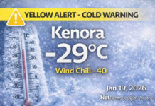
Yellow Cold Warning: Wind Chill Near -40 This Morning
THUNDER BAY – WEATHER DESK – Kenora and area woke up under a bitter Arctic chill this morning, with a Yellow Cold Warning in effect from Environment Canada.
At 5:00 a.m. CST, conditions at Kenora Airport were brutally cold and deceptively calm-looking: clear skies, a temperature of -29.4°C, and a northeast wind near 11 km/h combining to produce a wind chill of -39. Humidity is sitting around 76%, and the pressure at 101.5 kPa is rising as the Arctic high presses in.
Keep your weather eye on your pets outside.
Visibility is a crisp 32 km, but don’t let that blue-sky look fool you – your skin will notice the cold long before your eyes enjoy the view.
The cold warning highlights wind chill values near -40 this morning, which is firmly in the “frostbite in minutes”category. These conditions are especially risky for young children, older adults, people with chronic illnesses, anyone working or exercising outdoors, and anyone without reliable shelter.
While historical records for this exact date aren’t in front of us, late December in the Kenora region is known for its deep winter cold and occasional extreme cold snaps like this one. Today’s wind chills are near the sharp end of what northwestern Ontario can deliver in mid-winter.
Today: Sun, Then Snow – But the Cold Sticks Around
Despite the severe cold this morning, sunshine will dominate early in the day, giving way to increasing cloud around noon. That clearing sky combined with cold, dry air is why things feel so sharply frigid to start.
Later today, the pattern shifts:
-
Sunny this morning, then clouds thickening near noon
-
Periods of snow beginning late this afternoon
-
Winds turning southeast 20 km/h gusting to 40, then up to 40 km/h gusting to 60 by late afternoon
-
High near -16°C, but…
-
Wind chill near -40 this morning, improving only to around -27 this afternoon
That means even as the air temperature rises a bit, it will continue to feel dangerously cold, especially in exposed areas and out on the highway.
The Yellow COLD warning is there to flag that exposed skin can freeze in minutes in this kind of wind chill. Watch for:
-
Numbness or colour changes in fingers, toes, nose, ears
-
Tingling, pain, or loss of feeling
-
Muscle weakness or overall fatigue from the cold
If you notice those signs, get indoors and warm up right away.
Tonight: Snowy and Still Harshly Cold
Tonight, Kenora stays firmly in winter’s grip:
-
Periods of snow, with 2 to 4 cm expected
-
Winds southeast 40 km/h gusting to 60, shifting to southwest 30 km/h gusting to 50 after midnight
-
Temperature rising to about -11°C by morning
-
Wind chill around -27 this evening, easing slightly to around -21 overnight
That combination of snow and wind will mean:
-
Snow-covered, slick highways and back roads
-
Patchy blowing snow, especially in open areas
-
Tough driving conditions for late-day travel and overnight trucking
The Next Few Days: Cold Continues, But Some Sun Too
The pattern remains classic northwestern Ontario winter through the weekend:
-
Saturday: Mainly cloudy with a 60% chance of flurries, west wind near 20 km/h, and a temperature steady around -17°C, feeling near -28 with wind chill.
-
Saturday night: Cloudy periods, 30% chance of flurries, low near -24°C.
-
Sunday: Sunny and cold with a high near -18°C, followed by a clear night near -28°C – perfect for stargazing if you’re brave enough to step outside.
-
Monday: A mix of sun and cloud with a 40% chance of snow, high near -9°C, then another snowy, very cold night around -21°C.
In other words: the stormy pattern eases a bit, but the Arctic air mass isn’t going anywhere quickly.
Safety and Wardrobe: This is Full Arctic Gear Weather
This morning is absolutely a “full winter armour” kind of day:
-
Layers: Start with thermal base layers (top and bottom), add a warm mid-layer, and top with a heavy insulated parka.
-
Legs: Insulated snow pants or lined winter pants are ideal, especially if you’re shovelling, working outside, or waiting at a bus stop.
-
Feet: Insulated winter boots with thick socks; avoid running shoes or thin-soled footwear – the cold will cut right through.
-
Hands & Head: Thick, insulated mitts (warmer than gloves), a toque that covers your ears, and ideally a neck warmer or balaclava to protect your cheeks and nose.
Remember: if it’s too cold for you, it’s too cold for your pets to be outside for long.
Also, take a moment to check in on older family, friends, and neighbours. Even a short power interruption or furnace issue can become dangerous quickly in this kind of cold.
Kenora Cold-Weather Trivia
Kenora sits on the northern edge of the Lake of the Woods, which can sometimes take the edge off early-winter cold… but once the lake has mostly frozen and Arctic high pressure settles in, there’s nothing to buffer those Prairie–Arctic air masses from rolling straight across the region.
That’s how you end up with mornings like this: clear skies, postcard views, and wind chills cold enough to make your eyelashes freeze on a short walk.

