Northern Ontario Weather Focus – Kitchenuhmaykoosib
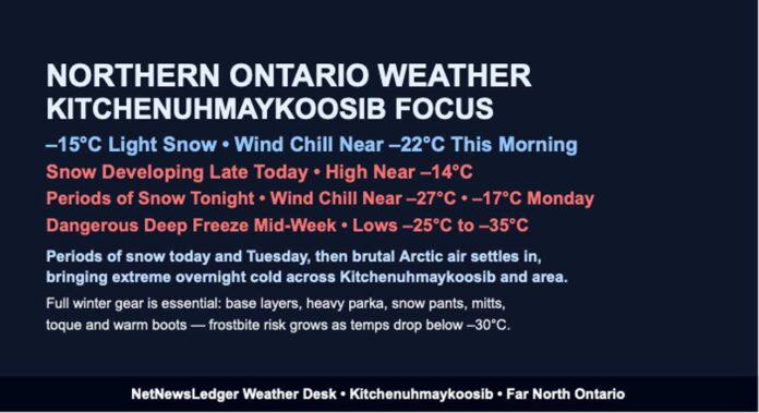
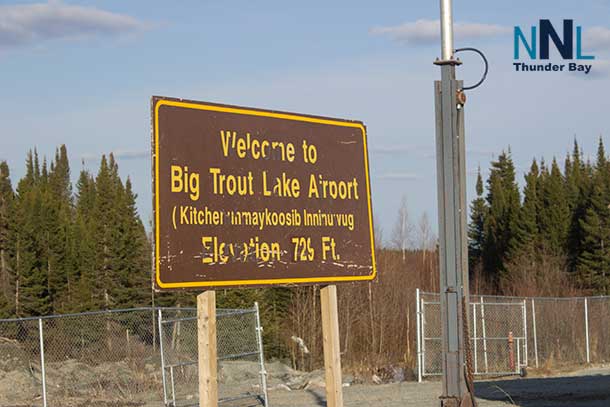
Thunder Bay WEATHER DESK – Kitchenuhmaykoosib Inninuwug is waking up under light snow and very wintry conditions this Sunday morning, with even colder Arctic air lining up for mid-week. At 7:00 AM CST, observations from Big Trout Lake Airport show light snow and a temperature of –15.1°C (we’ll call it –15°C).
The humidity is 90 percent, with a dew point of –16.4°C, and visibility is about 16 kilometres in the falling snow. The barometric pressure sits at 103.0 kPa, indicating a strong high-pressure system nearby, while a west-northwest wind near 11 km/h is driving the wind chill down to about –22°C.
Long-term climate patterns for mid-December in this part of the Far North typically bring daytime highs in the minus teens and overnight lows in the minus twenties or colder. The current setup is very much in line with a classic, harsh Kitchenuhmaykoosib December – and it’s going to get even colder later this week.
Today: Cloudy, Flurries Early, Snow Building Later
Through today, expect mainly cloudy skies with a 40 percent chance of flurries early this morning. By late afternoon, those scattered flakes become more persistent as periods of snow begin.
Winds will strengthen, becoming southwest 20 km/h gusting to 40 km/h near noon, which will add extra bite to the cold. The afternoon high is forecast near –14°C, but the wind chill will sit near –20°C this morning and dip closer to –25°C this afternoon.
That’s cold enough for exposed skin to start complaining very quickly, especially if you’re out on the land, travelling by snowmachine, or walking between homes and community buildings.
Tonight: Snow Tapers, Flurries Linger, Cold Deepens
Tonight, periods of snow will end after midnight, leaving behind cloudy skies with a 30 percent chance of flurries. Local snowfall amounts of around 2 centimetres are expected – not a major storm, but enough to freshen up the snowpack and keep roads and paths slick.
The southwest wind of 20 km/h gusting to 40 km/h continues into the night, and the temperature will drop to around –17°C. With that wind, the wind chill will hover near –27°C, firmly into frostbite-risk territory for anyone outside without full winter gear.
Monday: Brighter but Still Harsh, Then More Snow Chances
On Monday, conditions improve visually, with a mix of sun and cloud. Don’t be fooled by the brightness, though – it will still be sharply cold. Winds will swing around, with a northwest wind near 20 km/h gusting to 40 km/h, and the high will reach only about –17°C. The wind chill will sit near –28°C, enough for a risk of frostbite, especially in the morning and in open, exposed areas.
Monday night turns cloudy with a 40 percent chance of snow and a low near –18°C, another very cold night that will continue to build the snow cover and deepen the chill.
Tuesday: More Snow, Then a Sharp Drop at Night
On Tuesday, Kitchenuhmaykoosib can expect periods of snow and a high near –8°C, a relative “warm-up” compared to the days around it. However, this is not the start of a long mild stretch – the nighttime cold that follows is severe.
Tuesday night will bring cloudy periods with a 30 percent chance of snow, windy conditions, and a low near –25°C. Any fresh snow will be paired with bitter wind chills, and travel or outdoor activities will need serious preparation.
Wednesday to Friday: Deep Arctic Cold Tightens Its Grip
On Wednesday, skies will be cloudy with a high near –19°C – a full return to deep Arctic cold. The real punch arrives Wednesday night, with cloudy skies and a low near –33°C. That level of cold is dangerous, especially if winds remain elevated and you’re away from shelter for any length of time.
Thursday brings a mix of sun and cloud with a high near –25°C, followed by a clear night and a bone-chilling low near –35°C. That’s the kind of cold where vehicles protest starting, snow squeaks loudly under boots, and frostbite can develop extremely quickly on unprotected skin.
On Friday, the sun returns, with sunny skies and a high near –24°C, still extremely cold but with lighter winds and calmer weather. Friday night stays frigid but a touch less harsh, with a 30 percent chance of flurries and a low near –26°C.
By Saturday, there’s a 30 percent chance of flurries and a high near –22°C, keeping the Far North firmly in mid-winter conditions.
What to Wear in Kitchenuhmaykoosib
This is serious “Far North winter” gear weather, not just “throw on a hoodie” territory. With wind chills repeatedly near or below –25°C and plunging much lower by mid-week, dressing properly is essential:
-
Start with a thermal or fleece base layer (top and bottom) to trap your body heat.
-
Add a warm mid-layer, such as a hoodie, heavy sweater, or fleece.
-
Top that with a thick, insulated winter parka that blocks the wind.
-
On your legs, insulated pants or snow pants are highly recommended – jeans alone will feel like ice in –20s and –30s wind chills.
-
Wear insulated winter boots with thick, warm socks; cold feet will make any trip outside feel twice as long.
-
A toque that fully covers your ears, thick mitts instead of thin gloves, and a scarf or neck warmer you can pull over your face are crucial to protect against frostbite.
-
For snowmachine travel or long periods outside, goggles or glasses help protect your eyes from wind and blowing snow.
If you’re heading out on the land or travelling between communities, it’s wise to bring extra layers, a spare pair of mitts, and emergency supplies, especially as temperatures tumble toward –30°C and below mid-week.
Far North Weather Trivia – When Cold Builds the Land
In communities like Kitchenuhmaykoosib, these stretches of intense cold do more than just freeze eyelashes and door locks. They also build strong ice on lakes and rivers, making winter travel routes more reliable for snowmachines and traditional activities.
The same cold that makes the air sting and the snow crunch underfoot is also what turns the region into a connected winter landscape, with routes across the ice that support family visits, hunting, fishing, and community life. It’s harsh, but it’s also a key part of how winter works in the Far North.
The Last Word:
Kitchenuhmaykoosib faces light snow, flurries and deep cold today, with wind chills near –25 and brutal lows dropping toward –35°C by mid-week across the Far North.

