NetNewsLedger Weather – Kenora, Grassy Narrows, Whitedog & Lake of the Woods
KENORA – WEATHER DESK – It’s a bright but chilly start to the day across Kenora, Grassy Narrows, Whitedog First Nation and the Lake of the Woods region.
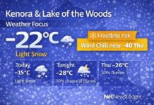
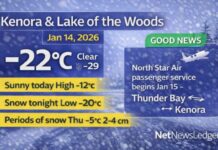
At 5:00 AM CST, conditions at Kenora Airport were mainly clear, with the temperature at –19.9°C, which we’ll call a very honest –20°C. There’s just a light southwest wind at 3 km/h, but even that is enough to bring the wind chill down to –22°C.
Humidity is fairly high at 86 percent, with a dew point of –21.6°C, visibility is a crisp 24 kilometres, and the barometric pressure sits at 101.8 kPa and is falling slightly, a sign that the quiet start won’t last forever.
Through this morning, skies will stay clear before clouds begin to mix in, leading to a blend of sun and cloud for much of the day. Despite the sunshine, the air mass overhead is solidly Arctic. The high is forecast to reach –11°C, but with winds increasing slightly to up to 15 km/h, the wind chill will feel closer to –27°C this morning, only easing to around –16°C this afternoon. That’s classic “your breath freezes in your scarf” weather, and exposed skin will get cold very quickly.
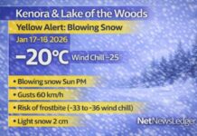
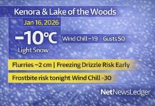
Tonight, the region shifts from calm and bright to cloudy and snowy. Skies will become fully cloudy, and periods of snow are expected to begin overnight, with about 2 centimetres of new snow by Friday morning. Winds will stay light, up to 15 km/h, but temperatures will settle near –14°C, and the wind chill will feel close to –15°C this evening and drop to around –22°C overnight. Roads and sidewalks will likely be snow-covered by the Friday morning commute, and any bare patches will become slick again under that fresh layer.
Friday looks like the coldest and harshest day of this stretch. Periods of snow will end in the morning, leaving mainly cloudy skies with a 40 percent chance of flurries into the afternoon. Another 2 cm of snow is possible overall. The wind will pick up, shifting to northwest 20 km/h in the morning, and that’s when things turn from “regular winter” to “serious cold.”
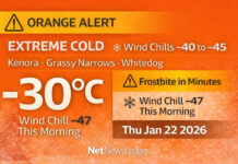
The temperature will actually fall through the day to around –21°C in the afternoon, and with the northwest wind, the wind chill is expected to be around –22°C in the morning and plunge to near –30°C in the afternoon. That is very clearly frostbite-risk territory, especially on cheeks, ears, noses and fingers. Friday is a day for full gear if you have to be outside, and a very good day to shorten any outdoor errands, walks, or time spent on the lake.
Friday night remains cloudy with a 30 percent chance of flurries and a frigid low near –25°C. With that kind of cold, vehicles will absolutely want block heaters, and quick trips outside will feel very intense without full coverage.
Looking ahead, Saturday will stay cloudy with a high around –20°C and a low near –24°C under cloudy periods, keeping the deep freeze in place. Sunday stays cloudy with a high near –17°C and a low close to –18°C, with a chance of flurries later according to the extended outlook. Monday continues with cloudy skies and a high near –13°C, then a low around –16°C overnight, while Tuesday brings a 40 percent chance of flurries and a “milder” high near –8°C. Wednesday remains cloudy with a high near –13°C, keeping the region in a steady mid-December rhythm of cold, cloud, and light snow.
This pattern is less about big storms and more about relentless cold and frequent small snowfalls, the kind of winter stretch Northwestern Ontario is famous for.
When it comes to getting dressed for this kind of day, the key is to dress for the wind chill, not the number on the thermometer. Start with a thermal or fleece base layer to trap body heat, add a warm sweater or hoodie, and top it off with a proper insulated winter jacket. If you’re walking, working outdoors, or spending time on the lake or ice roads, snow pants or lined pants are worth their weight in gold.
On your feet, insulated winter boots with good tread and thick socks are essential, especially with 2 cm of snow on the way to hide icy spots. A toque that covers your ears, along with warm mitts instead of thin gloves, will keep extremities warmer longer, and a scarf or neck warmer you can pull over your mouth and nose will make those –20 and –30 wind chills much more bearable. With sun in the mix today and over the next few days, sunglasses are also a smart addition to cut down glare off the snow and ice.
For a bit of local weather trivia, the Lake of the Woods region — with its thousands of islands and endless shorelines — becomes a completely different world in winter. Once the cold settles in and stays, like it’s doing now, the lake surface turns into a network of ice roads, snowmobile trails and fishing spots that connect communities, camps and cabins in ways that just aren’t possible in summer. The same cold that makes you bundle up to the eyebrows is also what turns the lake into one of Northwestern Ontario’s most important winter highways.
Last Words:
Kenora and the Lake of the Woods region start near –20°C under clear skies, with snow arriving overnight, –21°C and –30 wind chills Friday, and deep freeze conditions into the weekend.

