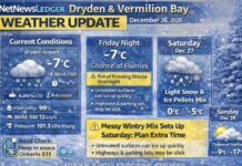
NetNewsLedger Weather – Dryden & Vermilion Bay Forecast
THUNDER BAY – WEATHER DESK – Dryden and Vermilion Bay are waking up to a solid mid-December chill this morning, with winter very much in control even if the skies are trying to brighten.
Its only going to get colder so might as well embrace the chilly hug of Old Man Winter.
At 5:00 AM CST, conditions at Dryden Airport were cloudy with the temperature at –18.4°C. A light east-southeast wind at 4 km/h is knocking the wind chill down to –22°C. Humidity is sitting at 79 percent, the dew point is –21.1°C, visibility is 16 kilometres, and the barometric pressure is at 101.8 kPa, indicating a fairly stable but cold setup before the next wave of snow moves in.
Through the morning, skies will clear and then shift into a mix of sun and cloud. It will look like a beautiful winter day from inside, but step outside and you’ll be reminded it’s still very much December in Northwestern Ontario. The high is expected to reach –12°C, but with light winds up to 15 km/h, the wind chill will feel closer to –24°C this morning and around –15°C this afternoon.
That’s more than enough to nip at exposed fingers, noses and ears if you’re out too long without proper winter layers.
Tonight, the pattern shifts as cloud thickens and light snow approaches. Skies turn cloudy, and periods of light snow are expected to begin before morning. Winds stay gentle, up to 15 km/h, and the low will slip to around –15°C. The wind chill will sit near –19°C overnight, so it will feel several degrees colder than the thermometer reads. By dawn Friday, roads and sidewalks are likely to be coated with a fresh layer of light snow overtop an already hard-packed base, and that’s a recipe for slick conditions on side streets and rural roads.
Friday will be the day to watch closely. Periods of snow will continue through the morning, bringing 2 to 4 centimetres of fresh accumulation before tapering off late in the morning. After that, skies remain cloudy with a 40 percent chance of lingering flurries through the afternoon. While the morning will start around –16°C, the temperature will actually fall to near –20°C in the afternoon as colder air digs in behind the departing system. Winds will become northwest near 20 km/h late in the day, and that’s when the real sting sets in. Wind chills will be around –19°C in the morning, dropping toward –30°C in the afternoon. Those are frostbite-risk conditions, especially for exposed skin on cheeks, ears, noses and fingers, and for anyone out walking, at the rink, or working outdoors.
Friday night stays cloudy with a 30 percent chance of flurries and a low near –26°C. That’s a proper deep-freeze night where block heaters, extra blankets and warm boots by the door move from “nice to have” to “essential.”
The weekend keeps the winter theme going. Saturday is expected to be cloudy with a high near –20°C. Saturday night brings cloudy periods and another sharp low near –26°C, reinforcing the deep cold. Sunday offers a mix of sun and cloud and a slightly “warmer” high near –17°C, with a 60 percent chance of flurries Sunday night and a low around –19°C. Monday will stay cloudy with a high near –13°C and cloudy periods overnight with a low near –18°C. Tuesday brings a 40 percent chance of flurries and a high around –9°C, with more cloud Tuesday night and a low near –14°C. Wednesday remains cloudy with a high near –13°C, keeping the region in a steady stretch of classic Northwestern Ontario winter: cold, cloud, and frequent light snow.
For dressing today and through the next few days, this is absolutely “dress for the wind chill” weather, not just what the thermometer says. A good strategy is to start with a thermal or fleece base layer, add a warm mid-layer like a sweater or hoodie, and finish with a proper insulated winter jacket. If you’re spending any length of time outside, whether walking to school or work, shovelling, or out on the trail, snow pants or lined pants will make a big difference. Insulated winter boots with thick socks are essential, especially with fresh snow on top of older packed snow and ice. A toque that covers your ears, warm mitts instead of thin gloves, and a scarf or neck warmer you can pull up over your mouth and nose will help keep wind chills in the minus twenties from feeling quite so harsh. With breaks of sunshine today and more ahead, sunglasses are also a smart choice to cut the glare off the snow, especially driving or out on open roads and lakes.
For a little local weather trivia, Dryden and Vermilion Bay sit in a corridor where many small systems slide through from the Prairies toward Northwestern Ontario. That often means fewer blockbuster blizzards and more of what we’re seeing this week: frequent light snows, persistent cold, and long stretches where the snow squeaks under your boots and never really melts between storms. It’s the kind of winter that quietly builds snowbanks, toughens up everyone’s layering game, and makes hot coffee and wood stoves feel that much better.
Last Words:
Dryden and Vermilion Bay begin at –18°C with sun and cloud today, light snow tonight, and wind chills near –30°C Friday as deep cold settles in for the weekend.


