Gentle Snow and Deep Cold for Dryden & Vermilion Bay
Thunder Bay – Weather – The weather on Tuesday in Dryden and Vermilion Bay is rolling along in true Northwestern Ontario style: light snow, steady cold, and just enough wind to remind you it is definitely December.
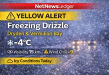
As of 6:00 AM CST Tuesday, conditions at Dryden Airport were showing light snow with a temperature of –14.1°C. Humidity is sitting at a fairly moist 87 percent, with a dew point of –15.8°C. Winds are light from the west-northwest at about 4 km/h, which is enough to push the wind chill down to –17.
Visibility is 16 kilometres, decent for early-morning travel, and the barometric pressure is 100.7 kPa, hinting at a weak system in the area.
Today: Cloudy, On-and-Off Flurries, and a Chilly East Wind
Through today, skies over Dryden and Vermilion Bay will stay mainly cloudy with about a 40 percent chance of flurries drifting through the region. The daytime high is headed for around –11°C, but once the wind swings around from the east and strengthens to near 20 km/h this afternoon, it will feel closer to –20 with the wind chill.
That kind of cold is more than enough to make bare hands and ears regret their life choices after a short time outdoors, so quick trips are fine, but lingering outside without proper gear is not a great plan.
Tonight: Light Snow Returns and the Cold Deepens
Tonight will stay mainly cloudy with a 60 percent chance of light snow across Dryden and Vermilion Bay. Northeasterly winds around 20 km/h will help drive periods of light snow, and by Wednesday morning a light coating will likely be on roads, sidewalks, and driveways. The low will drop to –18°C, and as the night goes on the wind will keep the wind chill near –19 in the evening and closer to –25 overnight. That is solid frostbite-risk territory for exposed skin over a longer stretch, especially for anyone walking or working outdoors.
Wednesday and Beyond: Bright but Brisk, Then Cloudy with More Flurries
Wednesday offers a break from the light snow and cloud with mainly sunny skies returning over the region. Winds will be light, up to around 15 km/h, but the morning low and fresh snow cover will keep the wind chill near –25 early on before easing to around –19 in the afternoon. The daytime high will be near –13°C, which is perfectly seasonal for early December but still enough to justify a full winter wardrobe. Wednesday night brings cloudy periods and another low near –18°C, with the kind of radiational cooling that makes the night feel extra sharp.
Thursday turns cloudy again with a high around –13°C. By Thursday night, there is a 60 percent chance of flurries and temperatures are expected to drop to about –21°C. On Friday, the flurries continue with another 60 percent chance of snow and a high near –19°C, followed by a very cold Friday night dipping to –25°C under cloudy periods.
The weekend keeps the winter pattern firmly in place. Saturday will see a mix of sun and cloud with a high near –19°C and a low around –22°C overnight. Sunday brings a 40 percent chance of snow and a high near –16°C, with more snow possible Sunday night and a low around –20°C. Monday stays cloudy with a daytime high near –15°C, continuing the run of solidly below-freezing days.
Long-term climate records for Dryden show that early December often brings daytime temperatures in the minus single digits and overnight lows in the minus teens to minus twenties, so this stretch of weather is very much in character. Exact record high and record low values for December 9 are not available in this report, but what the region is seeing today fits comfortably within the usual range of a Dryden winter.
What to Wear in Dryden and Vermilion Bay
This is layered-clothing weather, not “just grab a hoodie” weather. A thermal or fleece base layer under a warm sweater and a well-insulated winter jacket will go a long way toward keeping you comfortable. Snow pants or lined pants are a big help if you’ll be out shovelling or walking for any length of time. Warm winter boots with thick socks, a toque that covers your ears, and good mitts or gloves are essential. A scarf or neck warmer you can pull up over your face will make those –20 wind chills much easier to handle, and sunglasses are a smart addition for Wednesday and the clearer days to follow when the sun reflects off fresh snow.
Weather Trivia – Dryden’s Wintry Reputation
Dryden and Vermilion Bay sit right in the path of many of the systems that slide east out of the Prairies and across Northwestern Ontario. That placement, along with plenty of nearby lakes, means the area regularly sees frequent light snows instead of huge blizzards, and a lot of very cold, very bright winter days where the snow squeaks under your boots and the air sparkles like crushed glass in the sun. It might be cold, but for winter lovers it is hard to beat.
Last Word: Dryden and Vermilion Bay see light snow, wind chills near –20 today and –25 tonight, with sun Wednesday and more flurries later in the week.


