THUNDER BAY – Weather Desk Update – As of 1:01 PM EST Monday, the Wawa and Pukaskwa Park area is mostly cloudy and on the edge of a big winter storm. At 1:00 PM, it was mostly cloudy and cold at Wawa Airport, with a temperature of –11.8°C. A light north wind of about 5 km/h made it feel more like –15. The humidity is 72%, the visibility is 24 kilometres, and the barometric pressure is 102.8 kPa but falling. These are all good signs that this quiet early afternoon won’t last.
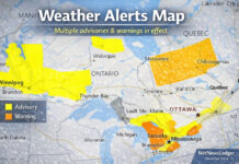
Environment Canada has put out a snow squall watch for the area, saying there is a High Impact Level and a Moderate Forecast Confidence Level. The worry is that snow squalls will start tonight before an Alberta clipper and last until Tuesday afternoon. There could be 10 to 20 centimetres of snow in total, with higher amounts in some places where bands stay put. Heavy snow and blowing snow could make it hard to see. Travelling on parts of Highway 17 and Highway 101 could become very dangerous because the weather is changing quickly and getting worse.
Tonight: Squalls start, with snow blowing and temperatures rising
The sky will stay mostly cloudy for the rest of the afternoon, with a 40% chance of flurries and a high near –8°C. Wind chills are around –13°C this afternoon, which is a lot warmer than the –20°C it was at the start of the day. If you’re outside for too long, your fingers or nose could get cold.
The real fun starts tonight
The clouds will stay around, and there is a 40% chance of flurries early on. Later in the evening, as the Alberta clipper gets closer, the flurries and snow will become more steady. Late tonight and overnight, there will be blowing snow in the area as winds shift and pick up speed from the southwest, reaching speeds of 30 km/h with gusts of up to 50 km/h. There will be 5 to 10 centimetres of snow in the area tonight, but totals can rise quickly under stronger squall bands. The temperature will actually go up overnight, reaching about –4°C by Tuesday morning.
However, the wind will make it feel like –13°C.
Tuesday: More snow, whiteouts in the morning, and then things get better slowly.
On Tuesday, flurries will continue through the morning, and there could be another 5 to 10 centimetres, especially in the bands that keep coming off Lake Superior. In the morning, blowing snow in the area could again make it hard to see at times until the winds calm down.
The wind from the southwest will be 30 km/h with gusts up to 50 km/h. It will get lighter later in the morning. The temperature stays close to –4°C all day, and the wind chill gets better from around –13 in the morning to around –6 in the afternoon. By Tuesday afternoon, the worst of the squalls should be over or move on, leaving mostly cloudy skies with only a 40 percent chance of flurries.
On Tuesday night, there will still be clouds and a 30% chance of flurries. The temperature will drop to around -13°C, which will feel much colder once the wind dies down and radiational cooling takes over.
Midweek: Less busy but still cold
The pattern calms down a lot by Wednesday. After the squall regime, a mix of sun and clouds with a high near -9°C will feel almost nice. It looks like it will be partly cloudy on Wednesday night, with a low of about –13°C. On Thursday, there will be a mix of sun and clouds, with a high of about -8°C. There is a small chance of flurries returning Thursday night and into Friday, but nothing like the snow squall setup we are watching for tonight and Tuesday.
What to Wear and How to Get There
Instead of just winter fashion, think “snow squall survival mode” for today and especially tonight into Tuesday. You’ll need a warm, insulated winter coat, layered clothing underneath, snow pants, insulated boots with good grip, a toque, warm mitts or gloves, and a scarf or neck warmer that you can pull over your face if you have to go outside. The strong winds from the southwest and the blowing snow will make things feel worse than they really are.
Drivers should be ready for quick changes from good visibility to almost whiteout, especially on open stretches and in higher areas. Keep your gas tank full, your winter emergency kit in the car, and drive for the weather, not the speed limit. Expect sidewalks and parking lots to be covered in snow and slippery, especially by Tuesday morning.
Lake Superior Snow Machine: Fun Facts About the Weather in the Area
Lake Superior makes this stretch of shoreline around Wawa and Pukaskwa Park one of Ontario’s classic “snow belts.” When cold air moves over the open water, which is warmer than the air, it picks up moisture and drops it as narrow, intense bands of snow inland. These are called snow squalls. That’s why one town can get 20 centimetres of snow and the next town over barely needs to shovel. It’s all about where those bands choose to sit.

