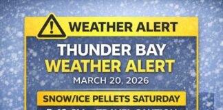
From Rain to Flurries as Colder Air Moves In
GERALDTON/GREENSTONE — It’s a soggy start before the switch to classic November chill. At 7:00 a.m. EST, Geraldton Airport is reporting light rain and 3.8°C. The barometric pressure is 99.5 kPa, humidity is a damp 97%, the wind is southwest at 4 km/h, and visibility is reduced to 2 km in the rain. Dew point sits at 3.4°C, so the air is nearly saturated.
Today — Rain Ends Near Noon, Then Colder with Gusty Northwest Winds
Periods of rain taper off around noon, leaving cloudy skies and a 40% chance of rain showers or flurries this afternoon. The key change is wind: a northwest flow increasing to 30 km/h with gusts to 50 this morning will usher in colder air. We’ll touch +5°C late morning, then temperatures fall toward 0°C through the afternoon. The UV index is 1 (low). Expect wet roads to feel slicker as the temperature drops, especially on bridges and in shaded stretches.
Tonight — Blustery with Flurries Around and a Sharper Chill
Clouds hang on with a 40% chance of flurries. The northwest wind strengthens to 30 km/h with gusts to 60, and the low dips to –6°C. With the wind, the overnight wind chill near –12 will bite. Any leftover moisture can refreeze, creating patches of black ice.
Sunday — Grey, Breezy, and Below Freezing
Sunday stays cloudy with a 40% chance of flurries in the morning and early afternoon. The northwest wind near 30 km/h gusting to 50 continues, so even with a high of –3°C, it will feel like –14 in the morning and around –9 later. If you’re out for errands or a walk, plan short stops and warm gloves.
Monday — Still Cloudy, Still Cold
The new week begins cloudy and steady on the cool side with a high near –4°C. Monday night brings cloudy periods and a low near –6°C. It’s a “keep the scraper in the front seat” kind of pattern.
Sunrise & Sunset
Sunrise is at 7:59 a.m. EST, with sunset at 5:05 p.m. EST. Daylight is short, so if you need to travel, aim for the brighter midday window.
H3: What to Wear
Lean on smart layers today. Start with a warm base, add a fleece or sweater, and finish with a wind-resistant, water-repellent jacket for those northwest gusts and lingering spits of flurries. A toque and insulated gloves make a big difference this evening and Sunday. Footwear with good tread will help on wet leaves today and icy patches tonight.
Travel & Safety Notes
Road spray will give way to refreeze as temperatures fall this afternoon and evening. Expect gusty crosswinds on open stretches and higher bridges once the wind swings northwest. Give yourself extra braking room, and watch for sudden reductions in visibility during heavier flurry bursts.
Greenstone Weather Trivia
Northwest winds crossing the local high ground can squeeze out extra flurries, which is why one end of Highway 11 can be dry while the other looks like a snow globe. Local knowledge beats the radar on days like this.

