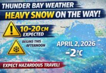
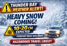
Winter Weather Brought to you by a Colorado Low or an Alberta Clipper?
Thunder Bay – WEATHER – When it comes to weather forecasting, two terms often pop up during the winter months, especially if you’re in North America: the Colorado Low and the Alberta Clipper. These meteorological phenomena play significant roles in shaping the weather patterns we experience, but what exactly are they, and how do they differ? Let’s embark on a whirlwind tour to uncover these intriguing weather systems.
The Colorado Low: A Snowy Siege
A Colorado Low is a low-pressure system that forms over the southeastern portion of Colorado or the northeastern part of New Mexico. As it moves eastward or northeastward, it draws moisture from the Gulf of Mexico, leading to significant snowfall or rain across the central and eastern United States, and often into Canada. Here’s why the Colorado Low is a key player in winter weather dynamics:
- Moisture Maven: Thanks to its path, the Colorado Low has access to ample moisture, which can lead to heavy snowfall, rain, and even severe thunderstorms. This moisture, coupled with the system’s intensity, can create powerful winter storms that impact large areas.
- Temperature Tug-of-War: The Colorado Low often brings a clash of air masses, pitting colder air from the north against warmer, moist air from the south. This battlefront is where the most dramatic weather occurs, including the potential for ice storms and blizzards.
- Widespread Impact: Given its track, a Colorado Low can affect a vast region over several days, making it a significant concern for weather forecasters and residents alike. Its ability to generate diverse precipitation types makes preparing for its arrival crucial.
The Alberta Clipper: Speedy and Sharp
On the other hand, the Alberta Clipper is a fast-moving low-pressure system that originates in the province of Alberta, Canada (hence the name). Clippers are known for their speed and their tendency to bring sharp, albeit generally less severe, weather changes:
- Quick and Cold: Alberta Clippers sweep southeastward across the central and eastern United States, bringing rapid drops in temperature and brisk winds. Their speed means they typically don’t pick up as much moisture as a Colorado Low, resulting in lighter snowfall—usually a few inches rather than feet.
- Windy Woes: The strong winds associated with Alberta Clippers can lead to biting wind chills and blowing snow, reducing visibility and making travel hazardous. Despite their lesser snow accumulations, the wind effects can be quite impactful.
- Short-Lived but Frequent: Clippers move quickly and typically clear out fast, meaning their effects are more short-lived compared to the lingering Colorado Low. However, during the winter, multiple Clippers can occur in succession, keeping regions in a continual cycle of cold snaps.
The Forecast: Understanding and Preparing
Both the Colorado Low and the Alberta Clipper are crucial components of winter weather in North America. By understanding these systems, meteorologists can better predict and communicate the risks associated with each, allowing people to prepare for what’s ahead. Whether it’s a slow-moving siege of snow and ice from a Colorado Low or a swift, chilly blast from an Alberta Clipper, knowing these patterns helps us navigate the winter months more safely.
So, the next time you hear a Colorado Low or an Alberta Clipper mentioned in the forecast, you’ll have a deeper insight into what these terms mean for your weather outlook. Stay warm, stay informed, and let’s weather the winter together!

