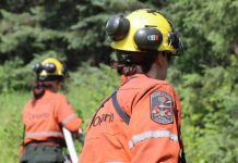
Sault Ste Marie – Wildfire Update – The Northeast Region of Ontario is grappling with an intensifying wildfire crisis as 19 active fires wreak havoc across the area. On June 18, a new fire, Cochrane 13, measuring 1 hectare, was confirmed on an island on the Attawapiskat River, located 0.6 kilometers east of Attawapiskat. Regrettably, this fire remains uncontrolled, posing a significant threat to the surrounding region.
Fires of Note
Several noteworthy fires continue to ravage the Northeast Region, requiring heightened attention and resources. Chapleau 3, spanning 3,916 hectares, is situated 2 kilometers south of October Lake and 2.5 kilometers west of Vichaw Lake. It remains uncontrolled. Similarly, Chapleau 6, covering 1,228 hectares, is located 2.5 kilometers west of Morin Lake and 1 kilometer east of Bolkow Lake. The fire is still not under control.
Cochrane 6, confirmed on June 2, spans 1,239 hectares and is located 9 kilometers west of Lake Abitibi and 1 kilometer east of Marathon Lake. This fire is being contained along cat guards, roads, and natural boundaries. Meanwhile, Cochrane 7, spanning a massive 10,719 hectares, is situated northeast of Lake Abitibi and 7 kilometers southwest of Joe Lake. Efforts to suppress the fire are ongoing, utilizing heavy equipment. Additionally, Kirkland Lake 5, spanning 2,300 hectares, is situated north of Lady Evelyn Lake, with helicopters assigned to combat the fire. Sudbury 10, remapped to 1,370 hectares, is located 3 kilometers west of Fox Lake and 5 kilometers east of Acheson Lake. Multiple crews are dedicated to fighting Sudbury 17, covering 5,857 hectares, situated 3 kilometers west of Madawanson Lake and 0.5 kilometers east of Pilot Lake. Sudbury 19, covering 459 hectares, south of Shakwa Lake and 1 kilometer west of Lower Shakwa Lake, is currently being held. Finally, Timmins 7, spanning 149 hectares, is located 0.3 kilometers northeast of Ahsine Lake and is not yet under control. Crews are focusing on the east flank of the fire. Wawa 3, covering 6,678 hectares, south of Trent Lake, Round Lake, and 5 kilometers northwest of Duffy Lake, is being held.
- Chapleau 3 was confirmed on June 1. It is a 3,916 hectare wildland fire located 2 km south of October Lake and 2.5 km west of Vichaw Lake. It is not under control.
- Chapleau 6 was confirmed on June 4. It is a 1,228 hectare wildland fire located 2.5 km west of Morin Lake and 1 km east of Bolkow Lake. It is not under control.
- Cochrane 6 was confirmed June 2. It is a 1,239 hectare wildland fire located 9 km west of Lake Abitibi and 1 km east of Marathon Lake. It is not under control. This fire is holding along cat guards, roads, and natural boundaries.
- Cochrane 7 was confirmed on June 2. It is a 10,719 hectare wildland fire is located northeast of Lake Abitibi and 7 km southwest of Joe Lake. It is not under control. Heavy equipment continues to be utilized to aid in suppression efforts.
- Kirkland Lake 5 was confirmed on June 7. It is a 2,300 hectare wildland fire located north of Lady Evelyn Lake. It is not under control. Helicopters have them assigned the fire.
- Sudbury 10 was confirmed on June 2. It has been remapped to 1,370 hectares and is located 3 km west of Fox Lake and 5 km east of Acheson Lake. It is not under control.
- Sudbury 17 was confirmed June 4. It is a 5,857 hectare wildland fire located 3 km west of Madawanson Lake and 0.5 km east of Pilot Lake. Multiple crews are committed to the fire. It is not under control.
- Sudbury 19 was confirmed on June 4. It is a 459 hectares wildland fire located south of Shakwa Lake and 1 km west of Lower Shakwa Lake. It is being held.
- Timmins 7 was confirmed on June 4. It is a 149 hectare wildland fire located 0.3 km northeast of Ahsine Lake. It is not under control. Crews are working on the east flank of the fire.
- Wawa 3 was confirmed on May 27. It is a 6,678 hectare wildland fire located south of Trent Lake and Round Lake, and 5 km northwest of Duffy Lake. It is being held.
Fire Hazard and Safety Measures
The fire hazard in the Northeast Region varies across different areas. From North Bay to Pembroke, the hazard is currently rated as moderate, while the region from Parry Sound going north faces a high to extreme hazard. Residents are advised to consult the Interactive Map for detailed fire hazard conditions in their respective areas.
Heavy Smoke Conditions
The Northeast Region is currently experiencing heavy smoke conditions due to the large number of fires in Northwest Ontario and Quebec. The smoke is drifting as far as north of Timmins, extending through Sudbury and past Parry Sound. Residents in these areas should take precautions and remain vigilant.
Restricted Fire Zone
To address the extreme forest fire hazard, the Ministry of Natural Resources and Forestry has implemented a Restricted Fire Zone. This zone, effective since June 1, covers the districts of Hearst/Cochrane/Kapuskasing, Chapleau/Wawa, Timmins/Kirkland Lake, Sault Ste Marie/Blind River, Sudbury, North Bay, Minden/Parry Sound/

