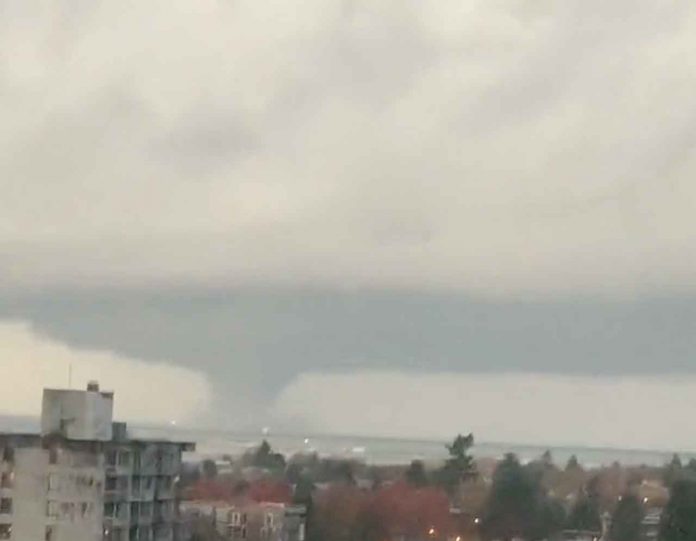
VANCOUVER – WEATHER – On Saturday, Environment Canada issued a very rare tornado warning for North Vancouver.
“A waterspout was spotted west of Vancouver International Airport and is moving north toward West Vancouver and the mouth of Howe Sound including Bowen Island”, stated the national weather service.
Wow. The Scenes from @UBC from our tornado-producing thunderstorm. #BCStorm pic.twitter.com/v6nlhRc3eR
— Tyler Hamilton (@50ShadesofVan) November 7, 2021
Looks like a LARGE waterspout outside Vancouver airport #yvr #bcstorm pic.twitter.com/LLWcaAQCmY
— Prairie Storm Chasers (@PrairieChasers) November 7, 2021
This is wild #bcstorm
Tornado watch issued after waterspout develops near Vancouver Airport | CTV News https://t.co/kZz5Ur1qvB
— Nafeesa Karim (@nafeesakarim) November 7, 2021
While to tornado watch has ended, the region remains under a special weather statement.
Special weather statement in effect for:
- Metro Vancouver – central including the City of Vancouver Burnaby and New Westminster
- Metro Vancouver – North Shore including West Vancouver and North Vancouver
- Metro Vancouver – northeast including Coquitlam and Maple Ridge
- Metro Vancouver – southeast including Surrey and Langley
- Metro Vancouver – southwest including Richmond and Delta
Potential for strong winds Monday overnight into Tuesday morning.
Threat: Strong southeast winds of 50 to 70 km/h except for exposed coastal sections of western Vancouver Island – winds will veer to west 70 to 90 km/h.
Locations: Communities adjacent to the Strait of Georgia, Haro Strait, Juan de Fuca Strait and exposed coastal sections of the west coast of Vancouver Island.
Timespan: Monday overnight to noon on Tuesday.
Remarks: A deep low will approach the northern tip of Vancouver island Monday night and will generate strong southeast winds.
There remains some uncertainty as to the exact strength of these winds as some weather prediction models are suggesting the potential for a secondary low pressure system to cross Vancouver Island, south of the main low pressure system. In this scenario, the winds will be at their strongest and warning level criteria will be met.


