Nine New Fires – Total in Region of 17 Active Fires
Thunder Bay – Wildfire Update – There were nine new fires confirmed in the northwest region by the afternoon of May 17 with more reports being investigated at this time.
-
- Kenora 24 is not under control at 0.1 hectares and is located on an island on Lake of the Woods, approximately 19 kilometres southwest of Kenora.
- Kenora 25 is not under control at 1 hectare and is located near Twin Lake, approximately 34 kilometres east of Kenora.
- Kenora 26 is not under control at 0.1 hectares and is located near Little Narrow Lake, approximately 34 kilometres east of Kenora.
- Dryden 13 is not under control at 30 hectares and is located near Melgund Lake, approximately 4 kilometres northeast of Borups Corners.
- Red Lake 10 is not under control at 7 hectares and is located near Paull Lake, approximately 66 kilometres southwest of Red Lake.
- Kenora 27 is not under control at 1 hectare and is located near Moosehorn Lake, approximately 52 kilometres north of Kenora.
- Kenora 28 is not under control at 0.5 hectares and is located near Unexpected Lake, approximately 88 kilometres northeast of Kenora.
- Kenora 29 is not under control at 0.1 hectares and is located near Mahree Lake, approximately 33 kilometres east of Kenora.
- Red Lake 11 is not under control at 0.1 hectares and is located near west of Flat Lake, approximately 12 kilometres southwest of Red Lake.
- At the time of this update, there are 17 active fires in the region. 11 fires are not under control, three fires are being held and three fires are under control.
- There were two more fires following yesterday’s report.
- Red Lake 9 is out at 0.2 hectares and was located in Woodland Caribou Provincial Park near Wrist Lake.
- Sioux Lookout 3 is not under control at 71.6 hectares and is located near Great Portage Lake, approximately 44 kilometres northwest of Sioux Lookout. This fire required aggressive initial attack with waterbombers and FireRanger crews. Six crews are assigned to this fire.
- The fire hazard is high to extreme in the southern half of the region along the Minnesota border. Recent rain has lowered the hazard to low to moderate through the northeast portion of the region but is forecast to increase over the next few days.
- To see the fire hazard near you, consult the interactive fire map at Ontario.ca/forestfire
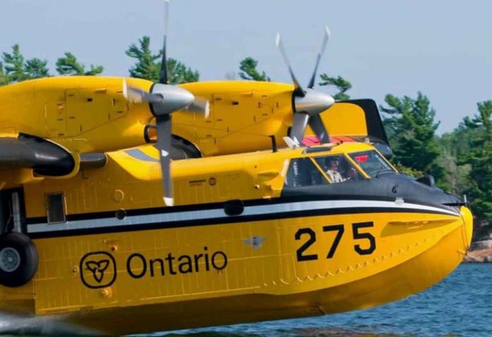
Help fight forest fires: Stay clear of waterbombers!
When waterbombers approach a body of water, move close to the shore so they can perform their scoop safely.
A waterbomber will not scoop from a lake or river if encroaching watercraft pose a safety hazard.
Be safe, stay clear of waterbombers.

