
WINNIPEG – WEATHER – On March 4, 1966, Winnipeg and much of southern Manitoba were swallowed by a full-on prairie blizzard—the kind that turns familiar streets into featureless white corridors and makes a short commute feel like a survival situation. It wasn’t “just a snowstorm.” By the next day’s reporting, the Winnipeg Free Press described a 14-hour blizzard that brought Greater Winnipeg “to a standstill,” with about 14 inches of snow whipped into deep drifts by winds up to 70 mph (about 113 km/h).
Even decades later, the storm still works as a benchmark for how quickly a modern city can lose mobility, communications, and normal routines when visibility collapses and wind-driven snow starts piling up faster than crews can clear it.
Editor’s Note: This storm was memorable to me as a young child, I was amazed at the volume of snow. All the dads in the neighbourhood worked together to dig out the driveways. Clearing the snow took days. The snowbanks along our home on Cook Road were easily 7 to 8 feet high.
What makes a blizzard different from “a lot of snow”
In Canada, blizzard warnings are tied more to visibility and wind than snowfall totals. Environment and Climate Change Canada describes blizzard conditions as high winds causing widespread reductions in visibility (around 400 metres or less) due to falling and/or blowing snow.
That matters because it explains why cities can be paralyzed even when snowfall totals don’t sound extreme at first glance: once the wind starts moving snow around, roads disappear and plows can’t keep ahead of drifting.
The storm’s setup: a classic “Colorado Low”
Many of the most punishing Prairie blizzards trace back to a Colorado Low—a powerful low-pressure system that forms in the U.S. Rockies/High Plains region and then tracks northeast.
The Transcona Museum notes the March 4, 1966 storm was driven by a Colorado low and hit Winnipeg-area communities with about 35 cm of snow and gusts around 110 km/h, closing roads, schools, and businesses.
South of the border, NOAA’s National Weather Service documented the broader March 2–5, 1966 blizzard across the Northern Plains as a long-duration event fueled by an intense Colorado Low—producing heavy snow and very strong winds over a wide region.
Winnipeg was in the sweet spot when that system delivered its worst punch to southern Manitoba.
How the shutdown unfolded in Winnipeg
From the Free Press coverage the next day, you can see the sequence that’s familiar to anyone who has lived through a major city blizzard:
1) Overnight snow becomes morning chaos.
Snow began after midnight, but the real danger rose with the wind: snow was whipped into high drifts, and by Friday, activity across the city stalled.
2) Transit becomes the first domino.
Buses were blocked by drifts, and getting them moved became part of the initial dig-out effort. In a city that relies on public transit for thousands of workers, once buses stop, everything from staffing hospitals to stocking stores becomes harder.
3) Downtown turns into an emergency shelter.
The Free Press reported about 1,600 people sought refuge at Winnipeg’s two largest retail stores—Eaton’s and The Bay—as the storm cut off normal travel.
Global News’ retrospective (using Environment Canada’s “almost 38 cm” figure) also highlights how the storm stranded people downtown and forced improvisation, including snowmobiles transporting essential workers.
4) Emergency response shifts from “service” to “improvisation.”
The Free Press described police constables acting as midwives when travel to hospital was “impossible,” underscoring how fast routine emergencies become high-stakes when roads are impassable.
5) Communications become the lifeline.
One striking detail: a radio call to Mayor Stephen Juba helped trigger an organized response—an emergency centre and bulletins to news outlets—because the scale of the blizzard wasn’t immediately obvious at the start of the day.
The human and economic toll
Historic storms are remembered for snowbanks and dramatic photos, but their real impact shows up in the difficult, personal outcomes:
-
The Free Press front page noted two men died “at blizzard’s height.”
-
Cleanup, overtime, damaged vehicles, stranded commuters, and interrupted business operations all translate to costs that can run into the millions—especially when the storm’s wind-driven drifting makes clearing slow and repetitive.
And the disruption doesn’t end when snow stops falling. The “after storm” period is when cities face their second crisis: digging out while keeping hospitals, fire protection, and essential supply lines functioning.
Why blizzards hit major cities so hard
Big cities have advantages—more equipment, more staffing, more infrastructure—but they also have built-in vulnerabilities:
Transportation gridlock spreads fast
A few stuck buses or jackknifed vehicles can cascade into system-wide congestion, blocking plows and emergency vehicles. When visibility drops, even experienced drivers make mistakes, and the margin for error disappears.
Cities depend on constant staffing
Hospitals, utilities, airports, transit control centres, and communications systems all run on shifts. If workers can’t get in—or can’t get home—fatigue becomes its own hazard.
Supply chains are “just in time”
Grocery stores, pharmacies, and fuel distribution depend on frequent deliveries. A single day of impassable roads can create localized shortages, especially if the storm covers a wide region.
Power and communications are exposed
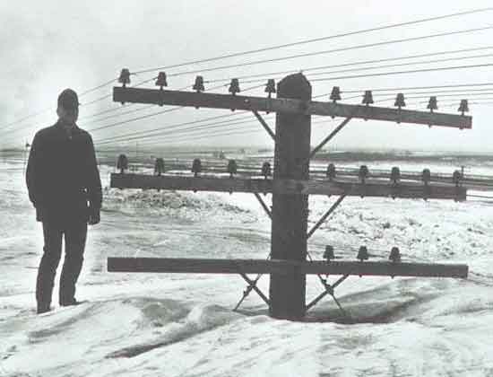
High winds, drifting, and ice can damage lines and hamper repair crews. Even when power holds, customer support and emergency call systems can be overwhelmed.
Public health risks rise sharply
Beyond frostbite and hypothermia, blizzards bring:
-
carbon monoxide poisoning from poor ventilation (vehicles, generators),
-
heart attacks from overexertion shoveling,
-
slips and falls during freeze-thaw cycles after the storm.
The lasting lesson of March 4, 1966
Winnipeg’s 1966 blizzard wasn’t only memorable because of the snow totals—it’s remembered because it showed how a city can be functionally cut off in hours when wind, visibility, and drifting line up.
The practical takeaway for any major city is simple: the “best” blizzard response isn’t heroic digging—it’s reducing exposure before the worst conditions arrive:
-
keep traffic off key corridors early,
-
open warming/shelter spaces quickly (downtown, transit hubs),
-
prioritize emergency routes and hospitals,
-
communicate clearly and repeatedly through radio, mobile alerts, and social channels.
Because when the wind-driven snow starts piling into walls and the street grid disappears, the city doesn’t need perfect forecasting. It needs preparedness that assumes the forecast might be understated.


