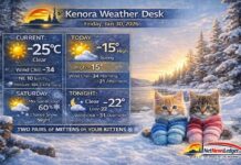
KENORA – WEATHER DESK – A sharp Arctic bite is holding the region in its grip this morning, with clear skies but deep cold in place. As the day goes on, clouds will increase and light snow (flurries) is expected to return late today, ahead of a steadier snowfall event midweek.
Today’s Weather Overview
Current Conditions (6:00 AM CST)
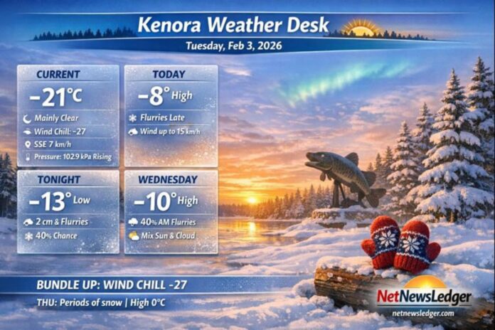
As of the 6:00 AM observation at Kenora Airport, it’s mainly clear and very cold at -21.2°C, with a wind chill near -27. A light SSE wind at 7 km/h is enough to add an extra sting, especially for exposed skin.
Barometric pressure is 102.9 kPa and rising, a classic sign of stable air right now—but the incoming cloud and flurries later today show the next weather maker is already lining up. Humidity is 82% with a dew point of -23.4°C, and visibility is excellent at 32 km.
What to Expect Today (Tuesday)
Expect a mix of sun and cloud through the day, with flurries developing late this afternoon. Winds stay light at up to 15 km/h, but temperatures will “recover” only to a high of -8°C. Wind chills improve slightly from -21 this morning to around -13 this afternoon—still winter-biting, just less brutal than sunrise.
Expected Conditions: The Next Three Days
Tonight (Tuesday night):
Flurries taper off after midnight, then it turns partly cloudy with a 40% chance of lingering flurries. Snowfall amounts near 2 cm are expected. Low -13°C, with wind chills dipping to about -19 overnight.
Wednesday, February 4:
A mix of sun and cloud, with a 40% chance of morning flurries. High -10°C. Wind chills hover near -19 in the morning and around -13 in the afternoon. UV index stays 1 (low). Wednesday night brings periods of snow with a low near -12°C.
Thursday, February 5:
A more active day: periods of snow with temperatures surging to a high of 0°C (a big warm-up compared to today). Thursday night turns cloudy with a 30% chance of flurries, and the cold snaps back to -18°C.
Friday, February 6:
Back to quieter winter weather with a mix of sun and cloud. High -13°C. Friday night: cloudy periods, low -17°C.
Quick look ahead (weekend into Monday):
More cloud and intermittent flurries chances: Saturday -9°C (40% flurries), Sunday cloudy -6°C, Monday cloudy -3°C.
Wardrobe Recommendations
-
This morning: Dress for -27 wind chill. Go with a heavy parka, insulated snow pants if you’ll be outside long, and a warm base layer (thermal top + leggings).
-
Hands, head, face: Mittens beat gloves in this cold. Add a toque and a neck warmer/balaclava—covering skin matters when the wind chill is in the -20s.
-
Tonight into Thursday: Keep winter boots with good tread handy—flurries and periods of snow can leave slick spots, especially on untreated roads and driveways.
-
Thursday’s warm-up to 0°C: Snow can get heavier and more compact. Waterproof outerwear and boots help if things turn damp or slushy during/after snowfall.
Weather Trivia
For early February, the “normal” high in the Kenora area is about -10°C and the normal low is about -19°C. Today’s forecast high of -8°C is actually a touch milder than average—but this morning’s deep cold reminds you winter still has teeth.

