TORONTO – WEATHER DESK – Toronto starts Saturday under bright skies and bitter cold, with high pressure overhead and a Yellow Cold Warning flagged for early this morning.
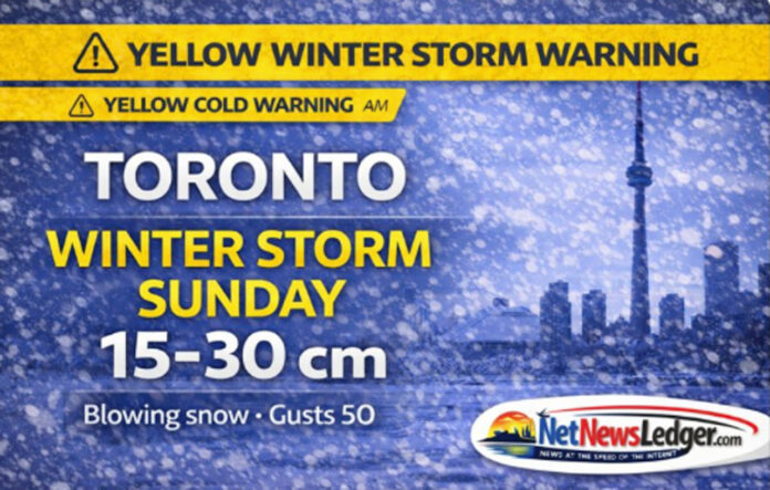
The bigger story is what’s next: Environment Canada has also issued a Yellow Winter Storm Warning for Sunday, with 15–30 cm of snow possible and near-zero visibility at times in blowing snow as winds gust to 50 km/h.
This is a classic “calm before the storm” setup—sunshine today, then snow squalls tonight, followed by a potentially disruptive Sunday.
Today’s Weather
Current Conditions (Toronto Pearson Int’l Airport – 8:00 AM EST)
-
Temperature: -20.1°C
-
Condition: Mainly Sunny
-
Wind: Calm
-
Humidity: 77%
-
Dew Point: -23.1°C
-
Pressure: 104.0 kPa, rising
-
Visibility: 24 km
With calm wind, the cold is still sharp but not as punishing as wind-driven conditions. The rising pressure supports today’s quieter weather—before the next system arrives.
Weather Alerts in Effect
Yellow Warning – Cold (Moderate Impact)
-
What: Wind chills near -30 to -33
-
When: Early this morning
Even if the wind is light at the airport, cold exposure risk remains high in open areas or if you’re out for long periods. Frostbite can develop within minutes on exposed skin in severe cold.
Yellow Warning – Winter Storm (High Impact, Moderate Confidence)
-
What: 15–30 cm of snow, locally higher amounts possible
-
Visibility: Near zero at times in blowing snow, with gusts up to 50 km/h
-
When: Sunday
-
How it unfolds:
-
Early Sunday morning: a local lake-effect band develops off Lake Ontario with heavy localized snow and reduced visibility
-
Sunday afternoon into Sunday night: snow becomes more widespread as a larger system moves in, with lake enhancement potentially boosting totals in some areas
-
-
Uncertainty: The exact placement of the heaviest snow remains uncertain, which is typical for lake-enhanced setups—neighbourhood-to-neighbourhood differences can be significant.
Travel may be hazardous Sunday. If you can shift plans, Sunday is the day to do it.
Extended Weather Forecast
Expected Conditions (Next Three Days)
Saturday, January 24 (Today)
-
Sky: Mainly sunny
-
High: -10°C
-
Wind: Up to 15 km/h
-
Wind chill: -30 this morning, improving to about -14 this afternoon
-
Risk: Frostbite risk remains, especially early
Tonight
-
Sky: Mainly cloudy
-
Snow: Flurries and local snow squalls beginning before morning
-
Local amount: 2–4 cm
-
Wind: Becoming east 20 km/h gusting to 40 before morning
-
Low: -15°C
-
Wind chill: about -25 overnight
Sunday, January 25
-
Snow: Snow at times heavy
-
Morning: local snow squalls possible
-
Later: local blowing snow late morning and afternoon
-
Amount (daytime): 5–10 cm (with storm totals potentially higher depending on band placement)
-
Wind: East 30 km/h gusting to 50
-
High: -7°C
-
Wind chill: about -25 morning, -15 afternoon
-
Sunday night: snow or snow squalls continue; windy; low -13°C
Monday, January 26
-
Sky: Mix of sun and cloud, 40% chance of flurries
-
High: -7°C
-
Night: Cloudy periods, low -14°C
Wardrobe Recommendations
Today (cold + sun):
-
Thermal base layer + insulated mid-layer (fleece/wool)
-
Winter coat with good insulation (wind-resistant helps even with lighter winds)
-
Warm mitts, toque, and a neck gaiter/scarf (protect cheeks and nose for the morning wind chill)
Tonight into Sunday (snow + wind + blowing snow risk):
-
Add a waterproof/windproof outer shell (jacket and boots)
-
Consider snow pants if you’ll be outside for shoveling or transit waits
-
Use boots with strong tread or add traction aids (icy sidewalks are likely)
-
Pack spare gloves/hat if commuting—wet gear gets cold fast
Storm Readiness and Travel Safety
-
Plan for rapidly changing visibility Sunday, especially near the lake-effect band.
-
If you must drive: keep your tank topped up, allow extra time, and carry a small vehicle kit (blanket, flashlight, phone charger, shovel, and snacks).
-
If you live in a snowbelt-prone area: expect the possibility of locally higher totals and drifting where winds funnel between buildings and open corridors.
Pet Safety During Cold and Snow Squalls
-
Keep walks short during the coldest periods; watch for paw lifting, shivering, or trying to turn back.
-
Wipe paws after outings to remove ice and road salt.
-
Keep cats indoors—especially once squalls and heavier snow start.
-
Sunday’s blowing snow and low visibility can be disorienting for pets outdoors; keep them close and supervised.
Weather Trivia
Lake-effect snow doesn’t need a big storm system to cause problems. When winds align over Lake Ontario and pick up moisture, a narrow band can dump heavy snow over one part of the city while another area gets much less—one reason forecasters often highlight uncertainty in exact placement during lake-enhanced events.

