
The Geraldton–Greenstone region is locked into a mid-winter deep freeze this Wednesday morning, and conditions are being made worse by blowing snow and poor visibility.
Environment Canada has issued a Yellow Advisory for Blowing Snow for Geraldton–Longlac–Caramat, warning that near-zero visibility is possible at times as strong northerly winds whip up falling and freshly fallen snow.
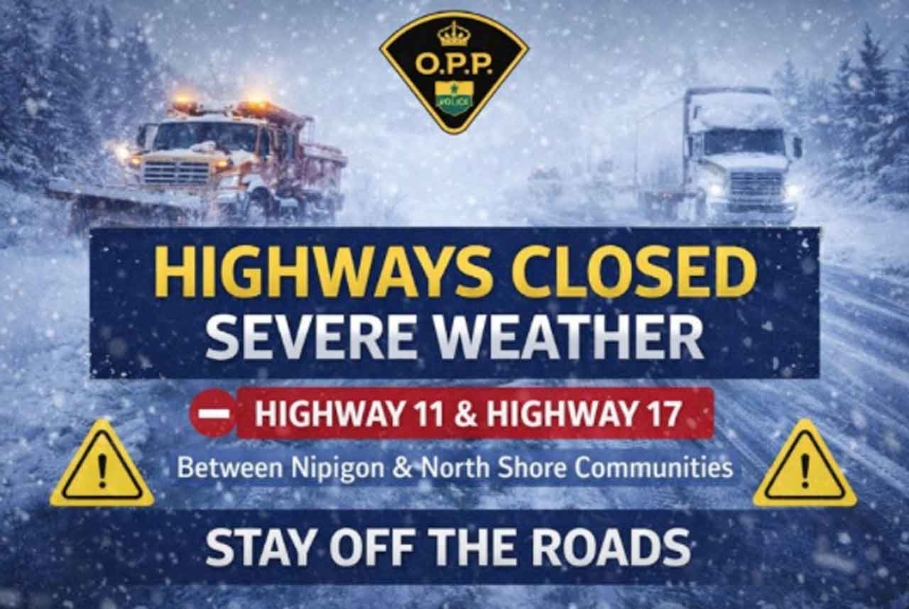
Highways 11 and 17 remain closed since last night due to weather and road conditions.
Travel may become hazardous quickly, especially on exposed highways and open stretches of road. For today, take a weather day if highway travel was in your plans.
Today’s Weather Overview
Current Conditions (Geraldton Airport — 7:00 AM EST)
-
Temperature: -24.3°C (Weather Focus: -24°C)
-
Condition: Mostly cloudy
-
Wind: NW 15 km/h
-
Wind Chill: -34
-
Humidity: 76%
-
Pressure: 101.9 kPa
-
Visibility: 16 km
Even with decent visibility at the airport right now, the advisory highlights that conditions can drop fast in blowing snow—especially outside town and in higher, more exposed terrain.
Yellow Advisory – Blowing Snow
What: Blowing snow and heavy snow at times, with 5–10 cm possible and significantly reduced/near-zero visibility in some areas.
When: This morning, possibly into this afternoon in some locations.
Why: Northerly gusts approaching 70 km/h can rapidly reduce visibility and cause sudden whiteout-like conditions.
Today (Wednesday, Jan 14)
-
Partly cloudy early, then becoming cloudy
-
Local blowing snow this morning
-
Wind: North 30 km/h gusting to 50
-
High: -17°C
-
Wind chill: -36 this morning, -27 this afternoon
-
Risk of frostbite
Travel note: If you must drive, be ready for sudden visibility drops. Road closures are possible if conditions deteriorate.
Extended Weather Forecast
Expected Conditions (Next Three Days)
Tonight (Wed, Jan 14)
-
Cloudy, becoming partly cloudy near midnight
-
Wind: North 20 km/h gusting to 40, easing late evening
-
Low: -25°C
-
Wind chill near -30
-
Risk of frostbite
Thursday (Jan 15)
-
Mix of sun and cloud
-
Wind up to 15 km/h
-
High: -11°C
-
Wind chill -30 in the morning, -18 in the afternoon
-
Risk of frostbite
Thursday Night into Friday (Jan 16)
-
Thursday night: Periods of snow, low -15°C
-
Friday: Periods of snow, high -10°C
-
Friday night: Cloudy periods with 40% chance of flurries, low -25°C
Wardrobe Recommendations
-
Today: Dress for wind and wind chill. A heavy parka, insulated mitts, toque, and a scarf/neck warmer are essential. If you’re outside for more than a few minutes, cover exposed skin to reduce frostbite risk.
-
Driving: Bring a winter kit (blanket, gloves, flashlight, snacks). In blowing snow, staying with your vehicle is often safer than walking.
-
Thursday/Friday: Snow returns—waterproof winter boots and moisture-resistant outer layers will help keep you warm and dry.
Weather Trivia
Blowing snow doesn’t always need a huge snowfall to become dangerous. When winds gust to 50–70 km/h, even a thin layer of loose snow can be lifted back into the air, cutting visibility sharply—especially on open highways and near fields or lakes.
META Description
Geraldton–Greenstone weather forecast for January 14, 2026: Yellow Blowing Snow Advisory in effect with poor visibility possible and 5–10 cm of snow in some areas. Bitter cold continues with wind chills near -36 this morning and frostbite risk. Snow chances return Thursday night into Friday.


