NetNewsLedger Weather Desk – Geraldton / Greenstone
Slippery Skies Today, Mixed Bag Tuesday, and a Return to Deep Freeze
THUNDER BAY – WEATHER DESK – Geraldton and the wider Greenstone region are starting the new week under light snow and a stiff breeze, with more variety on the way than most people would ask for in mid-December.
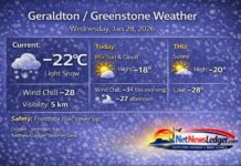
At 6:00 AM EST, conditions at Geraldton Airport showed light snow and a temperature of –8.2°C, feeling closer to –16°C with the west-southwest wind at 24 km/h, gusting to 37 km/h. The humidity sits at 75 percent, with a dew point of –11.9°C, and visibility is about 16 kilometres through the light snow.
The barometric pressure is 101.3 kPa, indicating a weak system sliding through, with colder air already lining up behind it.
For mid-December, Geraldton and Greenstone typically see daytime highs in the minus teens and overnight lows dropping into the minus twenties. Today’s temperatures line up well with a classic northern Ontario December – just with a bit more drama thanks to tomorrow’s ice pellets and freezing drizzle risk.
Today: Flurries Tapering, Cold Air Holding On
Through this morning, flurries will come to an end, leaving behind mainly cloudy skies with a 40 percent chance of flurries through the rest of the day. Local snowfall amounts of around 2 centimetres are expected – just enough to freshen up the snowpack and keep roads, sidewalks and driveways coated.
The northwest wind near 20 km/h this morning will ease to light by late morning, but the cold remains a factor. The high will only reach about –10°C, and the wind chill will sit near –22°C this morning and around –15°C this afternoon. That keeps things feeling properly wintry, especially for anyone walking, working outdoors, or heading along Highway 11 or 584.
Tonight: Clearing a Bit, Then Clouds Sneak Back In
Tonight will be partly cloudy, with cloud cover increasing again late in the evening. Winds will stay light, up to 15 km/h, but the temperature will drop sharply to around –20°C.
The wind chill will feel near –16°C this evening and close to –27°C overnight, which is cold enough to bring a risk of frostbite for anyone spending longer stretches outside without proper winter gear. It’s a good night for plugging in vehicles and making sure pets and people alike are tucked in somewhere warm.
Tuesday: Ice Pellets, Flurries and Freezing Drizzle – A Sloppy Mix
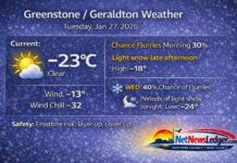
Tuesday is shaping up to be one of those “everything at once” winter days. The forecast calls for cloudy skies with a 40 percent chance of flurries changing to a 60 percent chance of ice pellets in the morning. On top of that, there’s a risk of freezing drizzle in the morning and afternoon, which is Mother Nature’s way of saying, “Please be careful out there.”
Winds will shift and ramp up, with southwest winds near 30 km/h, pushing milder air into the region. The high is expected to reach about +1°C, which means surfaces that are now frozen solid could become wet, slushy and very slippery, especially where freezing drizzle hits bare pavement or packed snow.
Even with the warming trend, the morning will still feel bitter at first: the wind chill will be near –23°C in the morningbefore the temperature and apparent warmth improve later in the day. By afternoon, it may feel less harsh, but the trade-off is trickier travel with ice pellets and possible glaze from freezing drizzle.
Tuesday night will stay cloudy with a 70 percent chance of flurries and a low around –15°C, turning any slush from the day back into ice and keeping driving and walking conditions slick into Wednesday morning.
Mid-Week Snapshot: Brief Break, Then More Snow and Serious Cold
On Wednesday, Geraldton and Greenstone get a bit of a visual break with a mix of sun and cloud and a high near –10°C. It’ll feel more like traditional northern Ontario winter again – cold, but not outrageous, and likely less messy underfoot than Tuesday.
By Wednesday night, the pattern turns snowy again, with cloudy skies and a 60 percent chance of snow and a low near –14°C.
Beyond that, the longer-range forecast shows more snow and a serious return to deep cold, including:
-
Thursday: Snow with a high near –6°C and flurries Thursday night with a low plunging toward –33°C, a dangerously cold value.
-
Friday: Cloudy with a high near –12°C, then a 60 percent chance of snow Friday night with a low near –12°C.
-
Saturday: More snow with a high near –7°C, and a 60 percent chance of snow Saturday night with a low near –25°C.
-
Sunday: A 60 percent chance of flurries and a high near –13°C.
In other words, after Tuesday’s messy mild-ish interlude, winter slams the door shut again with deep cold and repeated snow chances.
What to Wear in Geraldton and Greenstone
This is not a week for half-measures when it comes to winter clothing – especially with wind chills in the –20s and some overnight lows heading into the –30s later on.
For today and tonight, and heading into Tuesday’s mixed precipitation, dressing in layers is the safest approach. Start with a thermal or fleece base layer (top and bottom) to hold your body heat. Add a warm mid-layer such as a hoodie or sweater, and top it off with a proper insulated winter jacket that blocks the wind.
On your legs, insulated or lined pants will feel much better than basic jeans, particularly if you’re out around town, shovelling, or working outside. As temperatures drop toward –20°C and beyond at night, snow pants become a smart choice.
For your feet, insulated winter boots and thick socks are essential, especially on Tuesday when surfaces will be both wet and icy. A toque that covers your ears, thick mitts instead of thin gloves, and a scarf or neck warmer to pull over your nose and mouth will help protect against frostbite when wind chills dip below –20°C.
When freezing drizzle or ice pellets are in the forecast, it’s also worth thinking about traction: footwear with a good tread, or ice grips if you have them, can make the difference between a safe walk and a sudden slip.
Greenstone Weather Trivia – Why It Gets So Wild
Geraldton and the Greenstone region sit in a spot where Prairie systems, northern cold, and Great Lakes moisture all like to meet. That’s why your forecast can switch from flurries to ice pellets to freezing drizzle and back to snow in under 24 hours, and why you can see a high near +1°C one day and a low near –33°C just a couple of days later.
It’s all part of living in a place where winter is not just a season, but a full personality – sometimes grey and messy, sometimes bright and brutally cold, and always just a little bit unpredictable.
The Last Word on Weather:
Geraldton–Greenstone sees flurries and –10°C today, freezing drizzle and ice pellets Tuesday with a high near +1°C, then a sharp return to deep cold and snow later this week.


