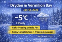
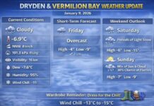
NetNewsLedger Weather Desk – Dryden & Vermilion Bay
Cloudy Skies, Flurries, and a Wintry Mix on the Way
Thunder Bay – WEATHER DESK – Dryden and Vermilion Bay are in for a classic Northwestern Ontario winter roller coaster: a cold, cloudy start, a messy stretch of ice pellets and rain showers, and then a hard snap back to deep freeze and blowing snow by Thursday.
As of 5:06 AM CST, at Dryden Airport, conditions were cloudy with a temperature of –14.6°C (rounded to –15°C). A southwest wind at 9 km/h is producing a wind chill near –20°C, so it feels colder than the thermometer suggests.
The humidity sits at 82 percent, with a dew point of –17.0°C, and visibility is around 16 kilometres under the cloud. The barometric pressure is 101.6 kPa and slowly changing as the next system approaches.
Typical mid-December conditions feature daytime highs in the minus teens and overnight lows dipping into the minus twenties – exactly the kind of pattern we’re seeing, especially once we hit Thursday night’s deep freeze.
Today: Cloudy, Flurries and a Slight Cool-Down
Today’s forecast keeps things cloudy, with a 40 percent chance of flurries this morning and early this afternoon. Winds will be light, up to 15 km/h, but the temperature does a bit of an odd shuffle:
-
High near –12°C,
-
then falling to around –14°C this afternoon.
The wind chill will feel near –20°C this morning and about –15°C this afternoon, so it stays properly wintry all day. It’s not a big snow day, but those on-and-off flurries will keep everything freshly coated and potentially slick, especially on side streets, sidewalks, and rural roads.
Tonight: Ice Pellets and Freezing Drizzle Risk
Tonight gets more complicated — and more slippery. The forecast calls for cloudy skies with a 60 percent chance of ice pellets overnight, along with a risk of freezing drizzle.
Winds will turn south 20 km/h, gusting to 40 km/h near midnight, pushing slightly milder air aloft over a still-frozen surface. The low will fall to around –16°C, but with the wind, the wind chill will feel closer to –25°C this evening.
That combination — cold air at the surface, warmer air aloft — is classic freezing drizzle and ice pellet weather, and it can create very slippery conditions, especially on untreated pavement, driveways, and steps.
Tuesday: Ice Pellets to Rain Showers, Then Back to Cold
On Tuesday, the cloudy theme continues with 60 percent chance of ice pellets early in the morning, then a few rain showers beginning late in the afternoon. There is also a risk of freezing drizzle in the morning, so the morning commute and early-day travel could be especially tricky.
Winds will be south near 30 km/h, helping drag in milder air. The high is forecast near +2°C, which will feel very different from today’s mid-minus teens. It will still feel like –16°C in the morning wind chill, but by afternoon it will be noticeably less bitter — even though the roads and walkways may be wet, slushy and icy.
Tuesday night stays cloudy with a 60 percent chance of flurries or rain showers, and the low will drop to around –18°C. That means anything that melts or turns slushy during the afternoon is likely to freeze solid overnight, setting up for icy footing into Wednesday.
Midweek: Quick Reset Back to Winter
On Wednesday, Dryden and Vermilion Bay get a more straightforward winter day: a mix of sun and cloud with a 30 percent chance of flurries and a high near –10°C. Back to “normal” snow, no freezing drizzle tricks.
Wednesday night, however, sees snow returning with a low around –14°C, adding fresh accumulation and rebuilding the snowpack.
On Thursday, we’re back into full-on winter: snow with local blowing snow and a high near –16°C. That blowing snow will reduce visibility at times, especially along open stretches of highway and rural roads.
Thursday night turns sharply colder under clear skies, with a low near –30°C — a serious deep freeze and solid frostbite risk for anyone out without proper gear.
Looking ahead a bit further:
-
Friday: 30 percent chance of flurries, high near –11°C; periods of snow Friday night, low near –16°C.
-
Saturday: 70 percent chance of flurries, high near –13°C; clear Saturday night, low near –26°C.
-
Sunday: 30 percent chance of flurries, high around –16°C.
In short, Dryden and Vermilion Bay get two days of messy, borderline-thaw conditions, followed by a solid return to cold and snowy December weather.
What to Wear in Dryden & Vermilion Bay
This is a layer-up week, with temperatures swinging from mid-minus teens to above zero and back down toward –30°C. To handle all of that safely and comfortably:
-
Start with a thermal or fleece base layer (top and bottom) to keep body heat in.
-
Add a warm mid-layer, like a sweater or hoodie.
-
Top it off with a proper insulated winter jacket that blocks wind and sheds snow and drizzle.
-
For your legs, lined pants or snow pants are smart, especially if you’re walking to school, work, or spending time outdoors.
On your feet, insulated winter boots with good tread and thick socks are key — especially with ice pellets and freezing drizzle making surfaces slick and very cold.
A toque that covers your ears, thick mitts instead of thin gloves, and a scarf or neck warmer you can pull over your mouth and nose will help a lot when wind chills dip toward –20°C and beyond — particularly later in the week when that deep freeze hits Thursday night.
Dryden Weather Trivia – From Slush to Squeaky Snow
Dryden and Vermilion Bay often sit right on the battle line between Arctic air from the northwest and milder Pacific or prairie air from the west. That’s why the area can go from squeaky, crunchy snow at –20°C to slushy puddles around 0°C and back to hard-packed, wind-blown drifts in just a few days.
This week is a textbook example:
-
Cloud and flurries around –12°C today,
-
ice pellets and rain showers at +2°C Tuesday,
-
then a hard return to –30°C wind chill and blowing snow by Thursday night.
It’s part of what makes winter in Dryden and Vermilion Bay both challenging and uniquely dynamic — the weather rarely stays boring for long.
Last Word on the Dryden and Vermilion Bay Weather Focus:
Dryden and Vermilion Bay see flurries and –12°C today, ice pellets and freezing drizzle risk tonight, rain showers Tuesday, then a sharp return to snow and –30°C cold.


