NetNewsLedger Weather – Thunder Bay Forecast
THUNDER BAY – WEATHER FOCUS – It is technically far warmer in Thunder Bay for this Thursday, but before anyone starts talking about spring, let’s remember that “warmer” here still means well below zero.
Your kittens still need mittens, and be kind to your pets not leaving them out in the cold.
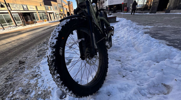
Yesterday, we caught up to Brad at 3Ride Bike Shop on Red River Road to talk a little about winter biking.
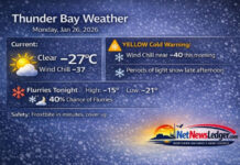
At 6:00 AM EST, conditions at Thunder Bay Airport were mostly cloudy, with the temperature at –10.7°C. A west-southwest wind at 11 km/h is pushing the wind chill down to about –16°C, making it feel a bit sharper than the number on the thermometer.
Humidity is sitting at 74 percent, with a dew point of –14.5°C, and visibility is an excellent 24 kilometres, so you can see across the harbour and out toward the Sleeping Giant without issue. The barometric pressure sits at 101.5 kPa and is rising, a sign that the weather is reasonably settled for now before the next system rolls in.
Today’s forecast calls for a mix of sun and cloud, which will help it look nicer out there, even if the air still has some bite. There’s a 40 percent chance of flurries early this morning, but any snow that does fall should be light and scattered. The afternoon high is expected to reach around –7°C, and with winds up to 15 km/h, the wind chill will sit near –20°C this morning, improving to about –12°C this afternoon. After the –20s we’ve seen earlier in the week, this will feel like a bit of a break, but it’s still firmly in winter territory.
Tonight, skies remain mainly cloudy with winds up to 15 km/h. The low will drop to near –11°C, and the wind chill will hover around –14°C, so it’ll feel crisp but not as brutally cold as some of the Arctic blasts we’ve seen already. Roads and sidewalks will stay wintery, with icy patches where yesterday’s snow and overnight cooling meet.
Tomorrow, Friday, is when things get more interesting again. The day will be cloudy, with periods of snow beginning in the morning and bringing about 2 cm of accumulation. It won’t be a major storm, but it will be enough to freshen the snowpack and make for slippery driving and walking conditions, especially through the day. The temperature will hold steady near –11°C, but once a northwest wind at 20 km/h kicks in late in the afternoon, the wind chill will feel near –14°C in the morning and drop toward –21°C in the afternoon. That’s when your cheeks will start reminding you that yes, this is still Thunder Bay in December.
Friday night looks much colder, with cloudy periods and a 60 percent chance of flurries, and the temperature plunging to around –22°C. That’s a proper deep-freeze night — the kind where car doors stick, eyelashes frost up, and you’re very glad you plugged in the block heater.
The weekend brings a quieter but colder pattern. Saturday will feature a mix of sun and cloud with a high near –17°C, then a low of about –21°C under cloudy periods Saturday night. Sunday looks sunny with a high near –14°C, a nice visual break from the cloud, but still solidly wintry. Sunday night brings increasing cloud and a 40 percent chance of flurries, with the low near –16°C.
Early next week, the pattern stays familiar:
-
Monday: Cloudy, high near –10°C, cloudy night near –15°C.
-
Tuesday: Cloudy again, high near –6°C, cloudy night near –7°C.
-
Wednesday: A mix of sun and cloud, high near –7°C, continuing the trend of slightly less harsh but still winter-locked temperatures.
What to Wear in Thunder Bay
Even if today feels “warmer,” this is still full winter wardrobe weather. To stay comfortable:
Start with a thermal or fleece base layer, then add a warm sweater and a proper insulated winter jacket. On the bottom, lined pants or snow pants will make walking, waiting for the bus, or shovelling much more comfortable, especially when wind chills are in the –15 to –20 range.
On your feet, insulated winter boots with good tread are important, as packed snow and thin ice are still widespread on side streets and sidewalks. A toque, warm mitts instead of thin gloves, and a scarf or neck warmer that you can pull up over your mouth and nose will make a big difference, especially in the morning and tomorrow afternoon when wind chills drop again. With sun in the forecast today, Saturday and Sunday, sunglasses are also a good idea to cut the glare off the snow.
Thunder Bay Trivia – Warmer, But Still Winter
Even on a “warmer” day like today, Thunder Bay’s winter personality is still all about contrast: bright skies, a sparkling harbour, and stubborn cold that hangs on under every clear patch. The city often enjoys more winter sunshine than some southern Ontario locations, but that comes packaged with colder air masses from the northwest. So yes, it’s warmer than earlier this week — but this is the kind of day that reminds you why every Thunder Bay closet has at least one serious parka.
The Last Words:
Thunder Bay is “warmer” at –11°C Thursday with sun, cloud and flurries, snow returning Friday and wind chills near –21°C before a deep freeze Friday night.

