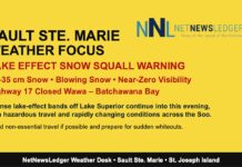
Bundle up, drive safe, and prepare for near-zero visibility as snow squalls make their snowy stand today
Sault Ste. Marie Weather Report – Sunday, December 7, 2025
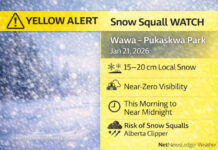
Snow Squall Alert in Effect – Up to 15 cm Possible Today
THUNDER BAY – Weather Desk – Sault Ste. Marie is waking up under a moderate impact weather alert this morning, and winter isn’t being shy about showing off. As of 8:35 AM EST, heavy snow showers are pounding the region with visibility reduced to just 0.4 km.
Observations at the Sault Ste. Marie Airport report a temperature of -7.5°C, a dew point of -8.8°C, and humidity at 90%, which means the snow isn’t going anywhere fast — except sideways.
Winds are currently light from the east at 5 km/h, but strong northerlies of 30 km/h gusting to 50 km/h are expected to take over today. That brings blowing snow, whiteout conditions, and a wind chill near -17°C — yikes.
The barometric pressure is rising at 101.8 kPa, but that’s small comfort as 10 to 15 cm of snow may pile up by evening, especially west of the city near the airport. If you’re travelling, visibility could suddenly drop to near zero, and road conditions will deteriorate quickly.
Tonight: Snow Lingers, Winds Shift
Tonight, the snow slows (slightly), with a 30% chance of flurries early on, before periods of light snow move in near midnight. The winds will shift, starting out north 30 km/h gusting to 50, then calming late this evening before ramping up again from the southwest after midnight.
Overnight temperatures fall to -11°C, and with those winds, the wind chill will feel like -14 this evening, dropping to a biting -21°C overnight. Definitely a three-blanket night.
Monday and Tuesday: Brief Break, Then More Snow
Monday starts with light snow ending in the morning, giving way to a mix of sun and cloud. Don’t get too comfortable — more snow returns Monday night. Temperatures rise slightly to -5°C, but gusting winds of 50 km/h will make it feel closer to -20°C in the morning and -11°C in the afternoon.
Tuesday brings yet more snow, with a high of -2°C, and a 60% chance of flurries continuing into the night. Visibility may again be impacted — the theme of the week seems to be “Snow Mode: Activated.”
What to Wear?
For today’s snow squall shenanigans, gear up like you’re going on a polar expedition:
-
Waterproof winter boots (you’ll need them)
-
Heavy-duty parka with wind resistance
-
Scarf, toque, and insulated gloves — frostbite is possible in under 30 minutes
-
Bright colors or reflective gear if you’re walking — visibility is low and safety is key
If you’re driving, toss a snow brush, booster cables, extra blanket, and emergency snacks in your car — just in case.
Weather Trivia Time!
Sault Ste. Marie is no stranger to snow squalls — thanks to its position on Lake Superior’s southeastern shore, it’s a prime target for lake-effect snow, which can dump over 100 cm in a single week under the right conditions!

