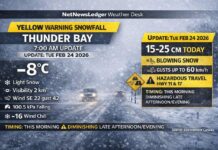
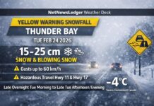
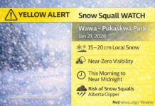
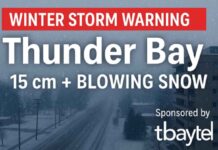
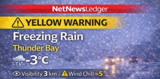
The short version on Winter Storm Advisories
THUNDER BAY – WEATHER – When an Alberta Clipper or a Colorado Low points at Northwestern Ontario, Thunder Bay often gets the alert—but the heaviest snow piles up along the North Shore of Lake Superior (Nipigon–Terrace Bay–Wawa). The “miss” isn’t hype. It’s Lake Superior and local terrain quietly steering, boosting, or shutting down snowfall right at the last minute.
At NetNewsLedger we work to keep you aware of the latest weather. Sometimes our insight suggests to our team that the storm is likely to miss Thunder Bay. However with the experts advising different, we will report the facts, not guesswork.
What’s chasing us: Clippers vs. Colorado Lows
-
Alberta Clipper: Fast-moving, colder, and usually light on moisture. On its own, it’s a few centimetres. Over the lake, bands can flare up.
-
Colorado Low: Slower, warmer, loaded with moisture. The snow shield is broader and heavier—but exact track matters. A shift of 50–100 km can move the bull’s-eye off Thunder Bay and onto the shore—or vice-versa.
How Lake Superior changes the script
1) Lake “boost”: more snow where air rises
Cold air crossing the (relatively) warmer lake picks up heat and moisture. When that air hits higher ground along the North Shore, it’s lifted and squeezes out heavier snow. That’s why places east of Thunder Bay can see intense bands and higher totals, even when the city sees little.
2) Lake “shadow”: less snow where air sinks
As air flows downhill into Thunder Bay, it can warm and dry out (a simple “downsloping” effect). That cuts snow totals in the city, even while nearby communities are shovelling hard. Locals call it the Thunder Bay hole for a reason.
3) Wind direction decides who gets hit
Squalls and lake-enhanced bands form downwind of the lake:
-
With some north or northeast flows, the North Shore (Nipigon to Wawa) can get buried.
-
With westerly setups, shoreline convergence can focus bands in pockets from Terrace Bay to Wawa.
-
With northwest winds, other Lake Superior shores take the worst, and Thunder Bay may sit in a shadow.
Small shifts in wind change band placement by tens of kilometres. That’s the difference between a dusting and a driveway-eater.
4) Dry slots and mixing zones
Colorado Lows can wrap in a dry slot (a wedge of drier air), or pull slightly warmer air that mixes snow with ice pellets or drizzle near the lake. Either one cuts totals in town while higher terrain still gets steady snow.
Why the alerts still go out
Who: Environment Canada
What: Watches, advisories, and warnings that cover a range of outcomes
Where: The Lakehead and North Shore corridor—a tight gradient zone
When: Issued early, then refined as radar and winds reveal real band placement
How: Forecast models show a cone of uncertainty. Along big lakes and hills, microscale effects (lake temperatures, wind shifts, terrain lift) can’t be pinned down perfectly hours ahead. Responsible alerting errs on the side of safety.
How to read these forecasts like a pro
-
Watch the wind: The direction tells you which shoreline is “downwind” and most at risk.
-
Look for key phrases: “Lake-enhanced,” “banding,” “locally higher amounts,” “snow squalls,” “track uncertainty.” These are your clues.
-
Expect gradients: It’s normal for 10–20+ cm differences over short distances here.
-
Use updates: Early alerts are broad; nowcasts (radar + observations) narrow the target quickly as bands form.
Bottom line for Thunder Bay Weather
Alerts you see for the city are not false alarms—they reflect a real risk zone. But Lake Superior and local hills often shift or concentrate the snow onto the North Shore while Thunder Bay stays lighter, or vice-versa. That’s why reporting is harder here than over flat prairie or far from big water: small shifts make big differences.
Practical prep (even for “busts”)
Keep the shovel, brush, and salt handy, charge the phone, and leave extra travel time when storms are inbound. If it’s your turn under a band, you’ll be glad you planned; if not, you got a second cup of coffee.

