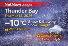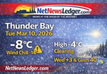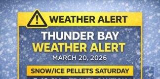
Impact Level: High • Forecast Confidence: Moderate
THUNDER BAY – WEATHER DESK – If you are headed east or west, its a good idea to check 511on.ca for road condition updates. Winter is here. Kenora is expecting up to 10 cm of snow, and Snow Squalls are the story for the Sault.
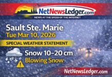
This morning. snow squalls are firing off Lake Superior this morning across Sault Ste. Marie and area, creating sudden whiteouts and fast accumulations.
Environment Canada guidance indicates localized totals of 20 to 40 cm where bands persist, with the most intense snow likely west of the city and near the airport. Strong gusts near 60 km/h will compound visibility issues. If you don’t need to travel this morning, don’t.
Current Conditions — 7:10 a.m. EST, Thursday, December 4, 2025
At Sault Ste. Marie Airport it’s –16.3°C and light snow with drifting snow. The wind is NE 19 km/h (gusty at times), wind chill –26, humidity 77%, barometric pressure 102.3 kPa and rising, with visibility near 1.6 km. That’s the “snow globe on fast-forward” look—brief clearings, then a wall of white.
Today: Squalls Ease Later, But Travel Stays Tricky
Flurries and squalls continue through the morning, easing to mainly cloudy conditions by afternoon with a lingering 40 percent chance of flurries. Local amounts 5 to 10 cm for many, up to 15 cm near Lake Superior. Winds swing north 40 km/h gusting to 70, then west 20 gusting to 40 by late morning. The high is –8°C, but it will feel closer to –23 this morning and –16 this afternoon. Expect snow-covered roads, drifting in open areas, and rapidly changing visibilities on Highway 17 and city arterials.
Tonight: Another Round of Flurries, Blowing Snow After Midnight
Skies stay mainly cloudy. There’s a 40 percent chance of flurries early in the evening, then flurries begin near midnight with local blowing snow and another 5 to 10 cm possible under any persistent bands. Winds strengthen south 20 km/h gusting to 40, flipping southwest 40 gusting to 60 after midnight. Temperature holds near –6°C with wind chill near –18. Plows will be busy; watch for snow ridges and black ice.
Friday: Brief Lull, Then Flurries Rebuild Late Day
Flurries end in the morning, then it’s cloudy with another chance late morning into the afternoon before flurries redevelop late day. Local 5 cm possible. Winds west 40 gusting to 60 early, becoming light by late morning. High –3°C, feeling –15 in the morning and –8 in the afternoon. Friday night stays snowy and cold with a low near –7°C.
Weekend Snapshot
Saturday looks flurry-prone and cold with a high near –3°C; Saturday night remains snowy and –15°C. Sunday trends cloudy with a 70 percent chance of flurries, high near –8°C, easing to cloudy periods near –15°C at night. Not a shovel-free weekend.
What to Wear
Go full winter kit: a thermal base layer, warm mid-layer, and a wind-resistant parka. Add a toque, insulated mitts, and a neck warmer or balaclava. Winter boots with aggressive tread are a must. If you’re out during squalls, keep skin covered—frostbite risk is elevated in gusts.
Travel and Safety Notes
Squall bands can shift a few blocks and change conditions from bare pavement to whiteout in minutes. Slow down, keep lights on, and leave extra space to stop. Expect plow ridges, drifts on open stretches, and near-zero visibility along exposed corridors and near the airport. Consider postponing non-essential trips until winds ease around midday.
Lake Superior Weather Trivia
Classic Lake Superior snow squalls form when cold air crosses comparatively warmer water, building narrow, intense snow bands. That’s why one part of town can see pavement while another digs out from 10+ cm in an hour.
META Description:
Sault Ste. Marie snow squall alert: whiteouts, 20–40 cm locally, gusts near 60 km/h. High −8. Flurries return tonight and Friday. Travel hazardous; avoid if possible.


