Tuesday, December 2, 2025—Bands Getting Weaker Slowly
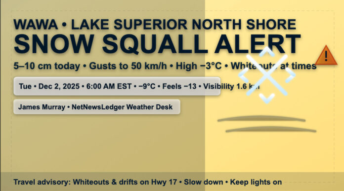
THUNDER BAY – WEATHER DESK – Wawa wakes up to a winter workout. At 6:00 a.m. EST, Wawa Airport reports light snow and –9.1°C, with a wind chill of –13. The wind is blowing from the northwest at 7 km/h, the pressure is 101.2 kPa, the humidity is 89%, and the visibility is only 1.6 km.
This morning, the Moderate-Impact Snow Squall setup is still going on. There are local amounts of 5 to 10 cm and bursts of almost no visibility in the heavier bands. Squalls should get weaker from late morning to early afternoon, but the weather will still be unpredictable.
Expect flurries today, with a chance of snow squalls and local blowing snow late this morning and this afternoon as the wind shifts to the southwest at 30 km/h and gusts to 50. The high will be –3°C, but it will feel more like –15°C this morning and –10°C this afternoon. Sometimes it will be hard to get around on roads and sidewalks, so plan ahead.
Tonight, the tap stays on: flurries with the chance of snow squalls and blowing snow in some areas late at night and into the night. If the bands stay around, they could add another 5 to 10 cm.
Winds will blow from the southwest at 30 mph, then turn north at 30 mph before morning. The temperature will rise to near 0°C by morning. Expect quick changes on Highway 17 and local roads, as well as drifting in open areas and plow ridges.
Midweek: The flurries stop, the wind changes, and the cold air comes back.
Wednesday: The flurries stop in the morning, and the rest of the day is mostly cloudy. The north wind, which was blowing at 30 mph and gusting to 50 mph, calms down in the late afternoon. By the afternoon, the temperature drops to –10°C, and the wind chill drops to –19°C later in the day.
Wednesday night: There will be times when it is cloudy, and there is a 30% chance of flurries. The temperature will be low, around -17°C.
Thursday: There is a 30% chance of flurries and it will be cloudy. The high will be 7°C.
Thursday night: There is a 60% chance of flurries and it will be cloudy. The low will be –12°C.
How to Dress and Get Around
Today is a day to put on layers: a thermal base layer, an insulating mid-layer, and a parka that keeps the wind out. Put on a toque, insulated mitts, and waterproof winter boots with good treads. If you have to drive, keep your lights on, go slowly, and leave a lot of space. Whiteouts can happen suddenly in squalls. Bring a small winter kit with you, like a scraper, brush, shovel, traction aid, and blanket.
A picture of the current air
Wind: 7 km/h from the NW (changing to the SW and gusty today) • Humidity: 89% • Pressure: 101.2 kPa • You can see 1.6 km
Wawa Weather Facts
Cold air from Lake Superior feeds snow squalls. The lake adds moisture to the air, creating narrow bands that can drop a day’s worth of snow in a few hours. One side of town gets buried while the other side sees flurries.


