Clearing sun, stubborn cold, and wind chill are the big stories
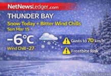
THUNDER BAY – WEATHER – It will be partly sunny this fine Sunday in the city.
At Thunder Bay Airport at 7:00 a.m. EST, it was partly cloudy and -10.9°C with a wind chill of -15. The barometric pressure is 102.4 kPa (falling), the humidity is 76%, and a west wind of about 7 km/h makes the air feel sharp. There is 24 km of visibility. It’s a morning for gloves—yes, mittens for your kittens.
Today: A mix of sun and clouds, with strong winds from the northwest and a high of −7.
This morning, there is a 30% chance of flurries and a mix of sun and clouds. Winds change to the northwest at 30 km/h, with gusts up to 50 km/h by late morning. The high is −7°C, but the wind will make it feel like −18°C at times. Expect the cold to hurt on open stretches and by the lakeshore.
Tonight, it will be partly cloudy, very cold, and the wind chill will be −20.
The sky becomes partly cloudy, and the wind picks up to 15 km/h. The temperature drops to −14°C, and the wind chill drops to about −20°C overnight. Look out for ice that forms again on sidewalks, parking lots, and bridge decks.
Monday, December 1: Bright spells, gusty southwest winds in the middle of the day, and a high of −8.
Another mix of clouds and sun. Winds from the southwest will be 20 km/h with gusts up to 40 km/h in the morning and will get lighter in the afternoon. The high is −8 degrees Celsius. In the morning, the wind chill is close to −20, but by the afternoon, it is around −13. The UV index is 1, which is low. There will be some clouds on Monday night, and the temperature will drop to around −15°C.
Tuesday (Dec 2) — Still Cold, Chance of Snow at Night
On Tuesday, there will be a mix of sun and clouds, and the high will be around −8°C. Tuesday night will be cloudy, and there is a 60% chance of snow. The low will be around −12°C.
What to Wear and Tips for the Road
Start with a thermal base, then add a warm middle layer, and finally a jacket that keeps the wind out. Put on a toque, warm mittens, and winter boots that grip. If you’re driving, slow down on open roads and expect black ice after dark. Leave extra room to stop.
Fun Facts About Lakehead Weather
Northwest winds off Lake Superior can cause short flurry streamers to form even on nice days. One neighbourhood may see flakes while the next stays sunny.


