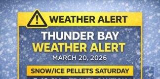
Impact Level Moderate, Forecast Confidence High
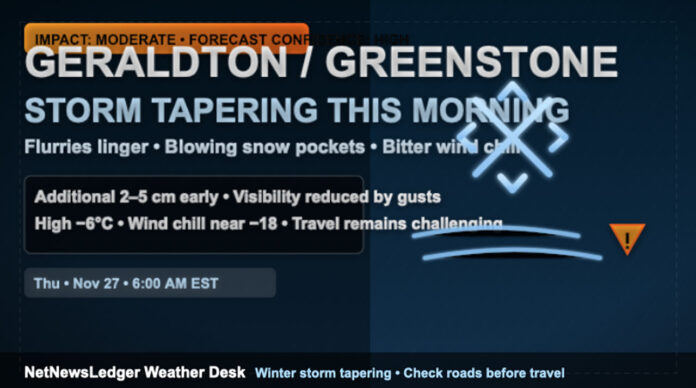
Geraldton – Weather – The winter storm over Geraldton–Greenstone is easing, but it will take a few hours for conditions to improve. As of 6:00 a.m. EST at Geraldton Airport, it’s light snow and –7.1°C with a wind chill near –15. Winds are out of the northwest at 26 km/h gusting to 42, humidity is 85%, visibility is down to 4 km, and the barometric pressure sits at 101.4 kPa. Another 2 to 5 cm of snow is possible this morning, with local blowing snow cutting visibility at times. Totals up to 30 cm are on the ground in parts of the region.
Today — Snow Fades, Flurries Linger, Wind Bites
Snow will taper off late this morning, then skies remain cloudy with a 60 percent chance of flurries. Blowing snow is still possible early. Expect another 2 to 4 cm where bands set up. Northerly winds around 30 km/h gusting to 60 will keep the daytime high near –6°C feeling closer to –18. Roads will be rutted and icy; drifts can form on open stretches of Highway 11.
Tonight — Icy, Blustery and Colder
Cloud sticks around with a 60 percent chance of flurries and pockets of local blowing snow. Northwest winds near 30 km/h gusting to 50 ease late. The low drops to –11°C with a wind chill near –21. Any slush hardens up, so expect black ice on bridges, ramps, and side streets by dawn.
Friday into the Weekend — Quieter but Still Wintry
Friday stays mainly cloudy with a 40 percent chance of flurries in the morning and early afternoon, lighter winds up to 15 km/h, and a high near –9°C that feels close to –18. Friday night brings cloudy periods and a sharper low near –15°C. Saturday offers a mix of sun and cloud with a high near –7°C, then cloudy periods and a 40 percent chance of flurries Saturday night, low near –16°C. Sunday features sun–cloud with a 30 percent chance of flurries and a high near –11°C, dipping to about –19°C under cloudy periods Sunday night.
Travel and Safety
Travel will be challenging this morning with low visibility in blowing snow and slick surfaces under fresh accumulation. Consider postponing non-essential trips until the snow eases and plows make progress. If you must travel, slow down, give plows room to work, and expect sudden changes in visibility on open stretches. Keep a scraper, winter washer fluid, and a small emergency kit in the vehicle.
What to Wear
Dress for the wind. A thermal base layer, a warm mid-layer, and a wind-resistant winter jacket will cut the bite. Add insulated gloves, a toque, and a neck gaiter. Waterproof, grippy boots will help on drifted sidewalks and icy parking lots—your ankles will thank you.
Greenstone Weather Trivia
Northwest winds rising over the local high ground can wring out surprise flurry bursts after a storm ends, which is why one end of town can look calm while another drifts in snow.

