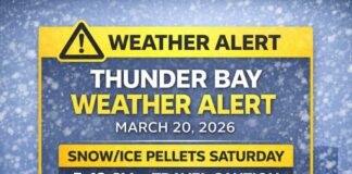
Clear, Cold Morning; Bright Today, Then Cloudier With Showers or Flurries Mid-Week
Thunder Bay – WEATHER DESK – If you head out this morning it is more of a November Day than you might like. It’s a bright but biting start in Thunder Bay. At 7:00 a.m. EST, the airport reports –11.8°C under clear skies, feeling like –16 with a light west-southwest wind at 7 km/h.
The barometric pressure is 102.3 kPa and rising, humidity sits at 86%, and visibility is 24 km. The sun will do some work today, but mornings stay cold enough to sting your cheeks.
Today and Tonight – Sunny and Chilly, Then a Very Cold Night
Sunshine rules the day with only a light breeze up to 15 km/h. The afternoon reaches +2°C, but the wind chill near –15this morning keeps it feeling wintry in the shade. The UV index is low at 1. Tonight turns clear and sharply colder again with light winds, a low near –8°C, and an overnight wind chill close to –13. Expect patchy black ice by dawn on bridges and shaded side streets.
Wednesday – Clouds Return, Late-Day Showers Possible
Wednesday begins with a mix of sun and cloud, then turns cloudy late in the morning. There’s a 40 percent chance of showers late in the afternoon as a weak system passes. Winds remain light, and the high reaches about +4°C, though it will still feel like –13 early on. Wednesday night stays cloudy with a 60 percent chance of flurries or rain showers and a low near +1°C. Surfaces will be mostly wet in town, but cooler pockets can still turn slick after midnight.
Thursday and Friday – On-and-Off Precipitation, Seasonably Cool
Thursday holds cloudy skies with a 60 percent chance of flurries or rain showers and a high near +2°C. Thursday night keeps cloudy periods and a 30 percent chance of flurries, dipping to about –3°C. Friday trends cloudy with a 30 percent chance of flurries, a high near –1°C, and cloudy periods Friday night near –8°C. It’s a typical November shuffle—nothing extreme, but roads can flip from damp to icy in a heartbeat after dark.
What to Wear and Road Tips
Dress in layers you can add or peel back: a thermal base, a warm mid-layer, and a wind-resistant jacket. A toque and insulated gloves make the morning commute a lot more comfortable. Choose grippy, waterproof footwear for frost and evening refreeze. If you’re driving early or late, leave extra room and watch for black ice on bridges and shaded stretches, especially Wednesday night into Thursday.
Lakehead Weather Trivia
On clear, calm nights like these, radiational cooling lets heat escape quickly into space. That’s why dawn can feel much colder than midnight—and why car roofs frost over even when sheltered sidewalks look dry.


