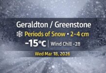
GERALDTON / GREENSTONE — Thursday, November 13, 2025 – A chilly, cloudy start with on-and-off flurries and a brisk northwest wind. At 7:00 a.m. EST, Geraldton Airport reports –1.1°C (wind chill –4), cloudy skies, pressure 100.9 kPa, humidity 88%, a west wind 9 km/h, and visibility 16 km.
Today — Mainly Cloudy, Flurries and a Northwest Bite
Expect mainly cloudy skies with a 60% chance of flurries. Winds shift to northwest 20 km/h gusting to 40, adding a bite despite a high near +2°C. The wind chill is near –8 this morning. Travel could see quick reductions in visibility under any heavier flurry burst, especially on open stretches of Highway 11.
Tonight — Partly Cloudy, Colder, Flurry Chance Early
Partly cloudy with a 30% chance of evening flurries. Winds NW 20 km/h becoming light early this evening. A colder low near –8°C with wind chill near –13 overnight. Watch for icy patches on bridges, ramps, and shaded side roads by dawn.
Friday — Cloud Builds, Wind Turns Southeast
Increasing cloudiness early. Wind becoming southeast 20 km/h early in the afternoon. High +3°C, but the morning wind chill near –12 will feel sharp at bus stops and job sites. Friday night: Cloudy periods, low –2°C.
Saturday — Showery and Milder by a Hair
Cloudy with a 40% chance of showers, high +4°C. Roads mainly wet.
Saturday night: Cloudy with a 40% chance of rain showers or flurries, low –5°C. Slick spots can form late as temperatures dip.
Sunday — Cool, Mostly Cloudy, Spotty Flurries/Showers
Cloudy with a 30% chance of flurries or rain showers, high +1°C.
Sunday night: Cloudy periods, low –7°C.
What to Wear & Travel Tips
-
Dress in layers: thermal base, warm mid-layer, and a wind-resistant jacket.
-
Toque and insulated gloves help a lot with the NW gusts.
-
Grippy, waterproof footwear for slushy or icy patches tonight and Saturday night.
-
On the roads, give yourself extra space—flurry bursts can cut visibility quickly, and refreeze after dark is likely.

