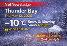
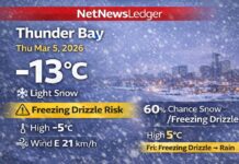
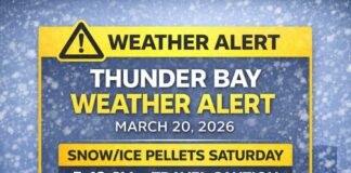
Special Weather Statement – 8 to 12 cm of Accumulating Snow, Then an Arctic Bite
GERALDTON – Winter showed up right on schedule this morning. At the Geraldton Airport at 6:00 a.m. EST it was –2.6°C with light snow falling and visibility down to 2 km. The pressure sits at 100.2 kPa, the air is quite moist with 93% humidity, and a northeasterly wind at 21 km/h, gusting to 33 km/h, drives the wind chill to –9.
A Special Weather Statement remains in effect for Geraldton–Longlac–Caramat, calling for 8 to 12 cm of snow today before tapering late this afternoon or early this evening.
Expect reduced visibility in heavier bursts, and difficult travel along Highway 11 as snow piles up and drifts in exposed stretches.
Today – Periods of Snow, Visibility Drops at Times, Temperatures Falling
Snow continues through the day with local amounts of 5 to 10 cm on top of what’s already fallen, bringing most areas into that 8 to 12 cm range by the time it tapers later. Winds back a touch to northeast 20 km/h with gusts to 40, then turn northwest near 20 km/h late this afternoon as the system slides by. Temperatures fall to about –5°C this afternoon, and with the breeze the wind chill hovers near –12. Plows and sanders will be busy; allow extra travel time and expect changing conditions from one kilometre to the next.
Tonight – Bitter Turn with Blowing Snow Easing, Extreme Wind Chill
Cloud breaks try to develop this evening, with increasing cloudiness early then a colder, drier push taking over. Winds become northwest 20 km/h before morning, and temperatures plunge to –12°C. The wind chill sits near –11 this evening and dips toward –22 overnight—a true mid-winter feel. Any slushy patches will refreeze hard; watch bridges, ramps, and side streets.
Saturday – Cold, Cloudy Start, Then Late-Day Clearing
Saturday stays mainly cloudy and cold, clearing late in the afternoon as drier air settles in. A west wind 20 km/h gusting to 40 adds bite before easing late day. The high is near –5°C, but a morning wind chill near –21 relaxes only to about –9 by afternoon. Dress for it; the sunshine will look warmer than it feels.
Saturday night brings cloudy periods with a 30% chance of flurries and a deep low near –18°C. It’ll be a night for the extra blanket and the block heater.
Sunday – Brighter but Still Wintry, Flurry Risk Returns at Night
Sunday offers a mix of sun and cloud with a seasonally chilly high near –4°C and light winds. Sunday night turns cloudy with a 60% chance of flurries and a modest low near –9°C, enough to keep things crunchy by Monday morning.
What to Wear and How to Travel It
This is full-on winter kit weather. Start with a thermal base layer, add an insulating mid-layer, and top it with a wind- and water-resistant parka. Thermal gloves, a toque, a neck gaiter, and waterproof boots with good tread will make a huge difference, especially with today’s blowing snow and tonight’s dangerous wind chill. On the roads, slow down, leave more room, and give plows plenty of space to work. Keep an emergency kit in the vehicle—scraper/brush, boosted washer fluid, phone charger, blanket, and a little sand or traction aid.
Greenstone Weather Trivia
Geraldton sits near the height of land between watersheds. When a northeasterly flow runs into that higher terrain, systems can wring out extra snow, which is why totals here often edge higher than surrounding communities—and why Highway 11 can go from wet to white in a hurry.


