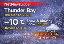
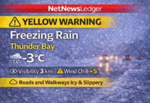
Friday Through Sunday – From Damp to Bright and Brisk
THUNDER BAY – A soggy start flips to a wintry feel fast today. At 6:00 AM EST, Friday, November 7, 2025, Thunder Bay Airport is reporting light rain and 1.7°C. The barometric pressure is 99.8 kPa and falling, humidity is 95% with a dew point of 1.0°C, and winds are north 10 km/h (gusts increasing later). Visibility is 16 km.
Periods of rain or wet snow end early this morning, leaving cloudy skies with a 40% chance of flurries. By afternoon we’ll see a mix of sun and cloud, but the north wind becomes 20 km/h gusting to 40 this morning before easing late day, and the temperature falls to about –2°C.
The UV index is 1 (low). Expect some slushy-to-icy transitions on untreated surfaces as temps slide below freezing.
Tonight – Clearing and Turning Cold
Skies turn clear with light winds (up to 15 km/h). It’s a sharp drop to –10°C overnight, with a wind chill near –14 by morning (around –5 early in the evening). Plan on widespread frost and potential black ice on bridges and shaded roads at dawn.
Saturday – Bright Spells, Biting Wind Chill
Saturday brings a mix of sun and cloud and northwest wind near 20 km/h in the morning. The high is about –3°C, but it will feel like –15 early and –8 in the afternoon thanks to the breeze. A classic crunchy-snow kind of day.
Saturday night: Cloudy periods with a 40% chance of flurries, low near –8°C.
Sunday – On/Off Flurries, Still Below Freezing
Sunday trends cloudier with flurries, and a high near –2°C.
Sunday night remains cloudy, low around –5°C. Expect lingering slick spots mornings and late evenings.
What to Wear & Road Tips
-
Dress in layers: thermal base, warm mid-layer, and a wind-resistant shell.
-
Toque and insulated gloves are must-haves today (as temps fall) and all weekend mornings.
-
Waterproof, grippy footwear for flurries/icy patches.
-
Driving early/late: slow down, leave extra space, and watch bridges/overpasses for black ice after today’s wet start.
Quick Lakehead Notes
A north wind off Superior helps flip this morning’s damp mix to scattered flurries and drops temperatures quickly. Once skies clear tonight, radiational cooling does the rest—hence the deep chill by Saturday morning.


